Successful retail planning depends on understanding location — who lives nearby, how they move, and where competitors are. GOAT gives retail planners and development teams the tools to conduct rigorous, data-driven location and accessibility analyses, from catchment area assessments to network-wide gap analysis.
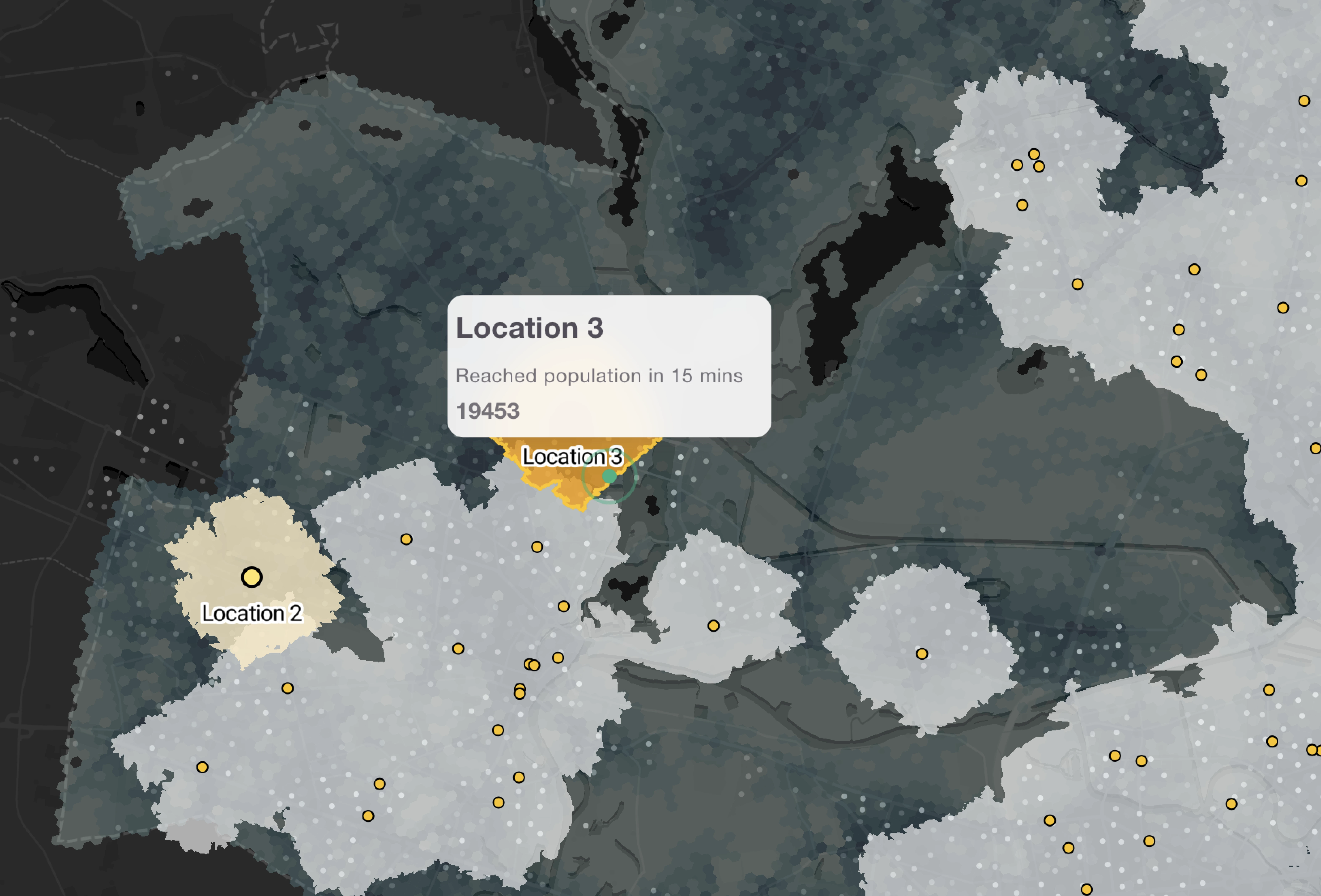
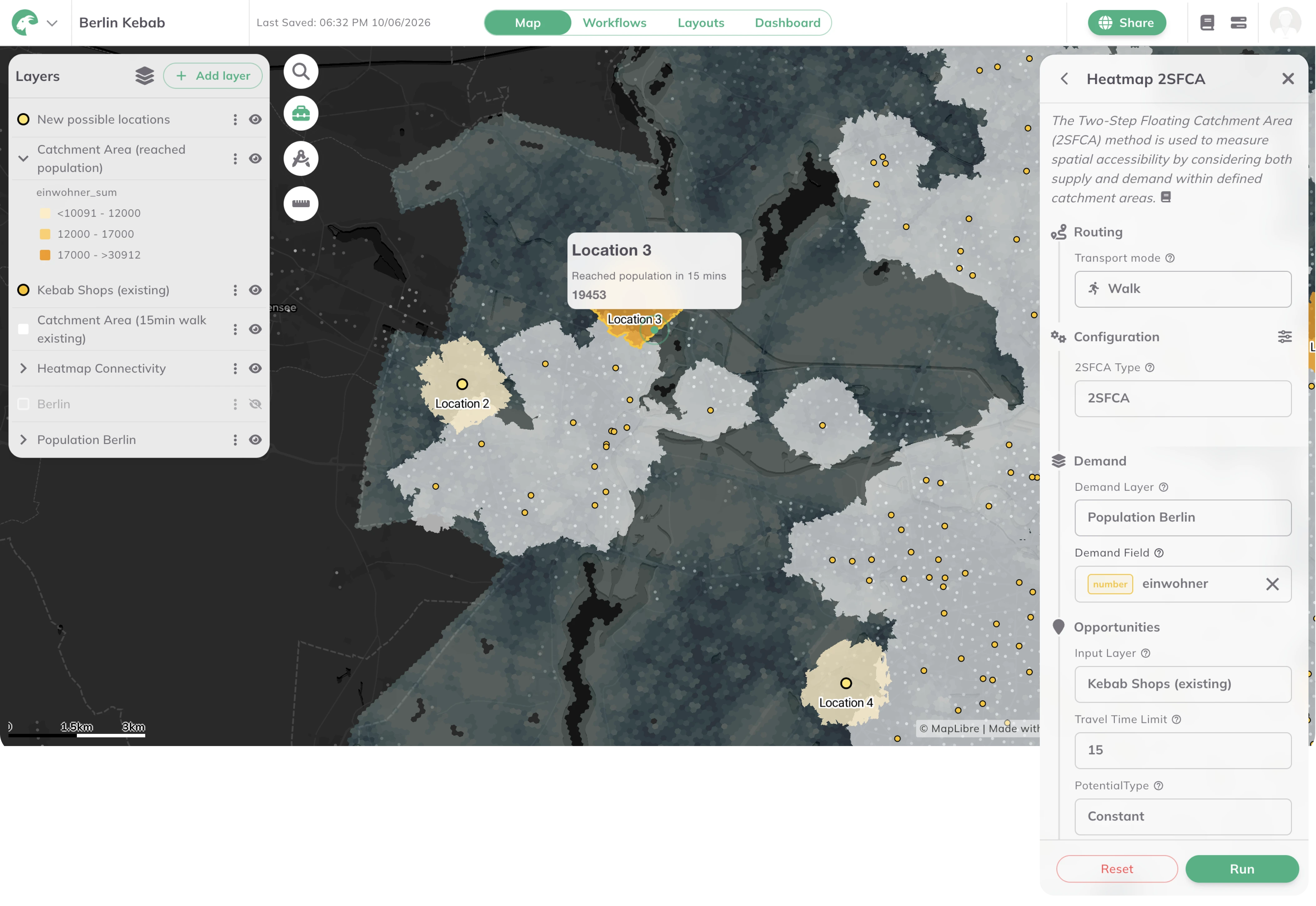
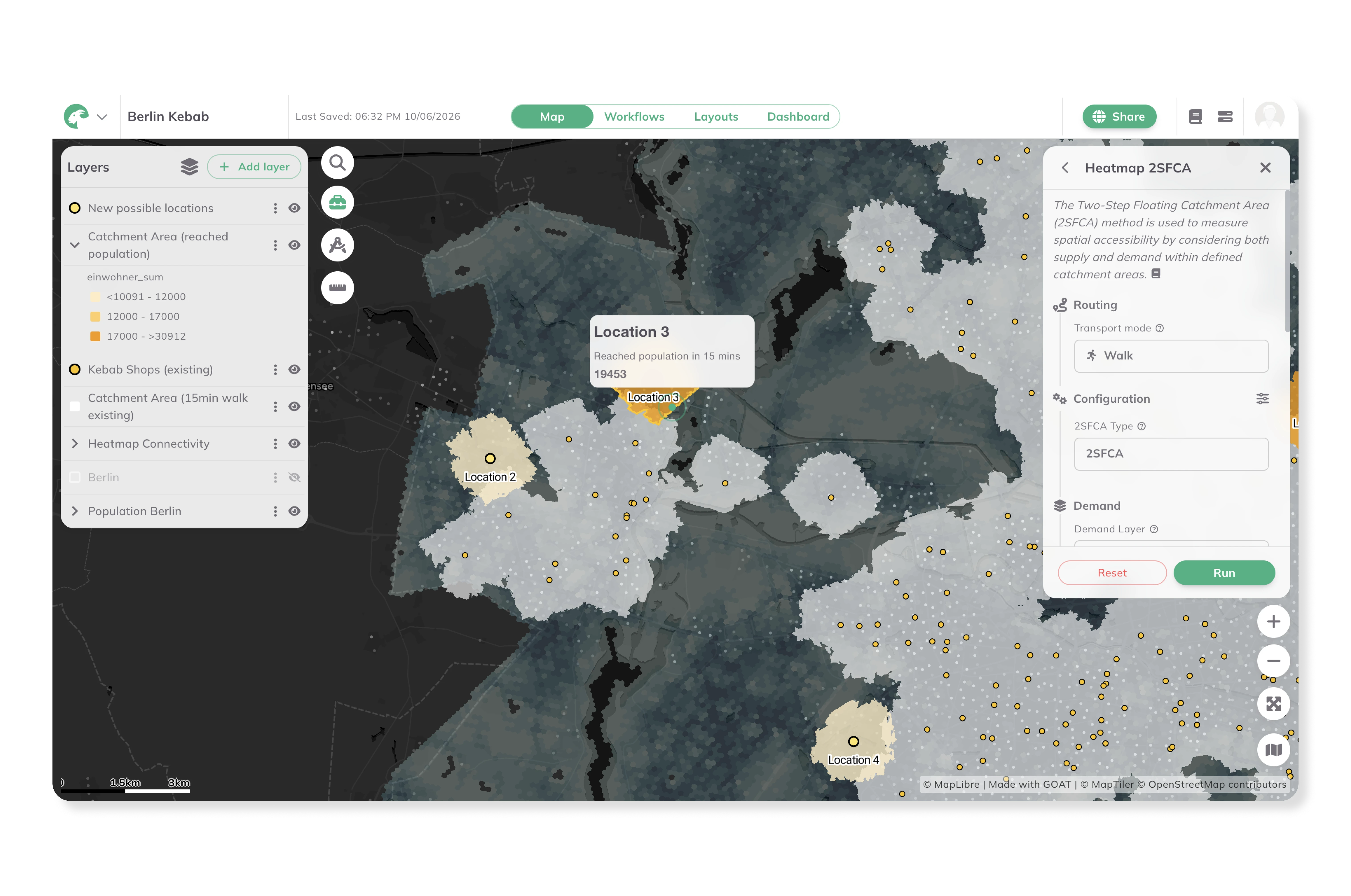
Evaluate the spatial suitability of potential retail locations based on population density, purchasing power, demographic structure, and multimodal accessibility. GOAT's isochrone and travel time tools calculate how many people can reach a given site on foot, by bicycle, or by public transport — providing a robust, comparable basis for investment decisions and branch network planning.
Identify areas where residents have poor access to essential retail — particularly food retail and everyday goods — by overlaying accessibility indicators with population and land use data. GOAT makes it possible to pinpoint retail deserts and prioritise locations for new supply, supporting both private investment decisions and municipal retail development strategies — as demonstrated in Plan4Better's retail planning project for the City of Bonn.
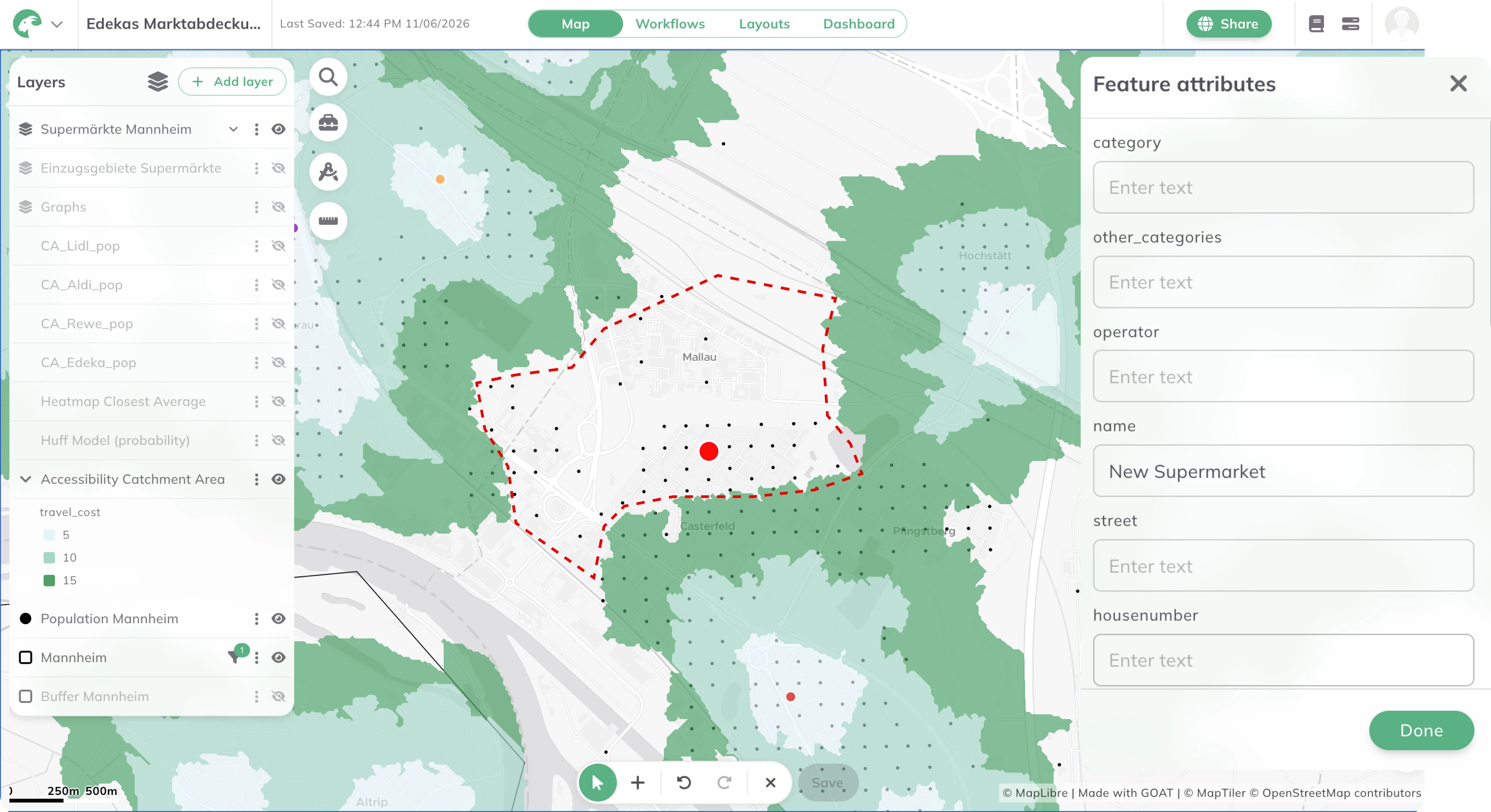
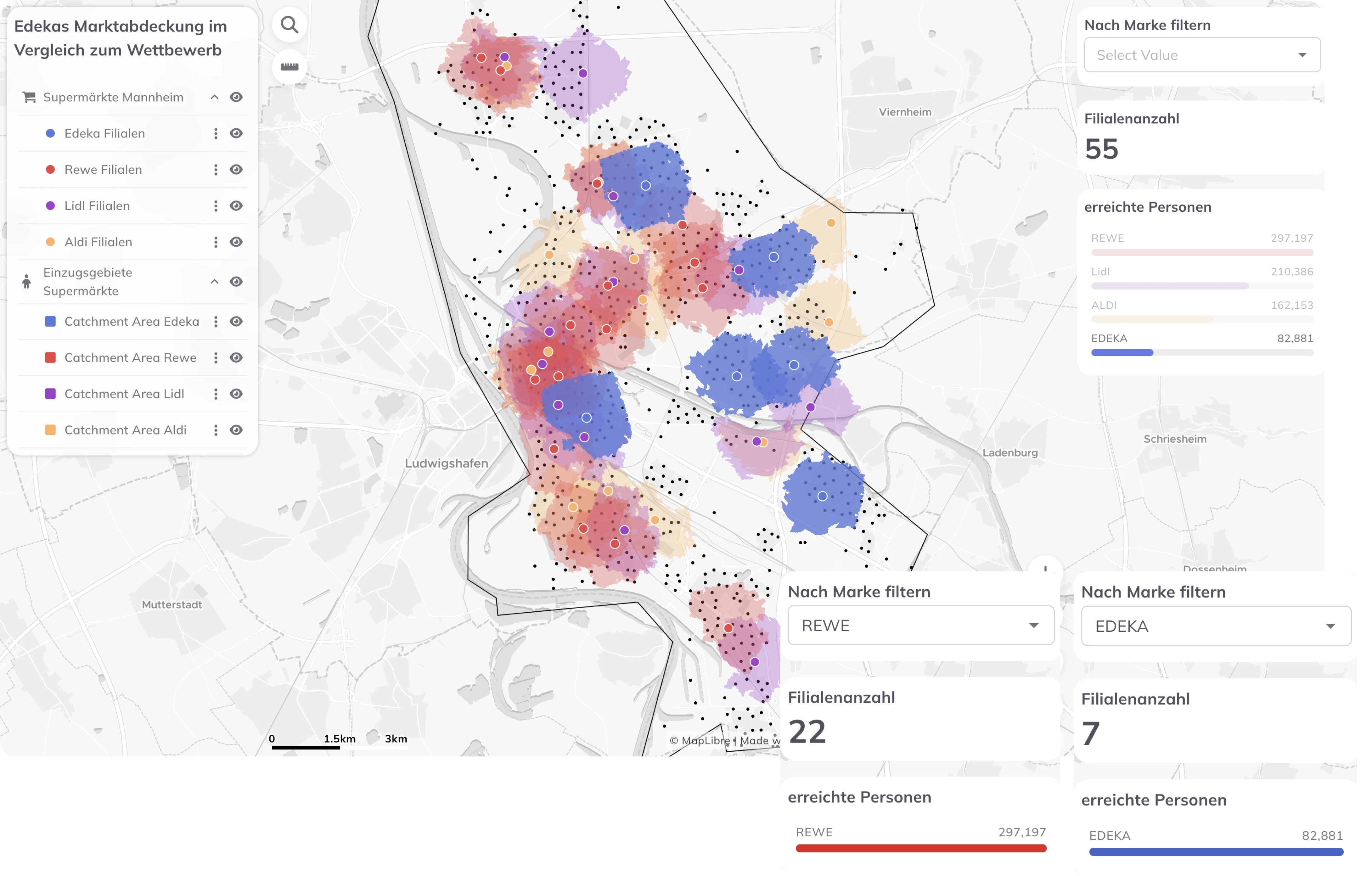
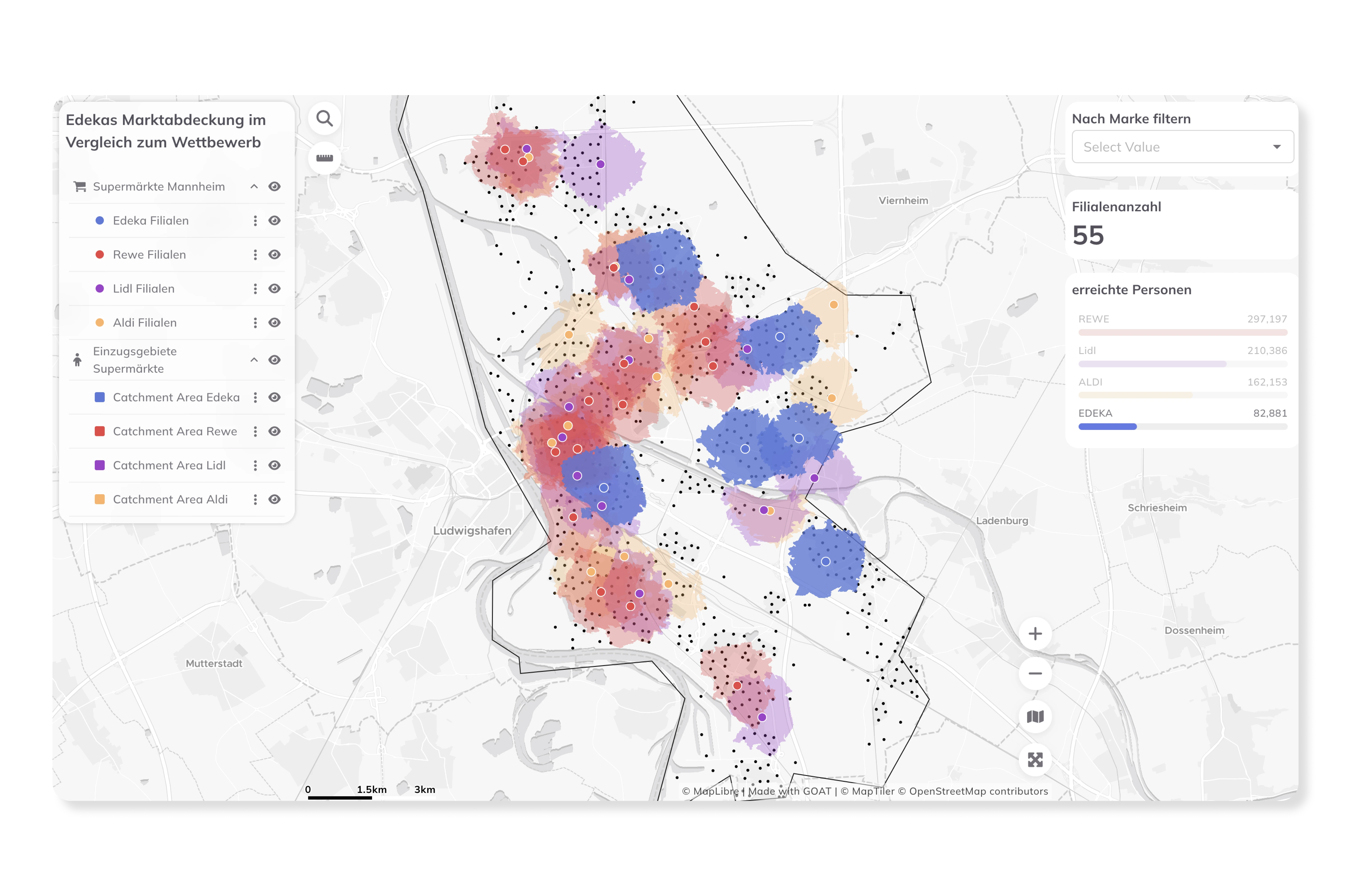
Visualise the spatial distribution of competing retail locations and assess market coverage across a region. By combining accessibility analyses with demographic and purchasing power data, GOAT provides a spatially differentiated picture of market potential — supporting strategic decisions about where to open, relocate, or consolidate retail locations.
Real analyses built by planners, researchers, and cities — explore what’s possible before you start your own.
high-resolution accessibility and catchment area analyses at the address, neighbourhood, and municipal level
cloud-based SaaS with no installation or IT overhead
cloud-based SaaS with no installation or IT overhead
built on open-source technologies and open data standards
from a single store assessment to a region-wide retail network analysis
used for retail planning projects in German municipalities including the City of Bonn

.jpg)
.jpg)
Join planners and cities already using GOAT to make better decisions, faster.