Mobility planning challenges are fundamentally spatial — from assessing public transport quality to identifying cycling infrastructure gaps. GOAT brings together GTFS timetable data, traffic flow data, and sociodemographic information in one browser-based platform, enabling transport planners to move from raw data to decision-ready insights without GIS expertise.
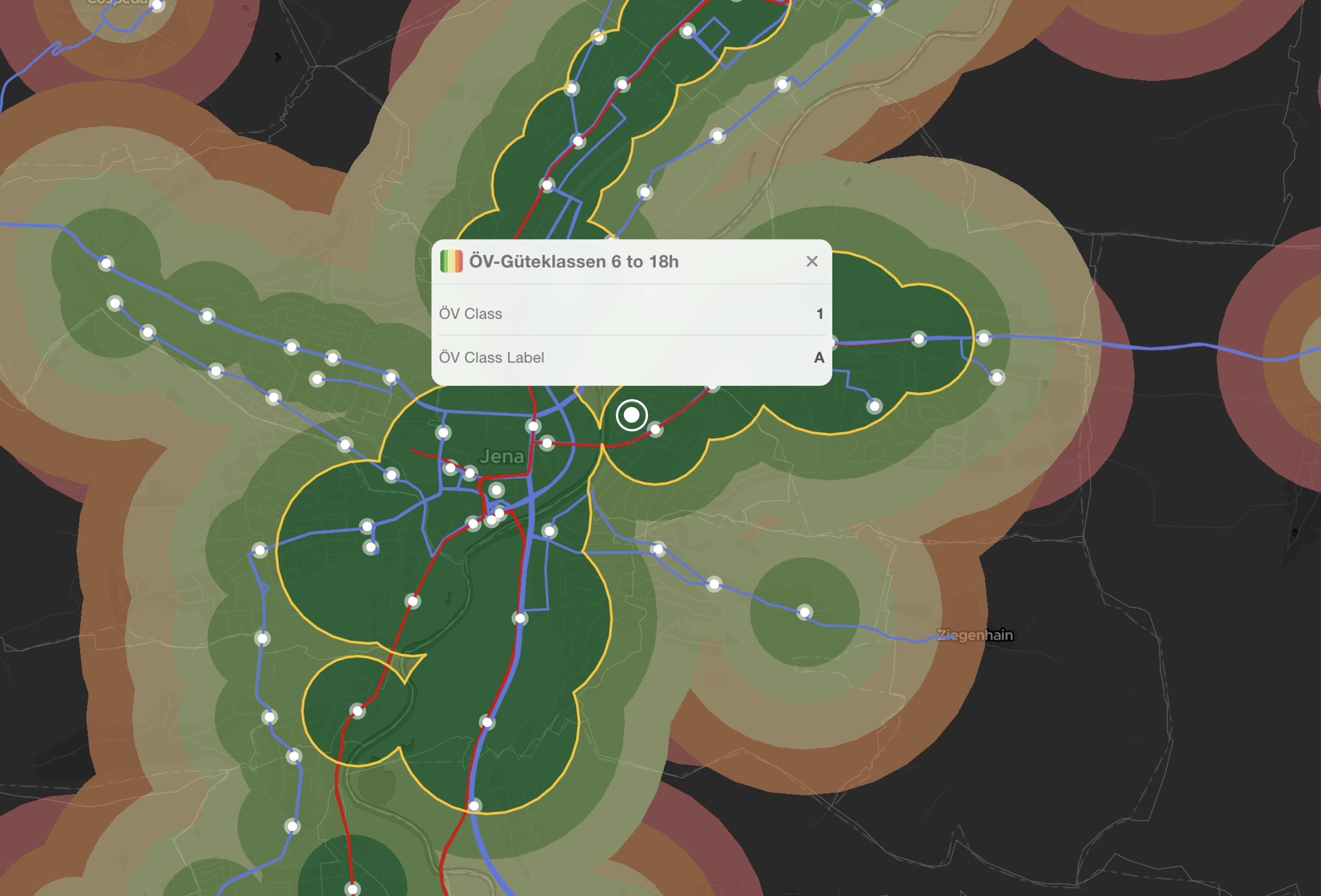
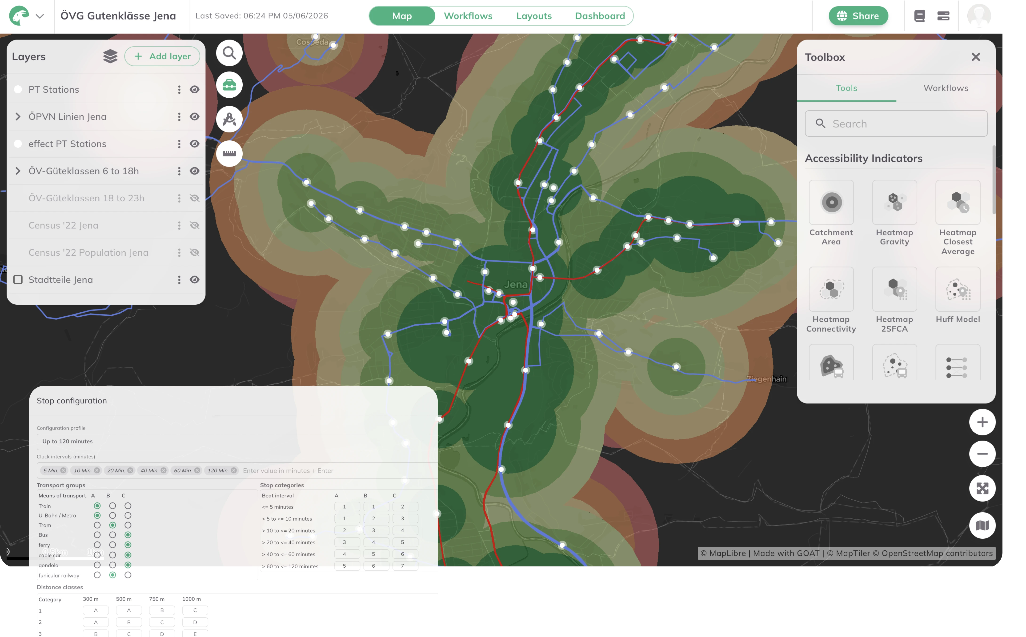
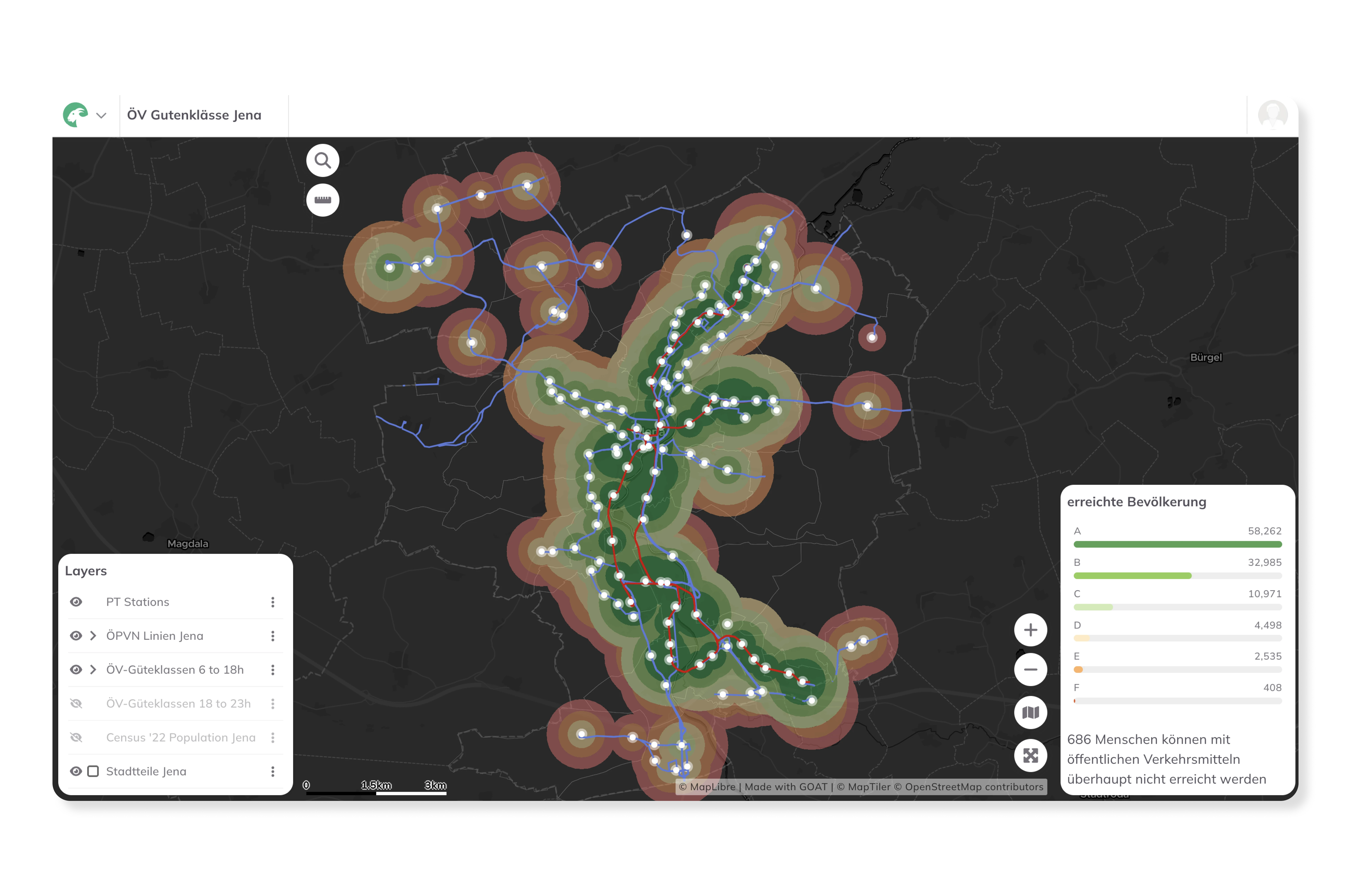
Calculate public transport quality classes (ÖV-Güteklassen) based on real timetable data to assess service levels at stop and municipality level. Identify underserved areas, benchmark against regional or national standards, and build a data-driven case for network improvements — including the integration of on-demand services alongside classical scheduled transit.
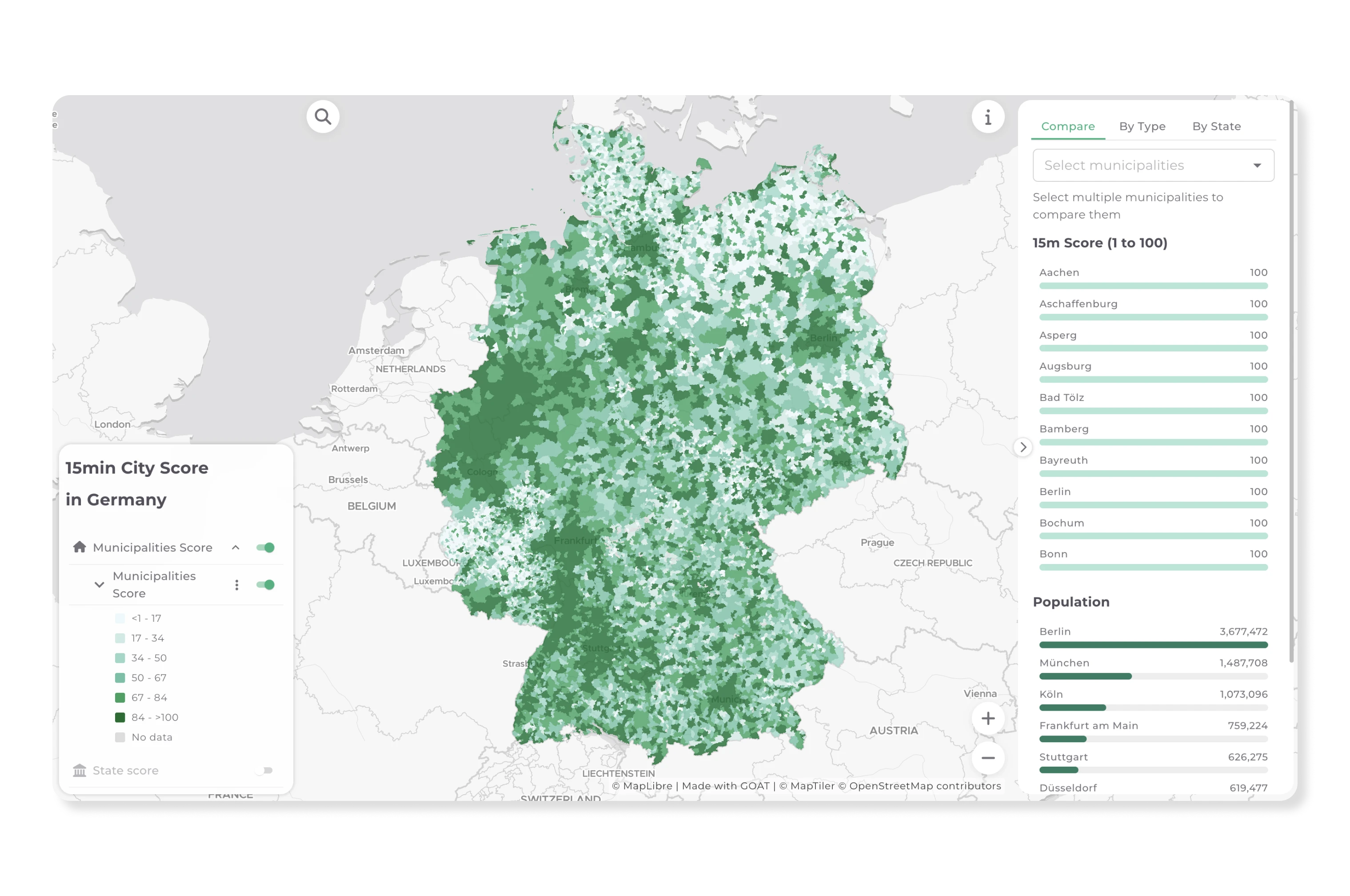
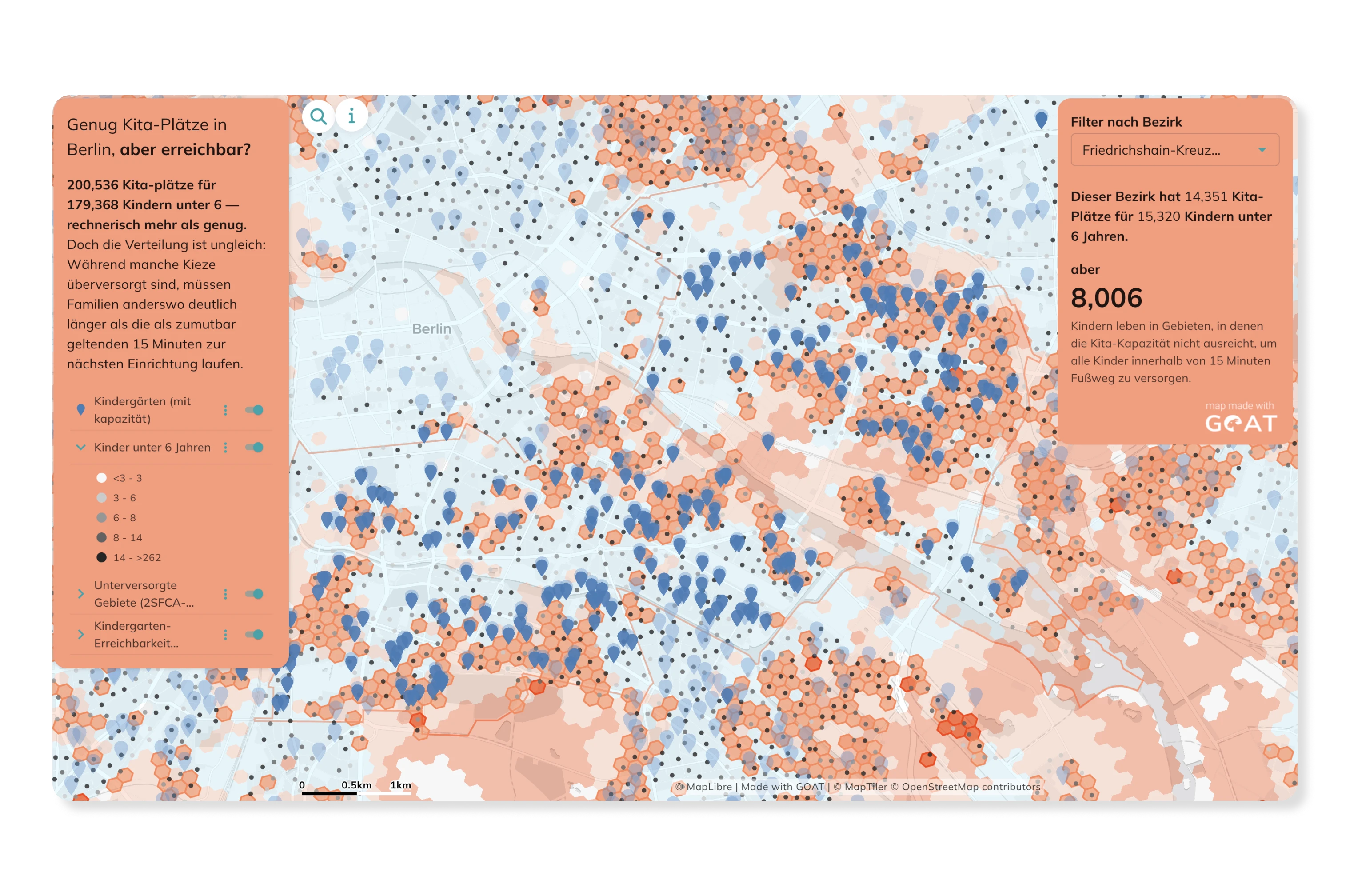
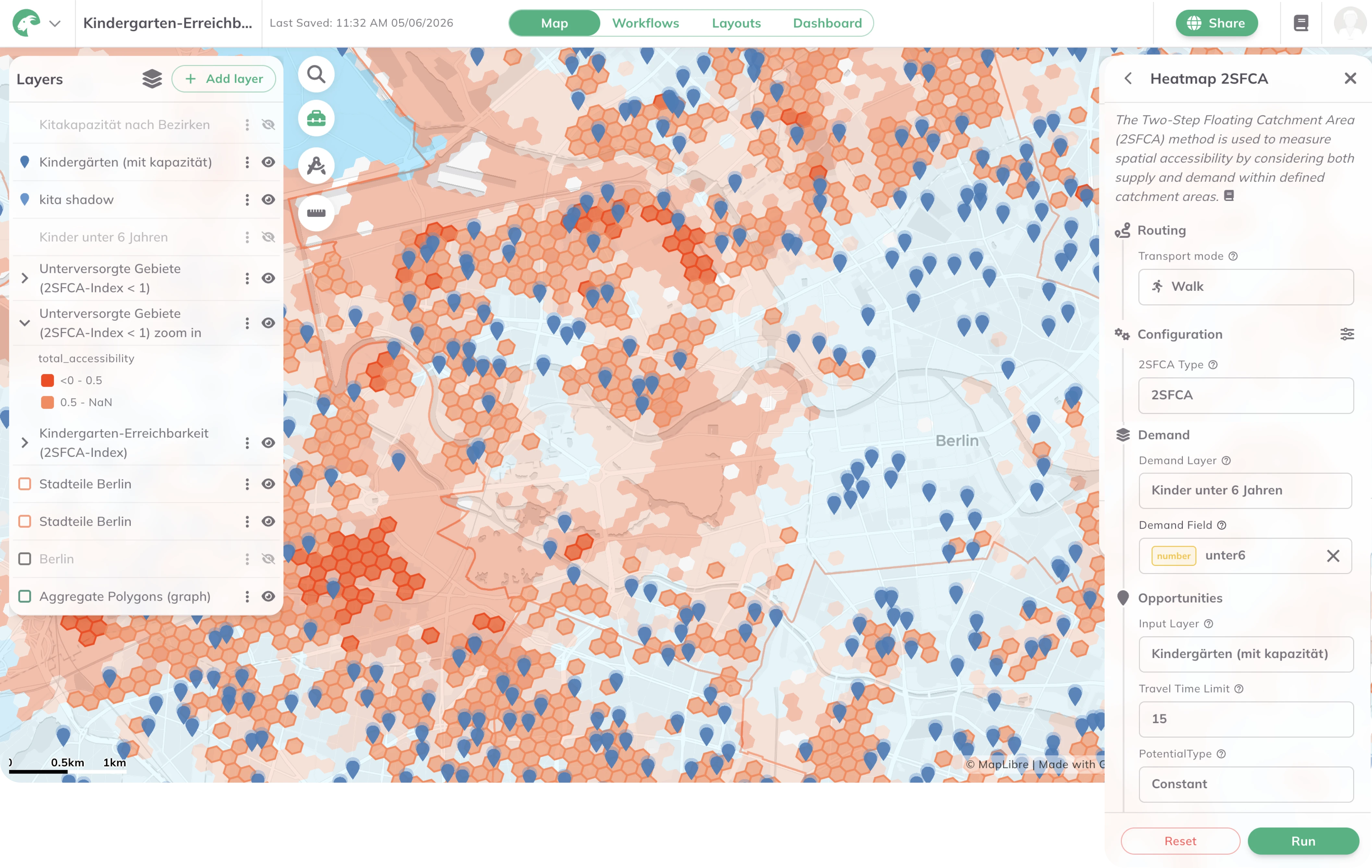
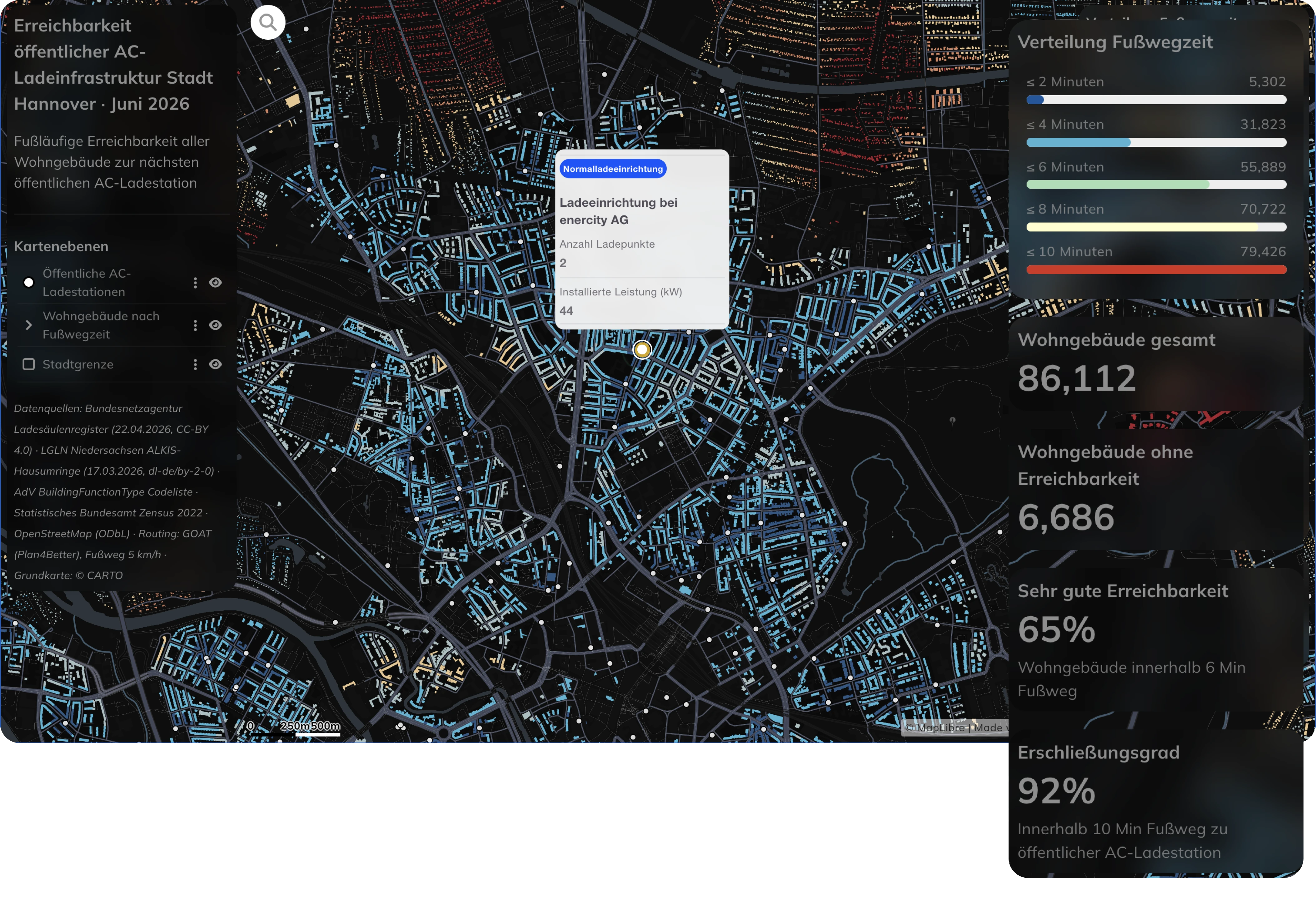
Evaluate how well residents can reach essential destinations — schools, healthcare facilities, workplaces, retail, and public transport stops — by foot or by bicycle. GOAT's isochrone and heatmap tools make it easy to identify gaps in the active mobility network and prioritise infrastructure investments where they matter most.
Assess the spatial suitability of locations for bike sharing, e-cargo bike stations, car sharing, and other shared mobility services. GOAT's catchment area and demand analysis tools help identify optimal placement based on population density, land use, and accessibility to key destinations.
Real analyses built by planners, researchers, and cities — explore what’s possible before you start your own.
GTFS feeds, population data, land use, cycling and pedestrian networks, on-demand services
cloud-based SaaS with no installation or IT overhead
cloud-based SaaS with no installation or IT overhead
built on open-source technologies and open data standards
from a single project study to a cross-regional planning platform
used by transport agencies, regional associations, and research institutions across Germany, Austria, and Switzerland

.jpg)
.jpg)
Join planners and cities already using GOAT to make better decisions, faster.