Cities and government agencies must make faster, better-informed decisions about infrastructure, mobility, and land use — with limited resources. GOAT makes powerful spatial analysis accessible to any planner, no GIS expertise required.
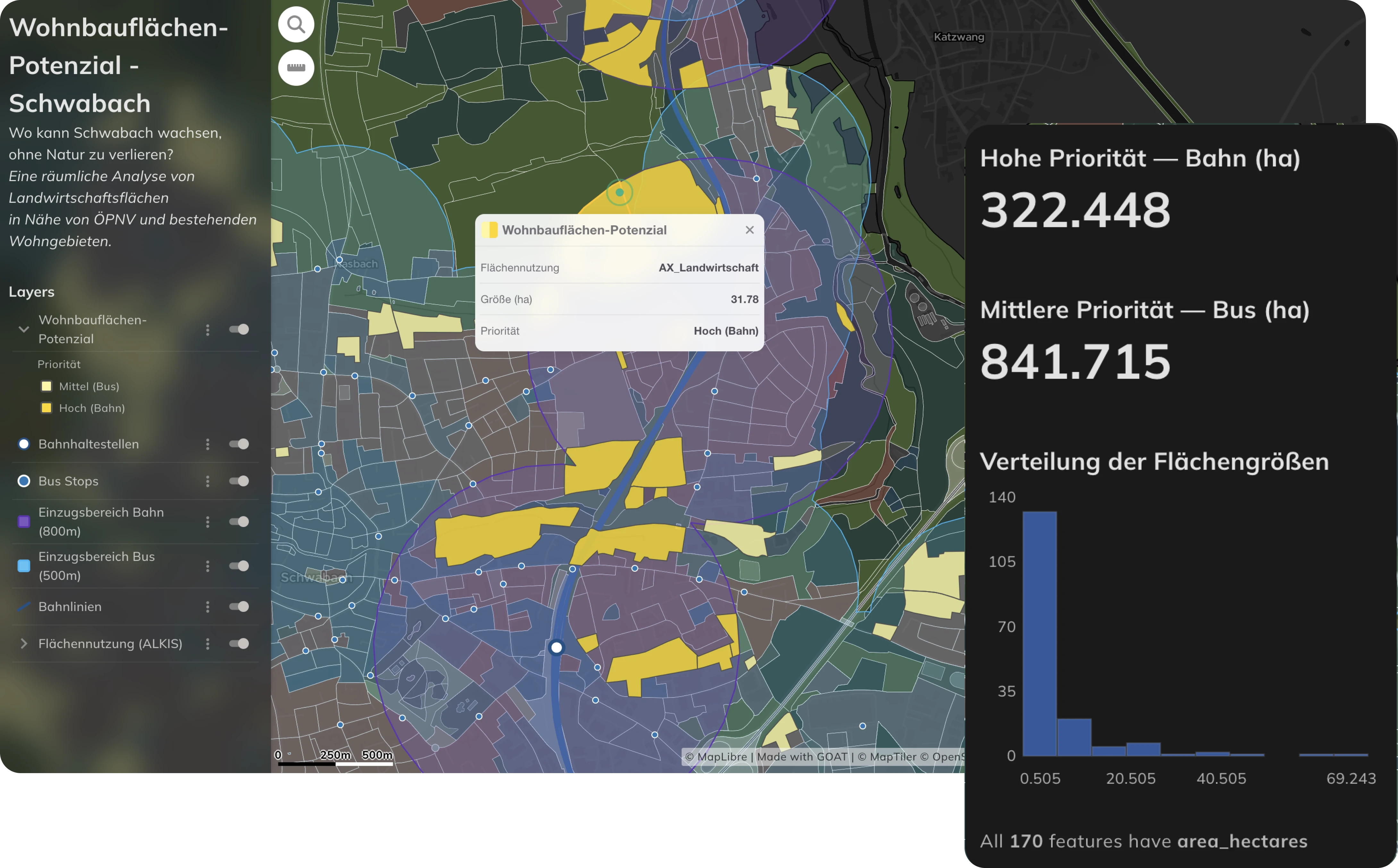
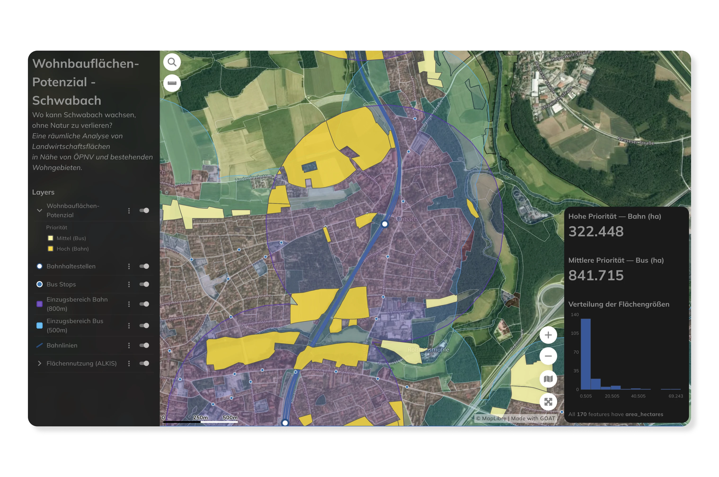
Analyse land use patterns, evaluate location suitability, and model the spatial impact of planning decisions — all within a single platform. GOAT supports digital development planning and enables planners to run scenario analyses before committing to costly infrastructure changes.
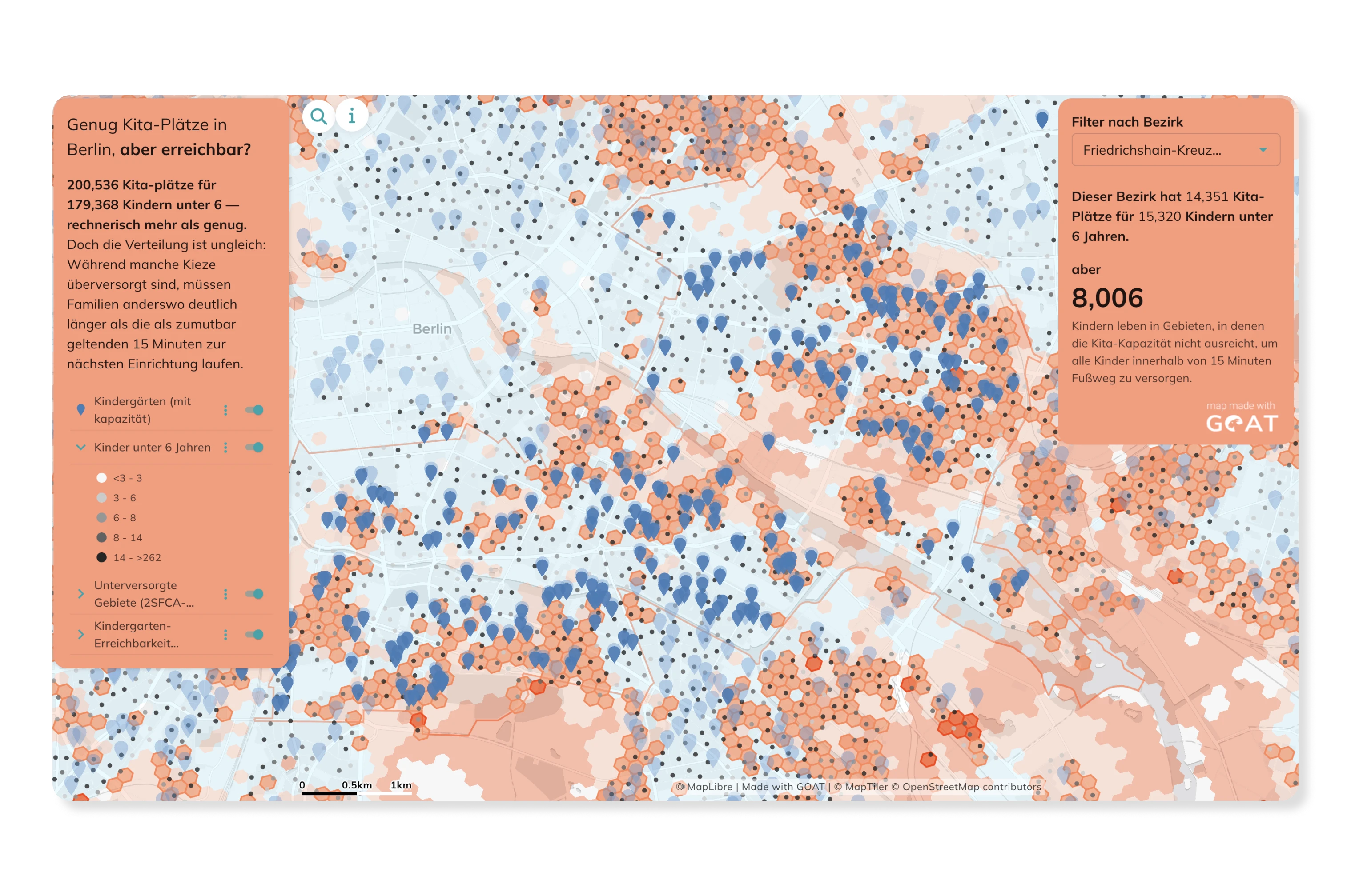
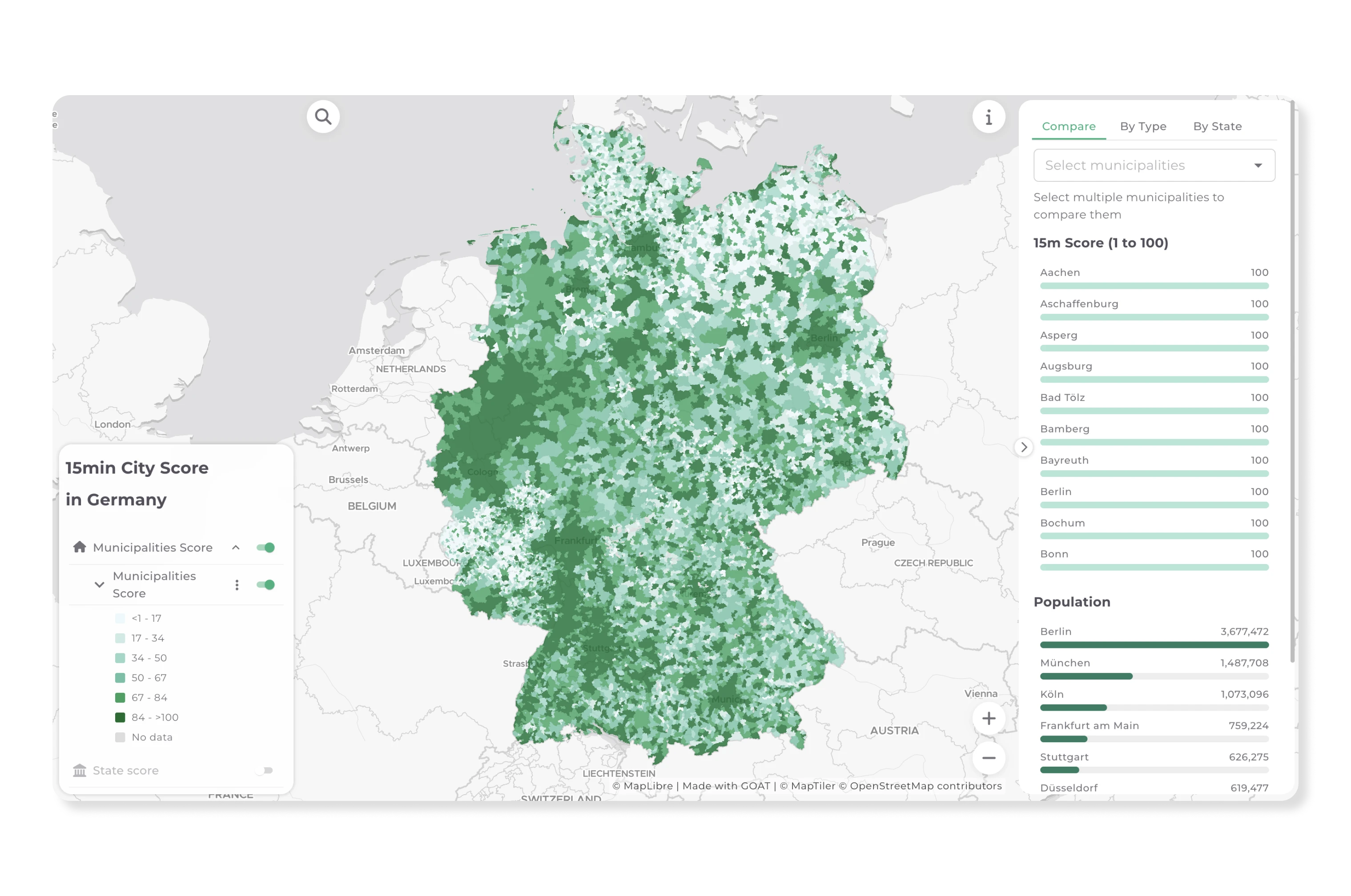
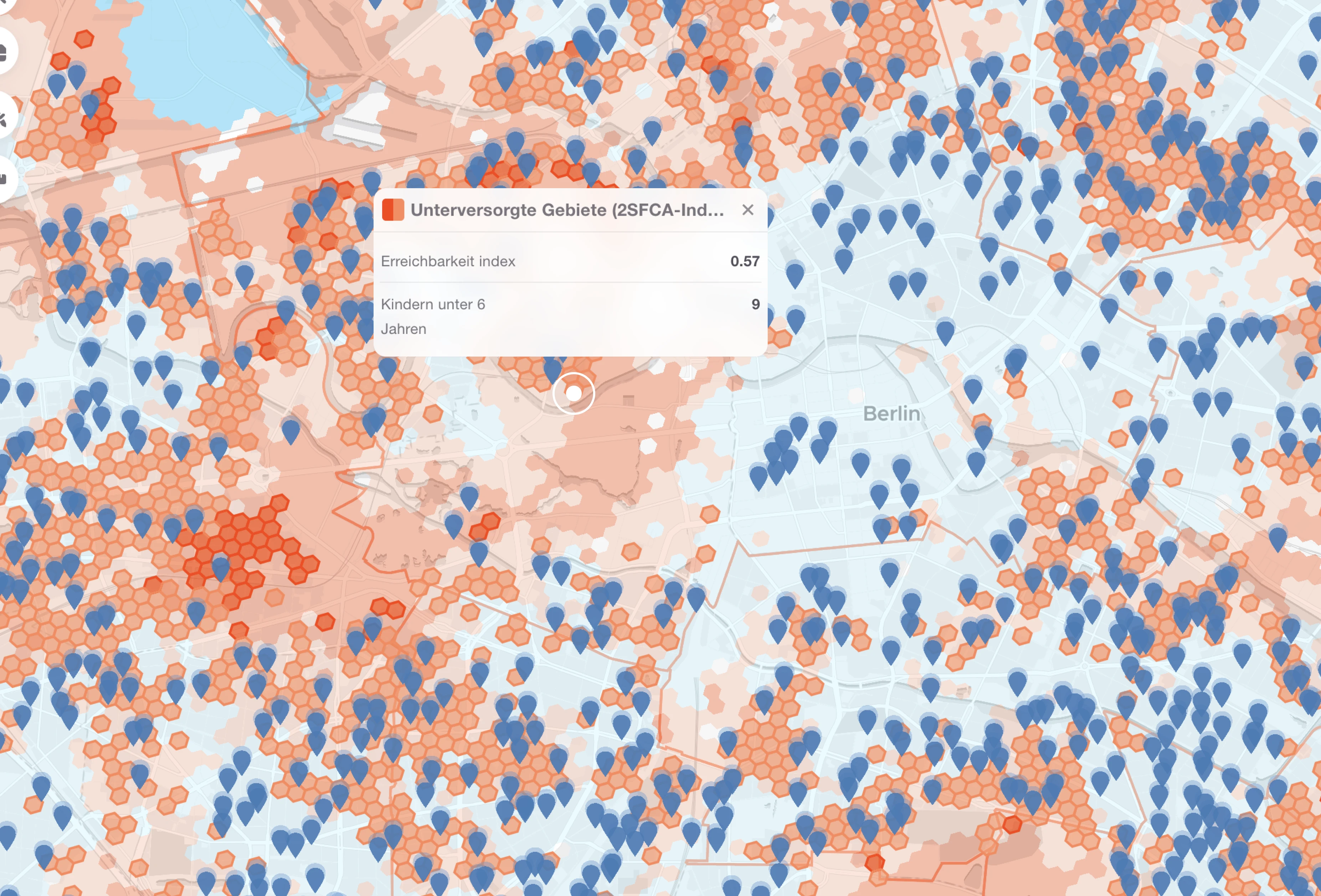
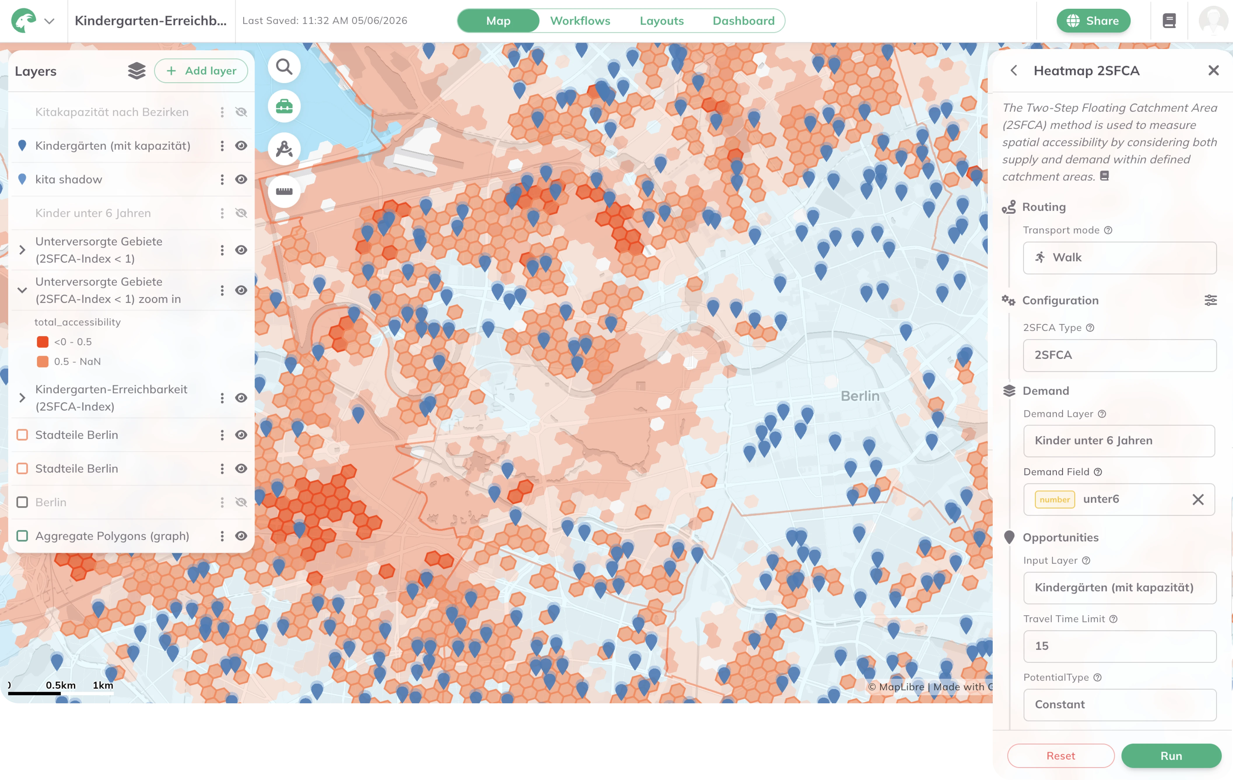
Assess how well residents can reach essential services — supermarkets, schools, healthcare, public transport stops — by foot, bicycle, or transit. GOAT's accessibility indicators help cities identify underserved areas and prioritise investments in walking, cycling, and public transport infrastructure.
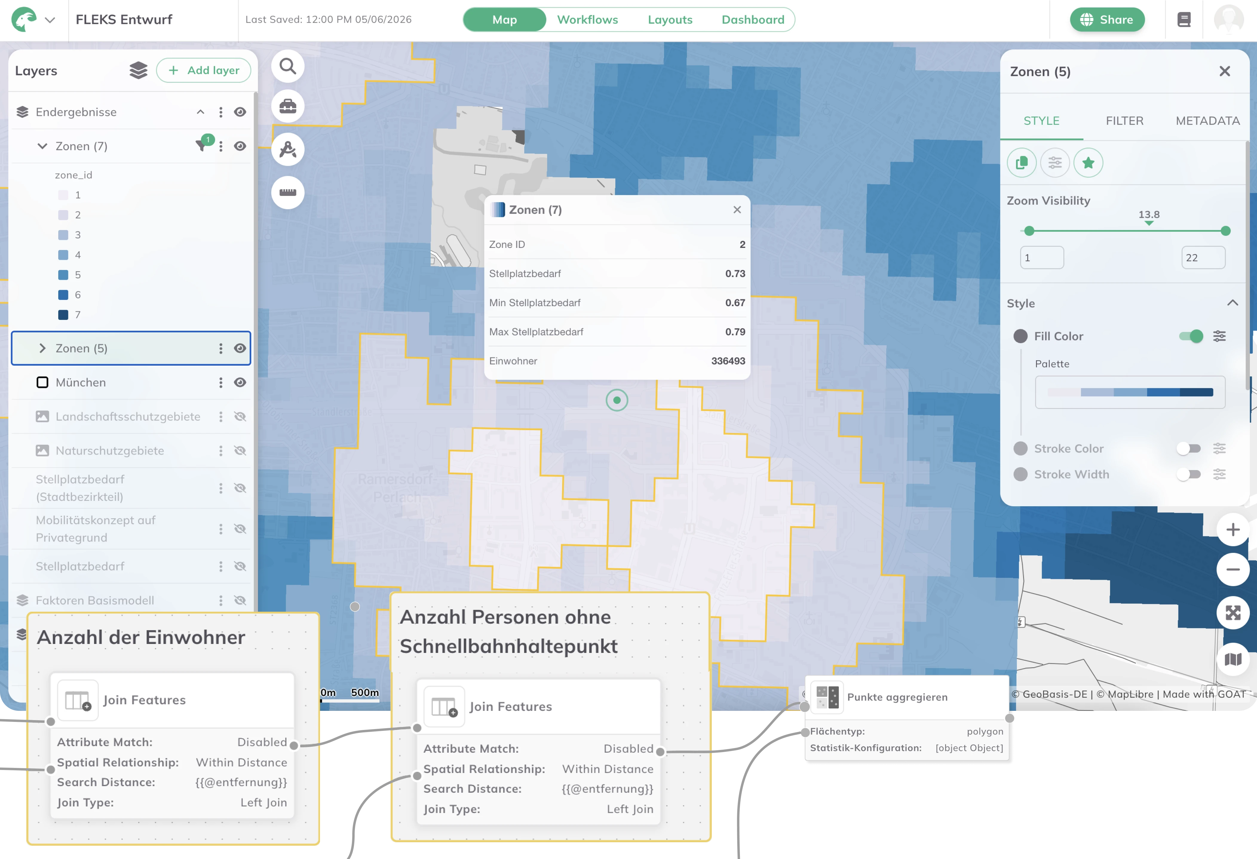
Calculate location-specific parking space requirements based on high-resolution sociodemographic data, public transport quality classes, car ownership rates, and land use context. GOAT's indicator-based approach — as demonstrated in the FLEKS project for the City of Munich — enables flexible, location-differentiated parking concepts that reduce construction costs while meeting actual demand.
Real analyses built by planners, researchers, and cities — explore what’s possible before you start your own.
land use, accessibility, and parking demand analysis in one platform
cloud-based SaaS with no installation or IT overhead
cloud-based SaaS with no installation or IT overhead
built on open-source technologies and open data standards
from a single department to a cross-municipal platform for entire regions
used by cities, regional authorities, and federal research institutions across Germany, Austria, and Switzerland

.jpg)
.jpg)
Join planners and cities already using GOAT to make better decisions, faster.