Healthcare access is unequal, and the gaps are growing. Identifying disparities, planning facilities in the right locations, and ensuring vulnerable populations are served are fundamentally spatial challenges. GOAT gives health planners and public authorities the tools to analyse access to medical care with precision and build a clear, evidence-based case for action.
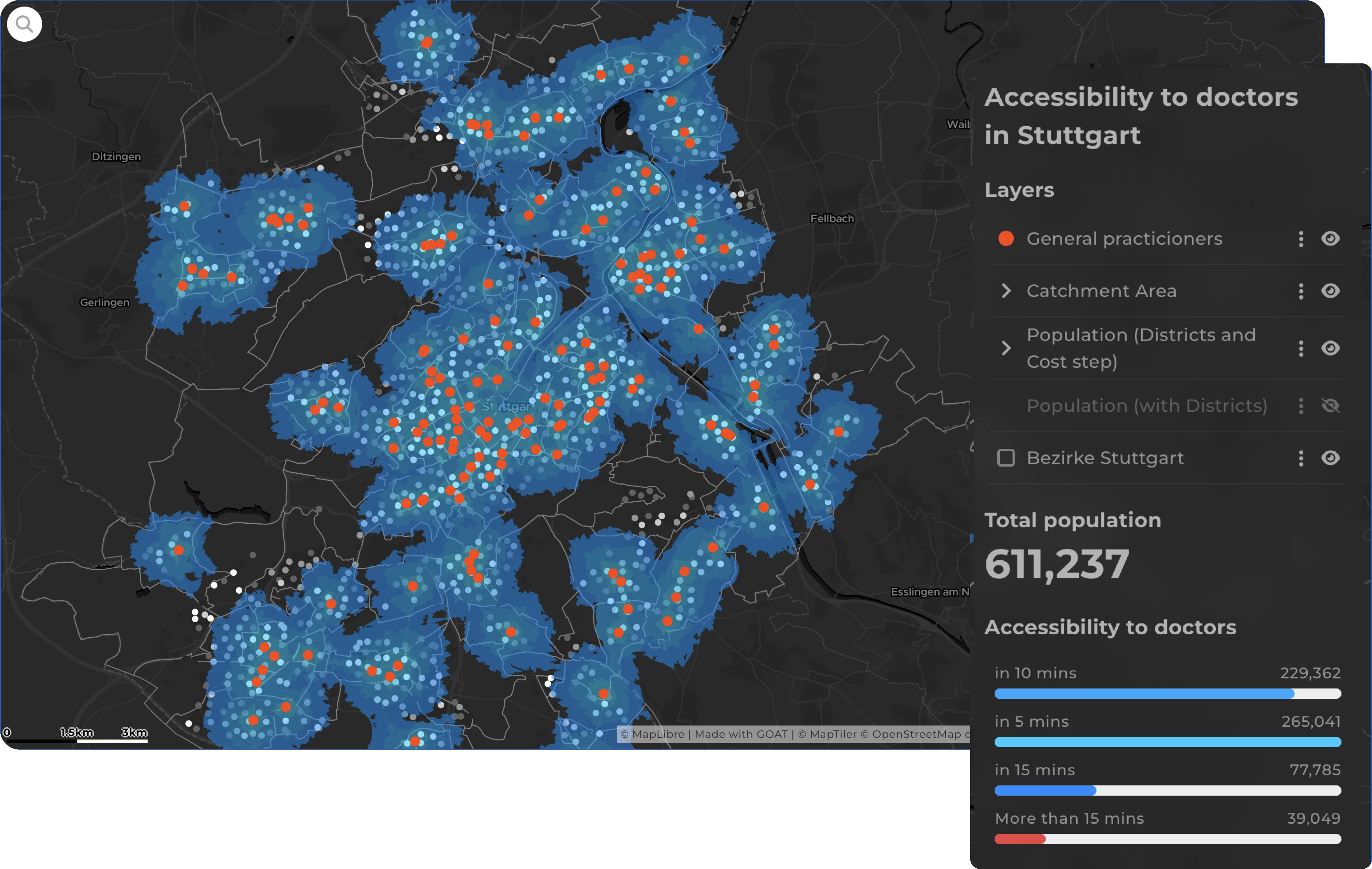
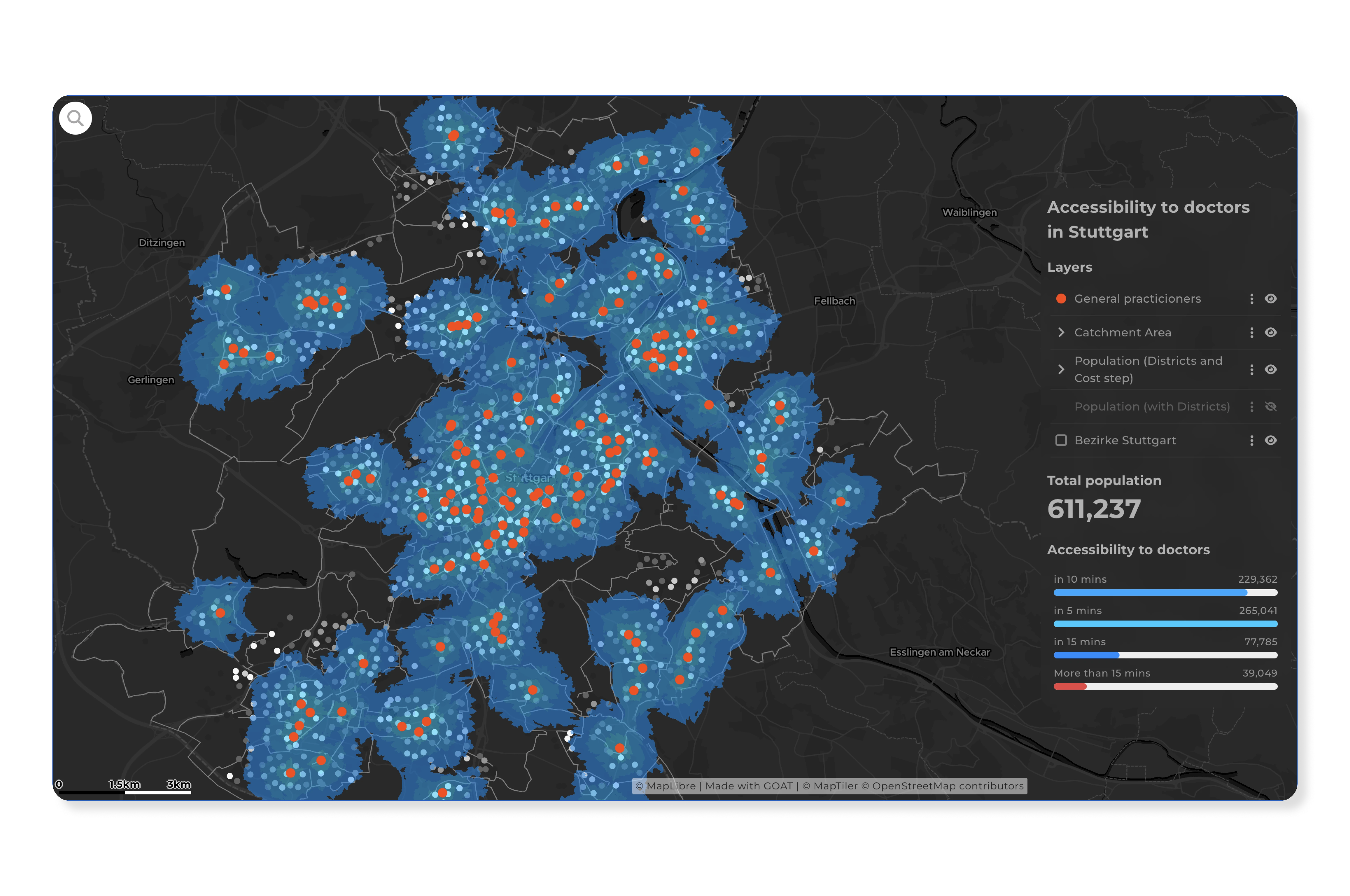
Calculate how well patients can reach hospitals, GP practices, pharmacies, specialist clinics, and care homes by different modes of transport — on foot, by bicycle, by public transit, or by car. GOAT's isochrone and travel time analyses identify underserved areas and support evidence-based decisions about where new facilities are most needed.
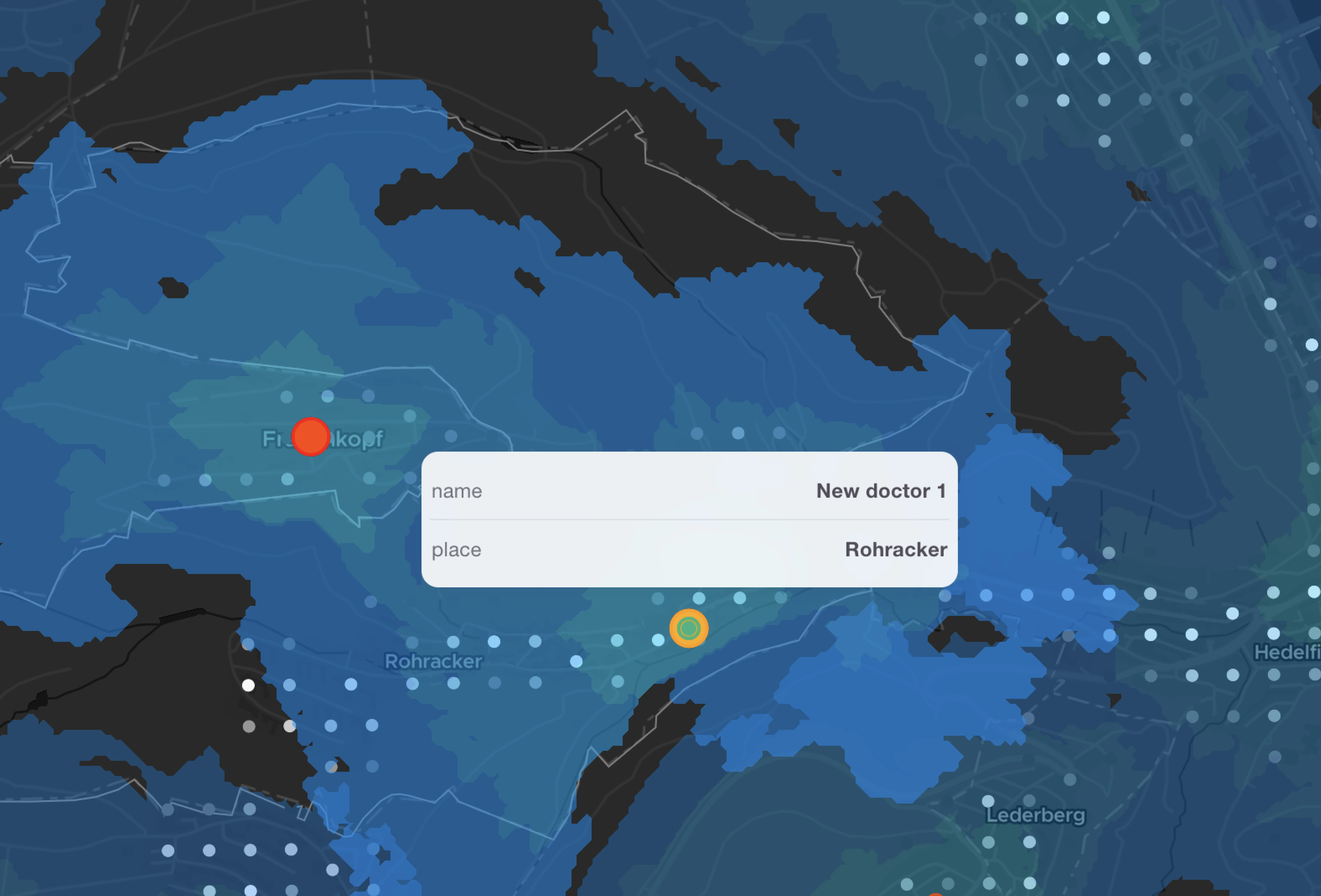
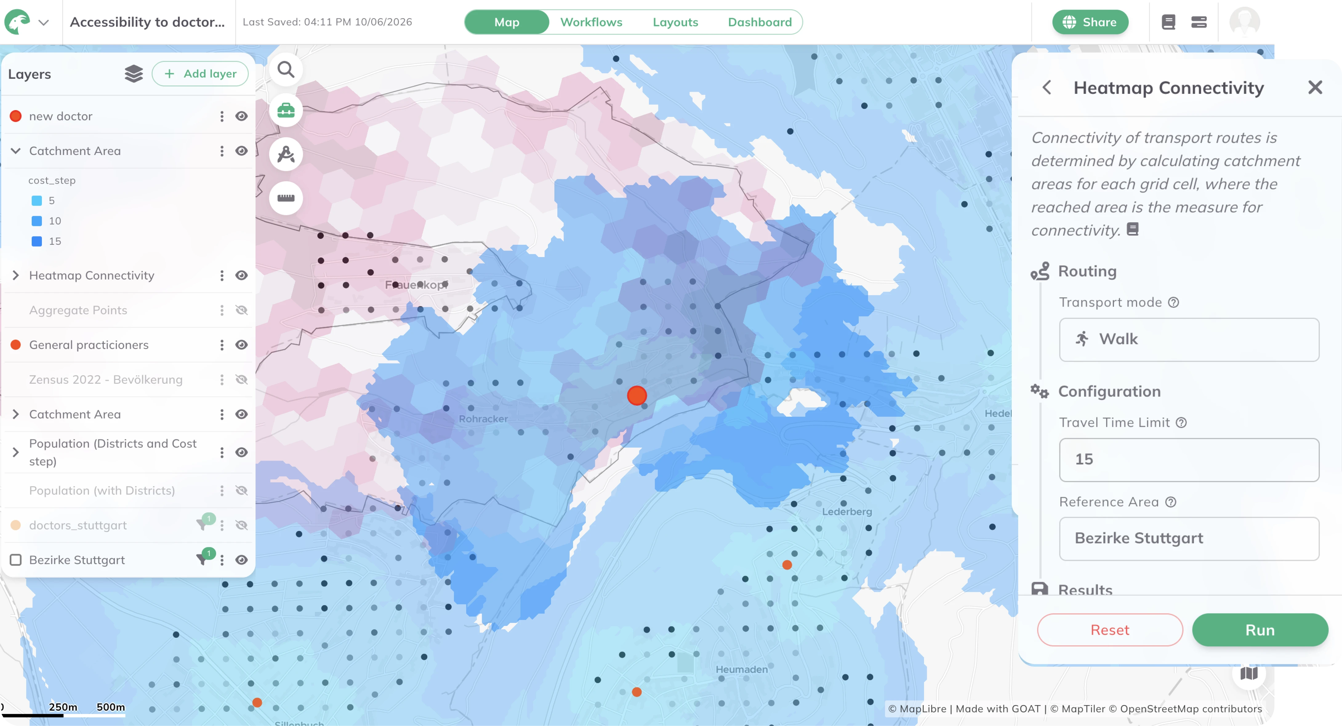
Evaluate the spatial suitability of locations for new medical facilities based on population density, demographic structure, existing provision, and multimodal accessibility. GOAT enables planners to compare location options systematically — providing a robust, data-driven foundation for investment decisions and planning applications.
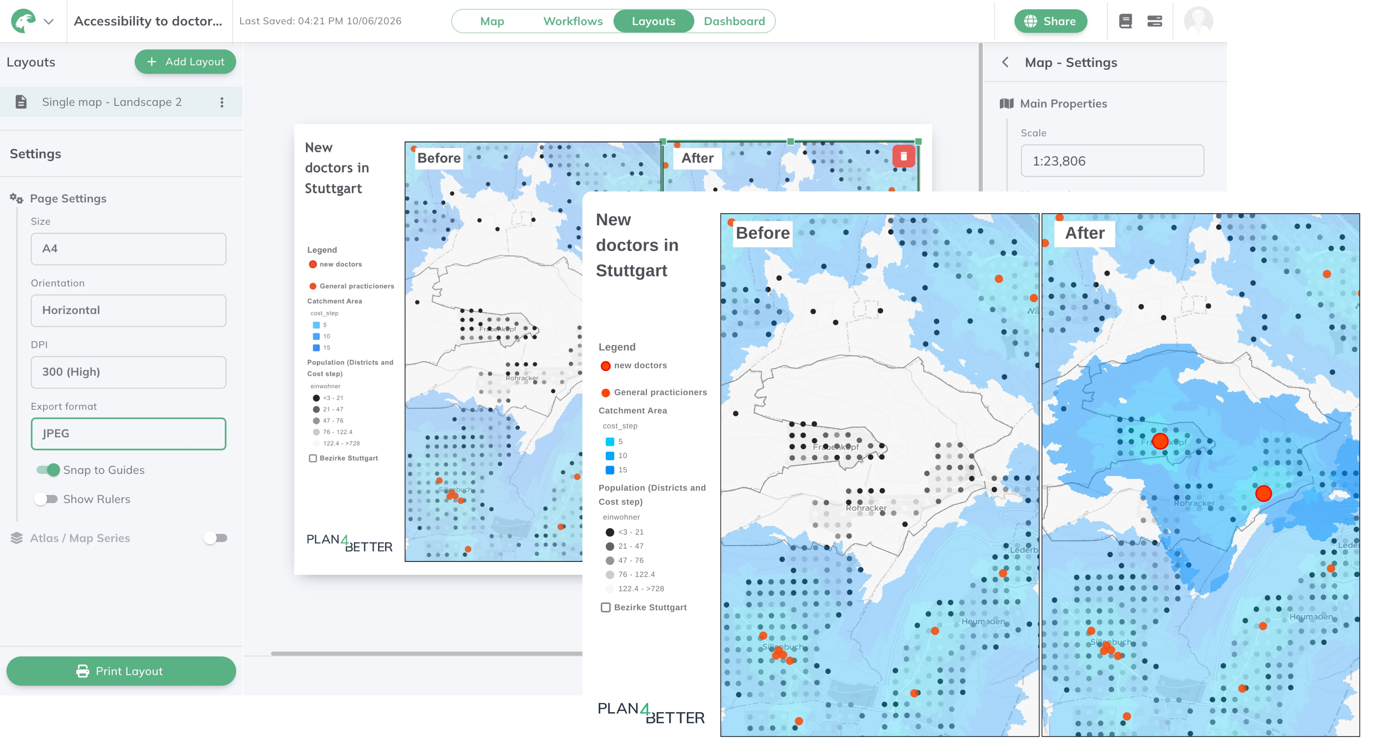
Move from analysis to a finished document without leaving the platform. GOAT's Layouts tool turns maps, accessibility results, and catchment analyses into print-ready reports — for healthcare planning committees, public participation, or applications to regulatory bodies. Add titles, legends, scale bars, and explanatory text, then export polished PDFs or PNGs that make the evidence behind a decision clear to non-specialist stakeholders.
Real analyses built by planners, researchers, and cities — explore what’s possible before you start your own.
high-resolution accessibility analyses at the address, neighbourhood, and municipal level
cloud-based SaaS with no installation or IT overhead
cloud-based SaaS with no installation or IT overhead
built on open-source technologies and open data standards
from a single facility assessment to a nationwide provision analysis
used by statutory health insurance bodies and public sector planning organisations across Germany

.jpg)
.jpg)
Join planners and cities already using GOAT to make better decisions, faster.