Location quality in real estate — walkability, transit access, proximity to schools and retail — demands spatial answers. GOAT gives developers, consultants, and housing departments the tools to evaluate and communicate location quality precisely, from site selection to parking demand modelling.
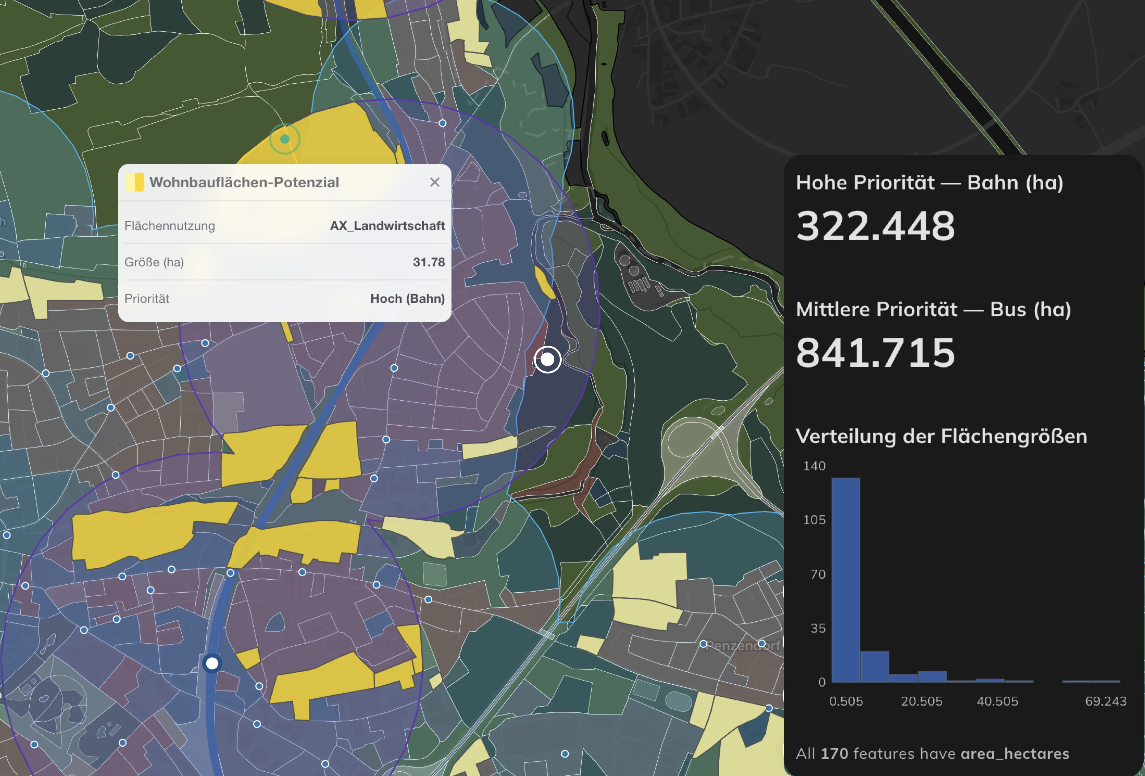
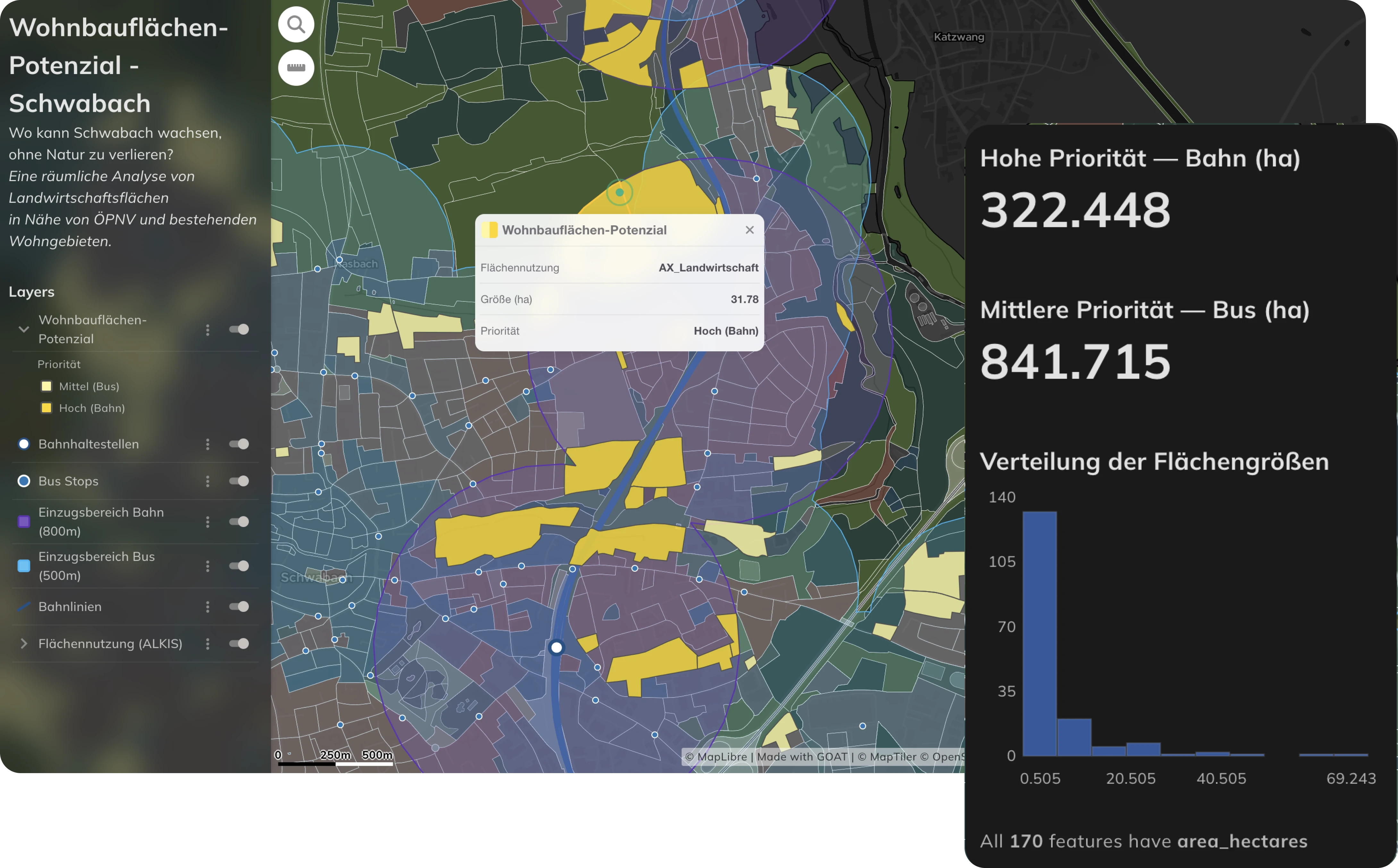
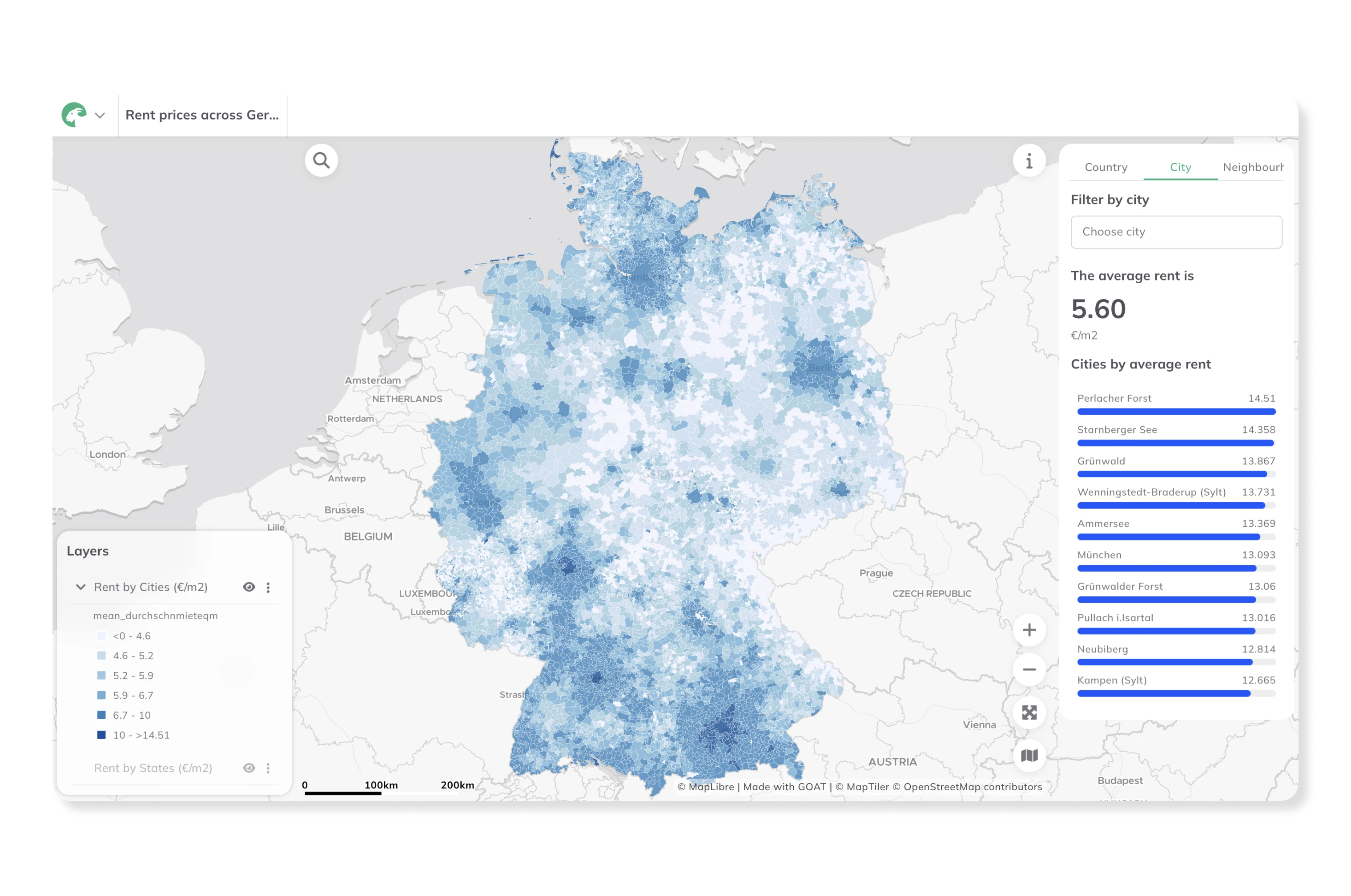
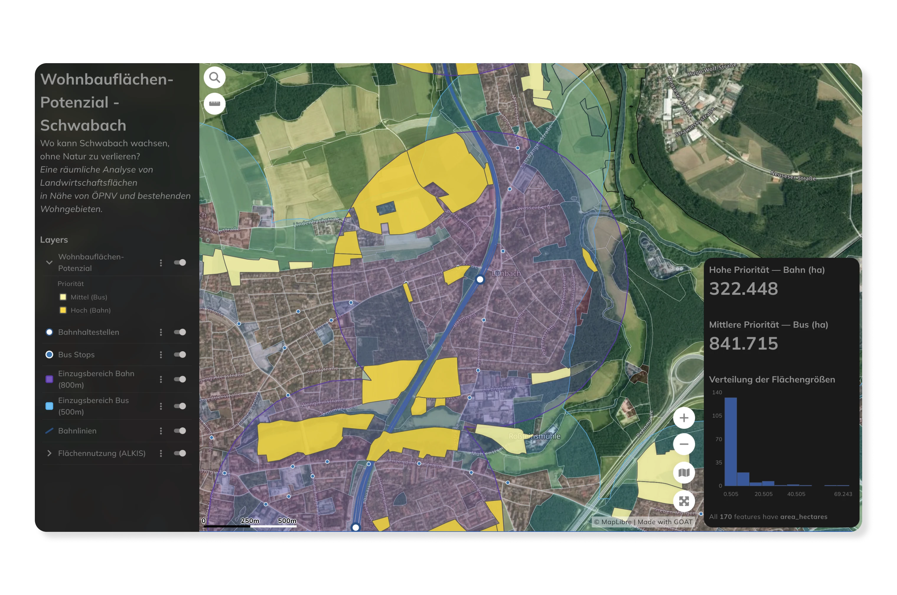
Evaluate the spatial suitability of development sites based on accessibility to daily destinations — supermarkets, schools, healthcare, public transport stops, and green spaces. GOAT's isochrone and heatmap analyses provide a comprehensive picture of location quality for walking, cycling, and transit, supporting strategic site selection and investment decisions.
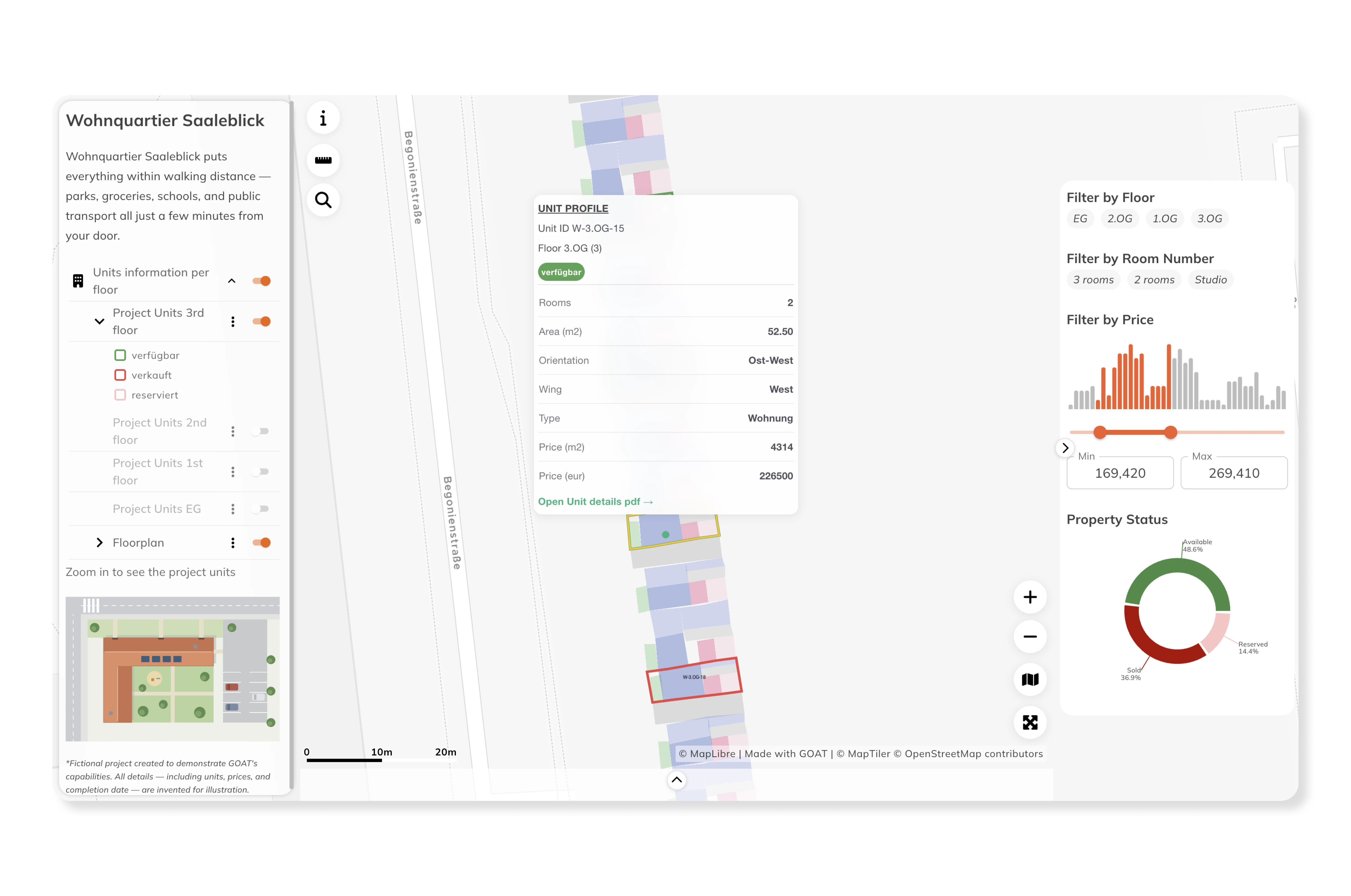
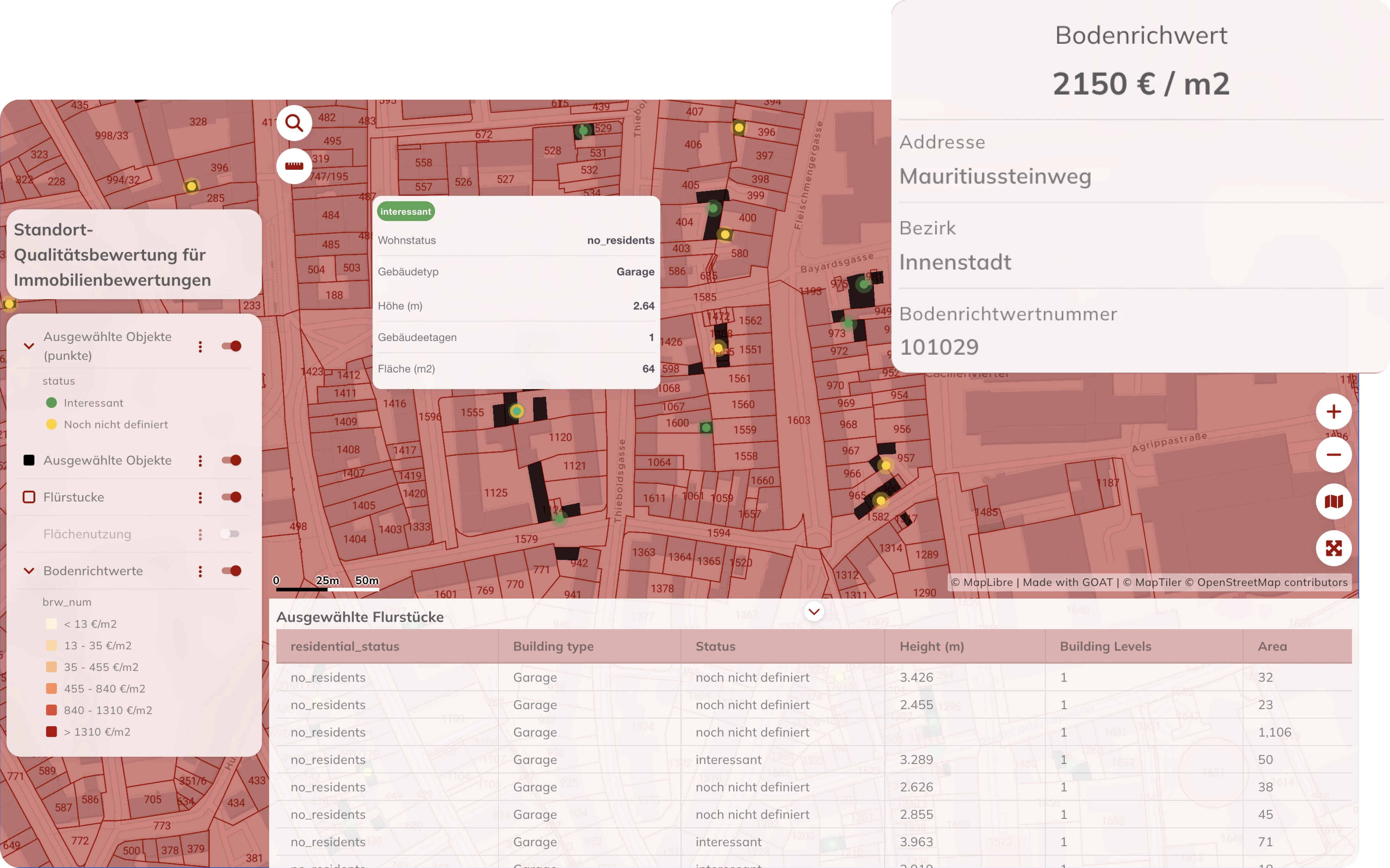
Understand how proximity to parks, public transport, schools, and retail affects the attractiveness and value of residential and commercial properties. GOAT enables detailed accessibility profiling of individual locations — providing a robust, data-driven foundation for valuation reports and development appraisals.
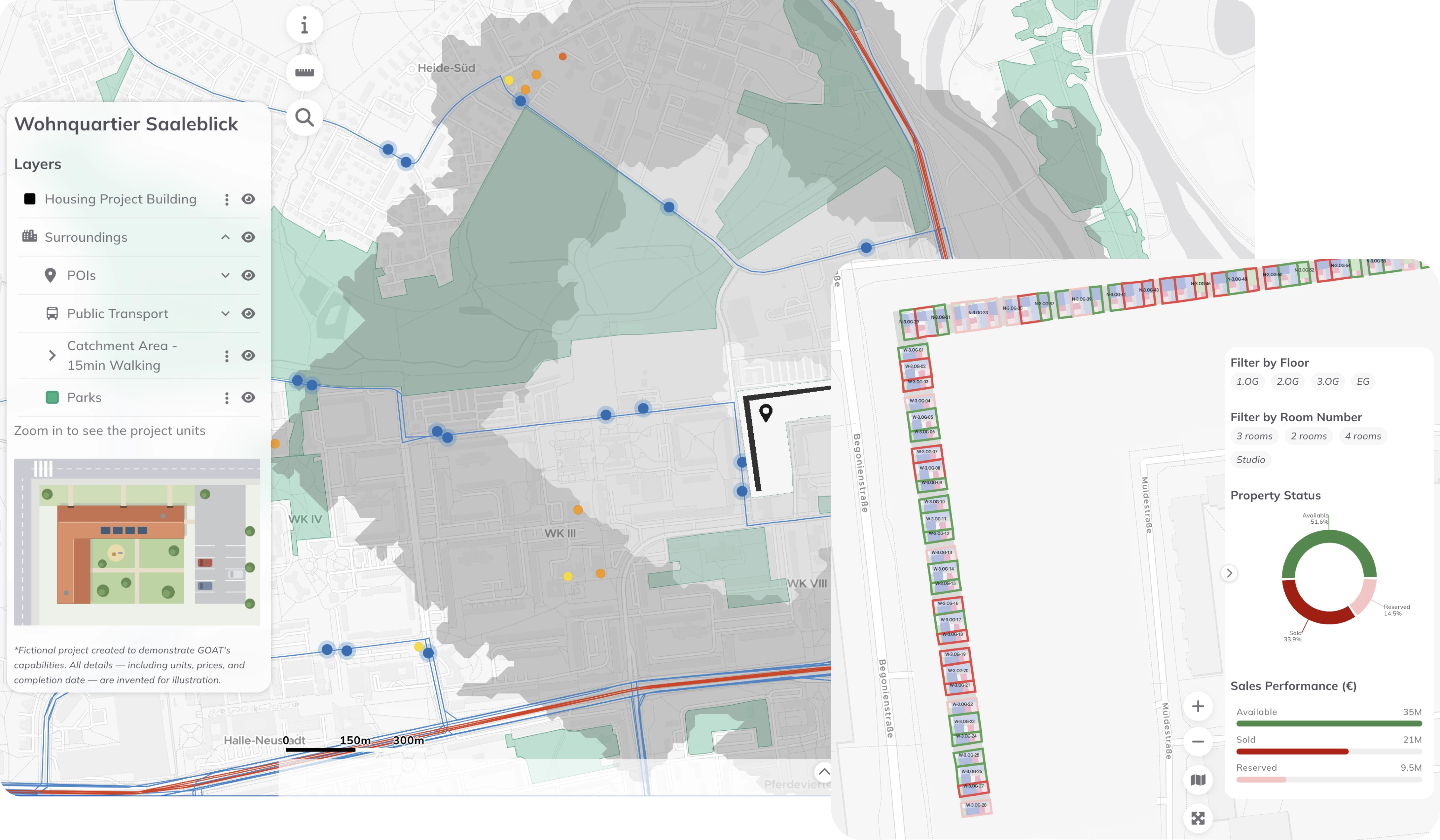
Present location analyses and planning results as interactive maps and dashboards — for use in client presentations, investor reports, public participation processes, or applications to planning authorities. GOAT makes complex spatial data accessible and visually compelling for non-specialist audiences.
Real analyses built by planners, researchers, and cities — explore what’s possible before you start your own.
accessibility indicators for walking, cycling, and public transport in one platform
cloud-based SaaS with no installation or IT overhead
cloud-based SaaS with no installation or IT overhead
built on open-source technologies and open data standards
from a single site assessment to a portfolio-wide location analysis
used for residential development projects, parking demand studies, and mobility concepts across Germany

.jpg)
.jpg)
Join planners and cities already using GOAT to make better decisions, faster.