Healthcare
Cities & Governement
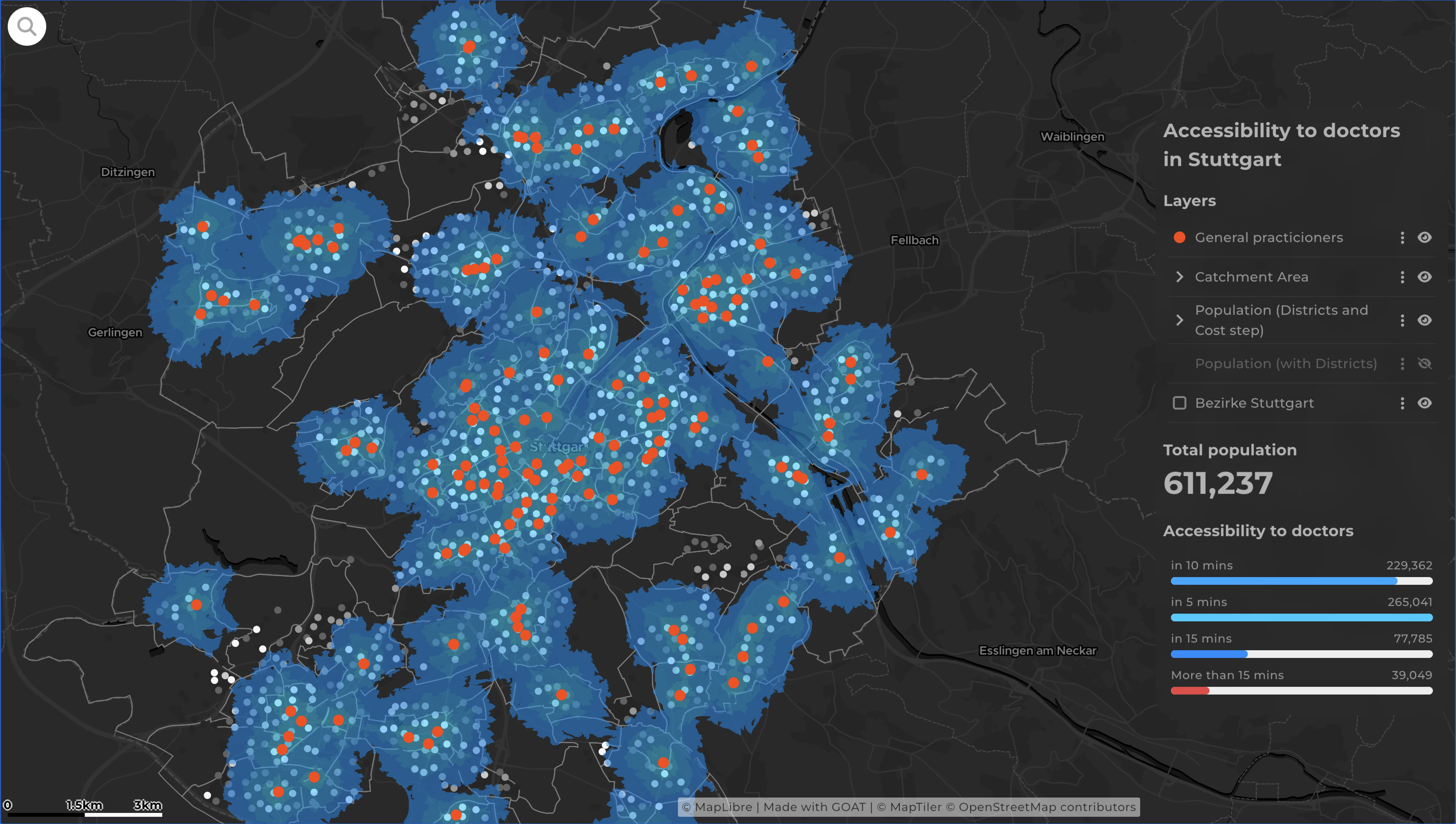
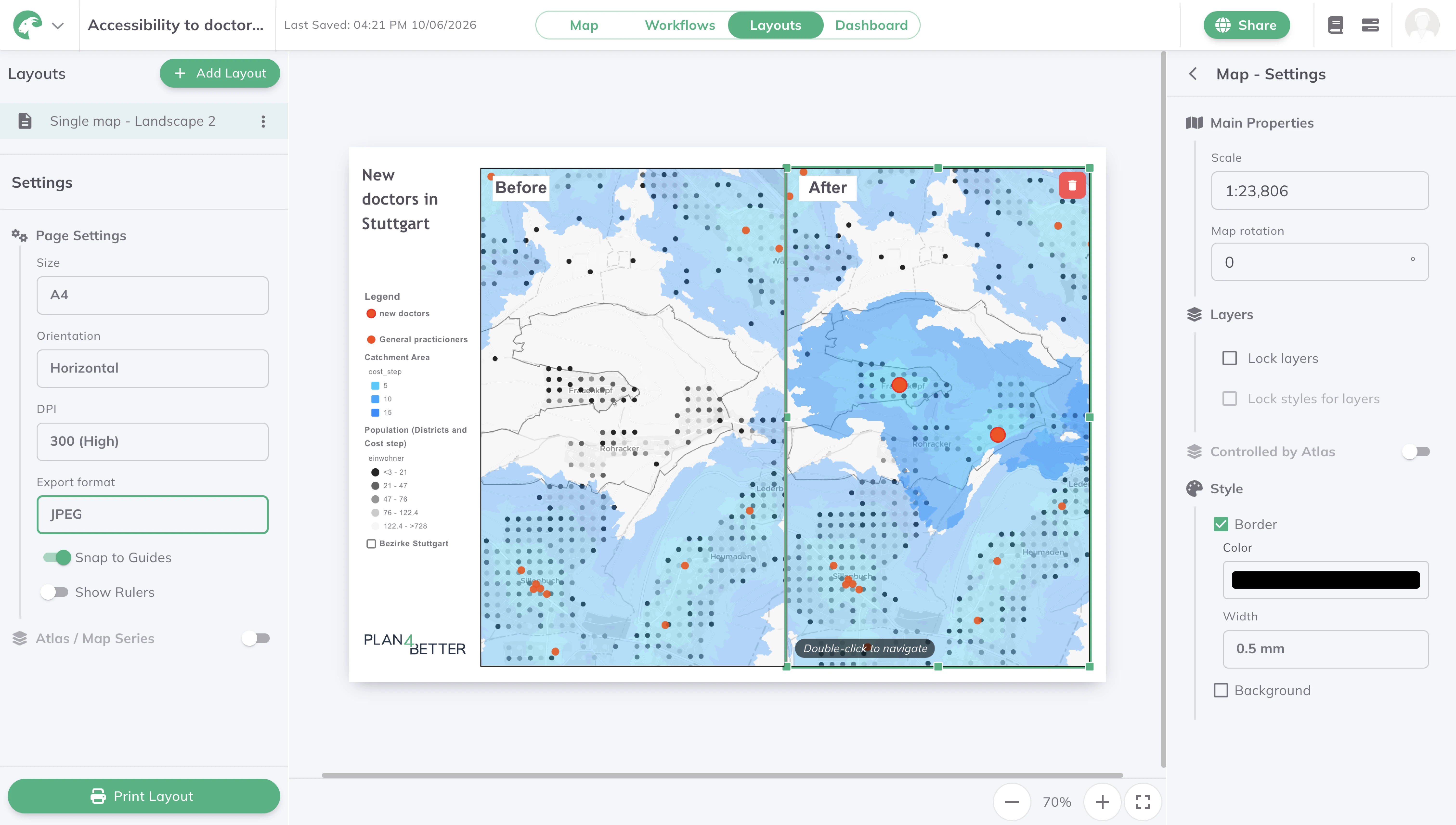
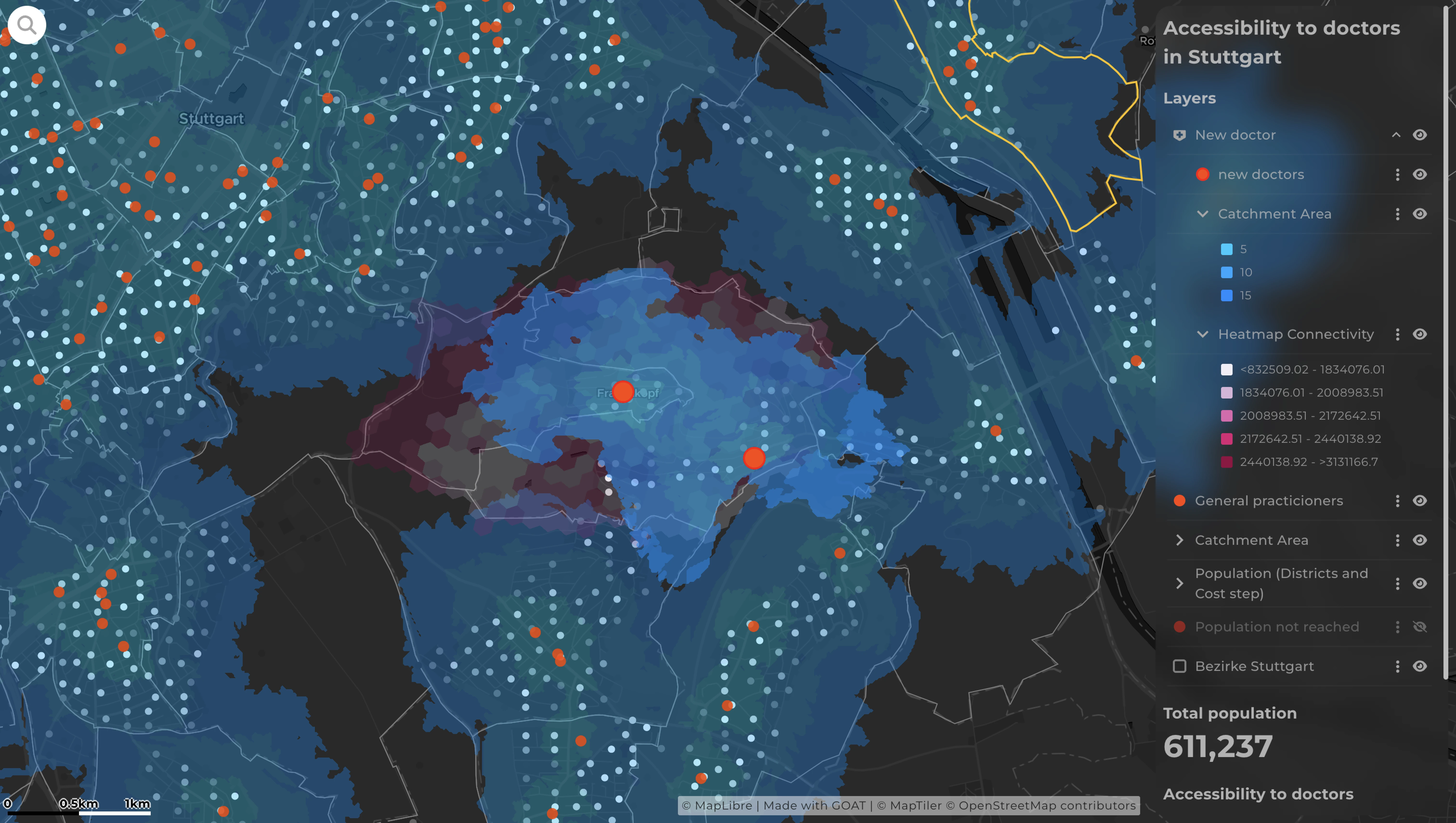
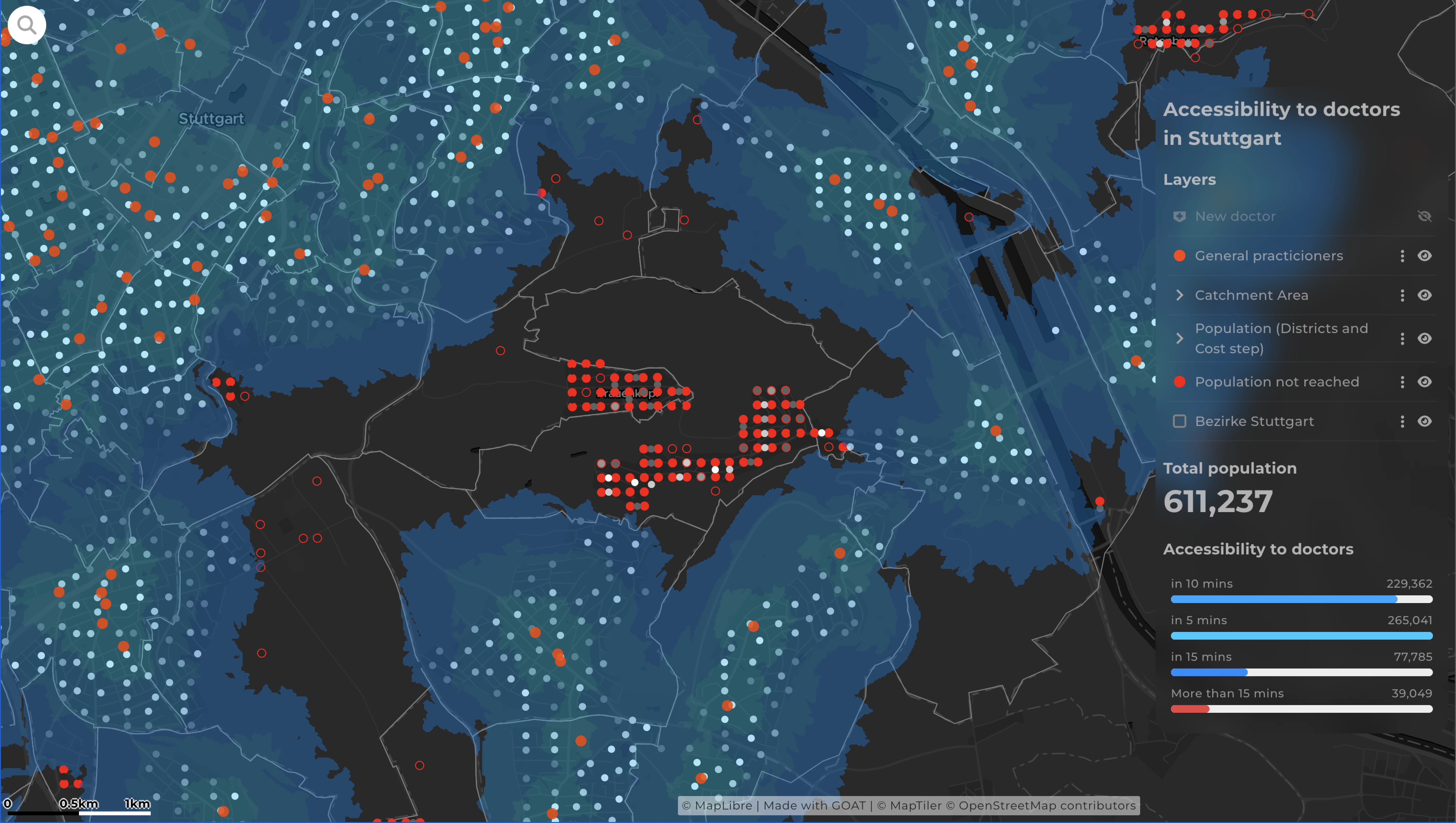
Reaching a doctor shouldn't depend on where you live — but increasingly it does. This map starts from the GP practices themselves and draws a catchment area around each one, showing how far people across Stuttgart can travel to reach care on foot. Where those catchments thin out or leave blank space, access is falling short — and those gaps become visible at a glance. A second step uses connectivity analysis to test candidate sites and suggest where a new practice would do the most good. For health authorities, insurers, and planners deciding where care is needed most, it turns a vague sense that "the outskirts are underserved" into a clear, evidence-based map — and the same workflow applies to hospitals, pharmacies, or any essential service.

.jpg)
.jpg)
Join planners and cities already using GOAT to make better decisions, faster.