GOAT at the Kassenärztliche Vereinigung Baden-Württemberg

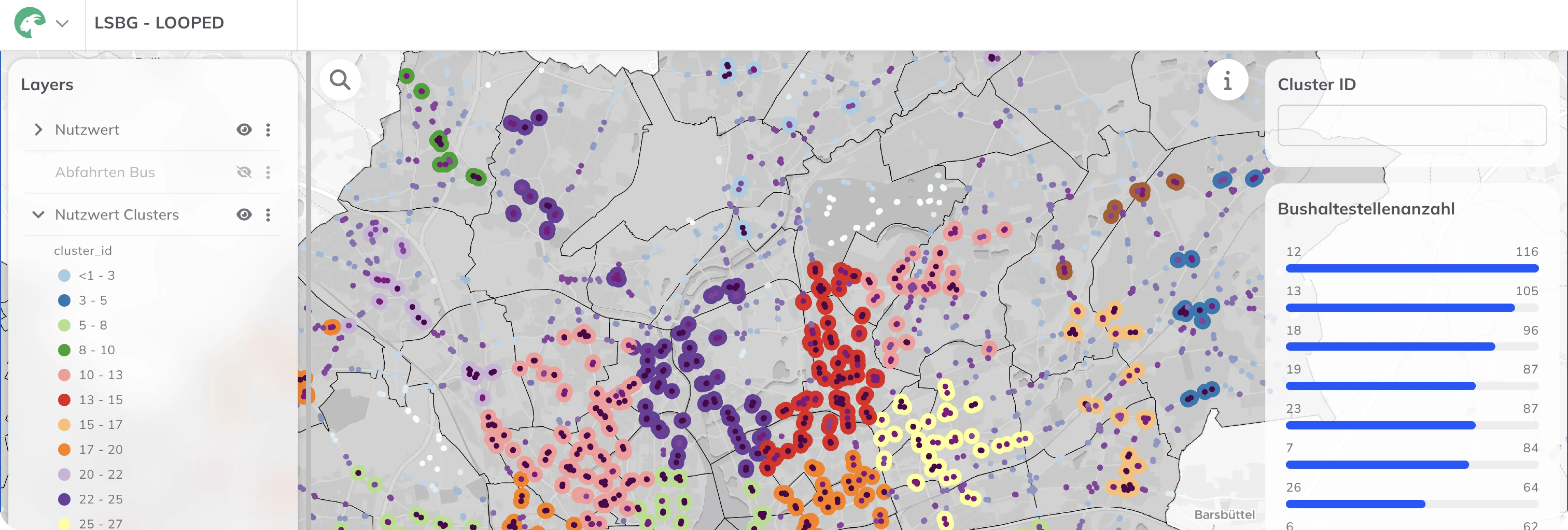
KVBW is establishing a modern geodata infrastructure using the WebGIS GOAT to tap into the previously unused potential of its existing data. The insights gained will support the individual departments in their planning and decision-making.

GOAT at the Kassenärztliche Vereinigung Baden-Württemberg

General information:

Client:
Kassenärztliche Vereinigung Baden-Württemberg
Period of time:
2025 - 2029

Planning Cases:

  • Routing and accessibility analyses to support decision-making in licensing / assurance
  • Integration of medical practice, hospital and rescue service data to optimize on-call availability and deployment planning in emergency service
  • Interactive maps for business consulting discussions with members of the Service & Consulting division
  • Map-based reports for mayors, district administrators and the Ministry of Social Affairs

Overview

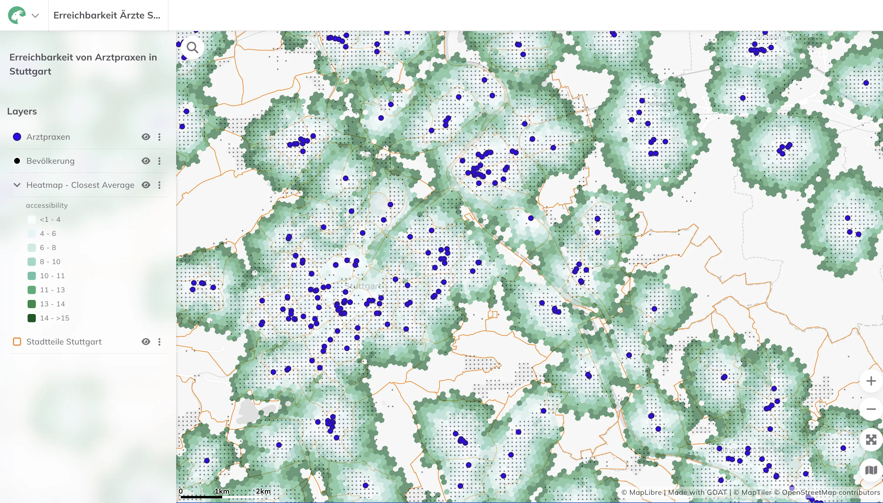
The Association of Statutory Health Insurance Physicians of Baden-Württemberg (KVBW) supports approximately 23,700 physicians and psychotherapists. In doing so, the KVBW faces the challenge of placing a greater emphasis on the spatial component of healthcare provision. Spatial analyses are becoming increasingly important—also in the context of questions around ensuring statutory medical care. Access and needs-based equity remain central issues and can be addressed using the WebGIS GOAT. Consequently, the creation, analysis, and visualization of maps at the KVBW is of great importance.  

Various departments—ranging from licensing and assurance through billing to emergency services—face the challenge of processing spatial questions more quickly and in a standardized manner. At the same time, external stakeholders (mayors, district administrators, and the Ministry of Social Affairs) require robust maps and analyses as a basis for decision-making.

Project Objectives

  • Establish a modern geodata infrastructure to make more efficient use of all spatial data
  • Develop standardized analysis workflows for accessibility, provision and demand analyses
  • Enhance planning and advisory capabilities across all business areas
  • Enable fast, user-friendly map creation and distribution for internal and external users

Solution Approach with WebGIS GOAT

The KVBW chose the cloud-based WebGIS GOAT to centrally store, visualize and process spatial data in interactive dashboards. Key aspects of the implementation include:

  • Simplicity of a modern web interface
  • Integration of all relevant datasets (practice locations, population statistics, infrastructure) into a unified platform
  • Configuration of dashboards with custom widgets for accessibility analysis (drive times, walking routes) and demand visualization
  • Establishment of roles and access rights for internal teams and external partners
  • Training of departments in map creation, data maintenance and export functions

Benefits

  • Reduced manual effort through standardized analysis processes
  • Accelerated decision-making cycles in licensing and emergency service committees
  • Increased transparency and traceability for external stakeholders
  • Improved data quality through centralized maintenance and version control
  • Strengthened collaboration between departments via a unified platform
Map
People on bicycles
People on bicycles

Let's create sustainable communities!

Whether you need state-of-the-art GIS technology, extensive datasets or expert advice – we are ready to help you shape a sustainable and liveable future for  our community.

Make an Appointment