The Hamburg State Agency for Roads, Bridges and Waterways (LSBG) is tasked with systematically retrofitting approximately 2,400 bus stops for barrier-free access. The automated, standardized multi-criteria analysis required for this is being developed using the WebGIS GOAT.
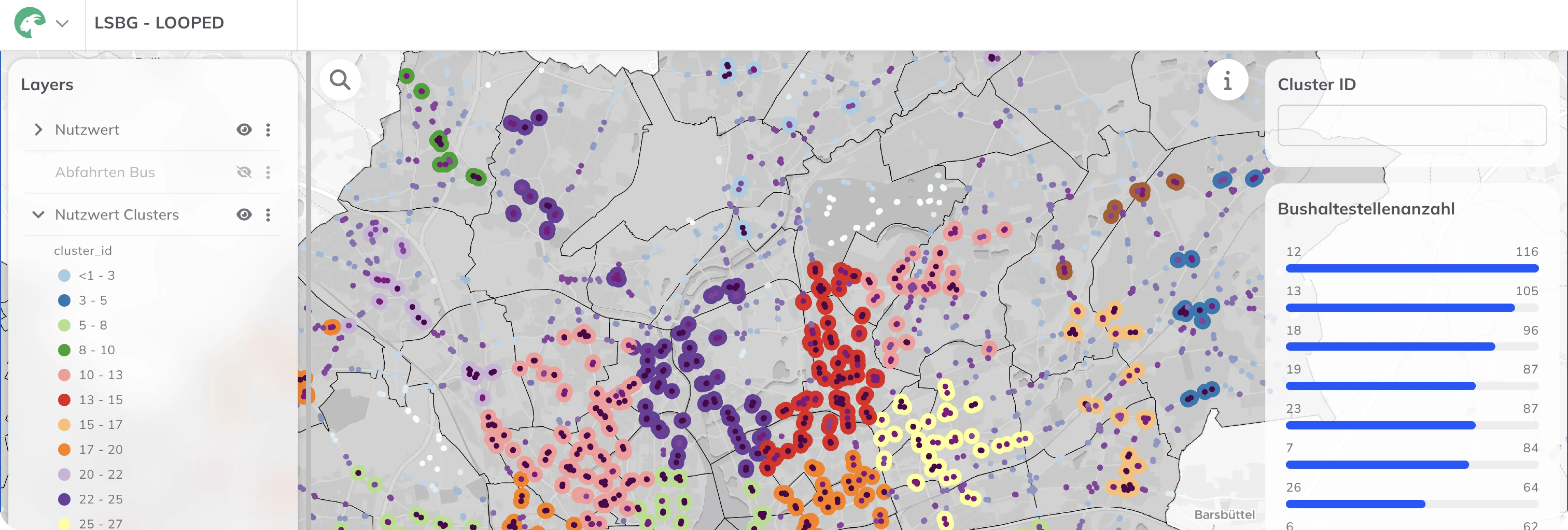
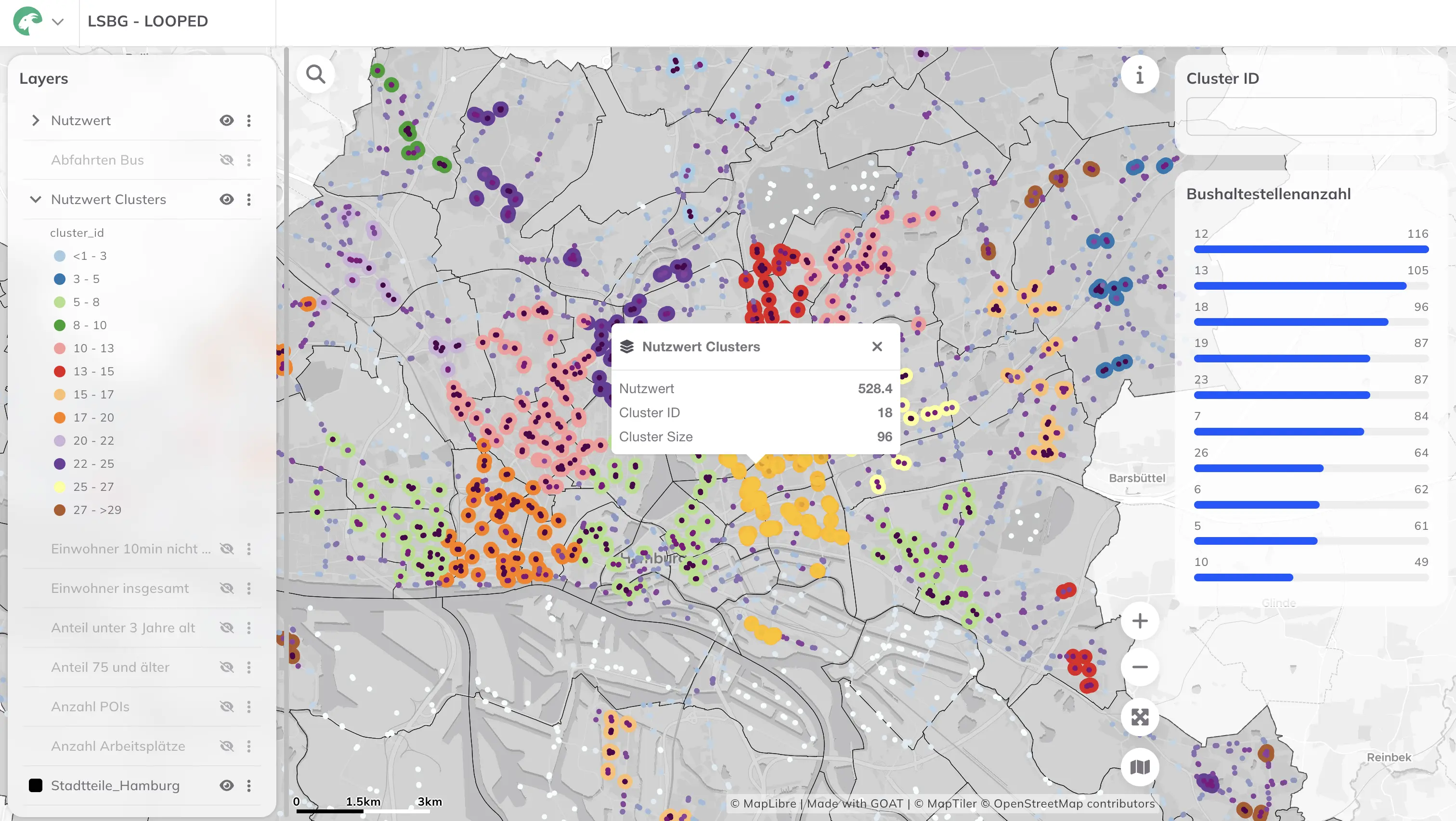
The systematic prioritization and barrier-free retrofit of approximately 2,400 bus stops presents a massive planning and logistical challenge. Given limited resources, it’s crucial to initiate measures where they will have the greatest impact—both in terms of accessibility and cost-efficiency. To this end, the Hamburg State Agency for Roads, Bridges and Waterways (LSBG) is pursuing a fully digital, serial planning approach to ensure efficiency and scalability. The core challenge lies in the sheer number of individual stops and their complex evaluation criteria—from spatial integration into the urban fabric, to accessibility, to sociodemographic factors. Only a highly automated, data-driven, holistic approach can make this complexity manageable.
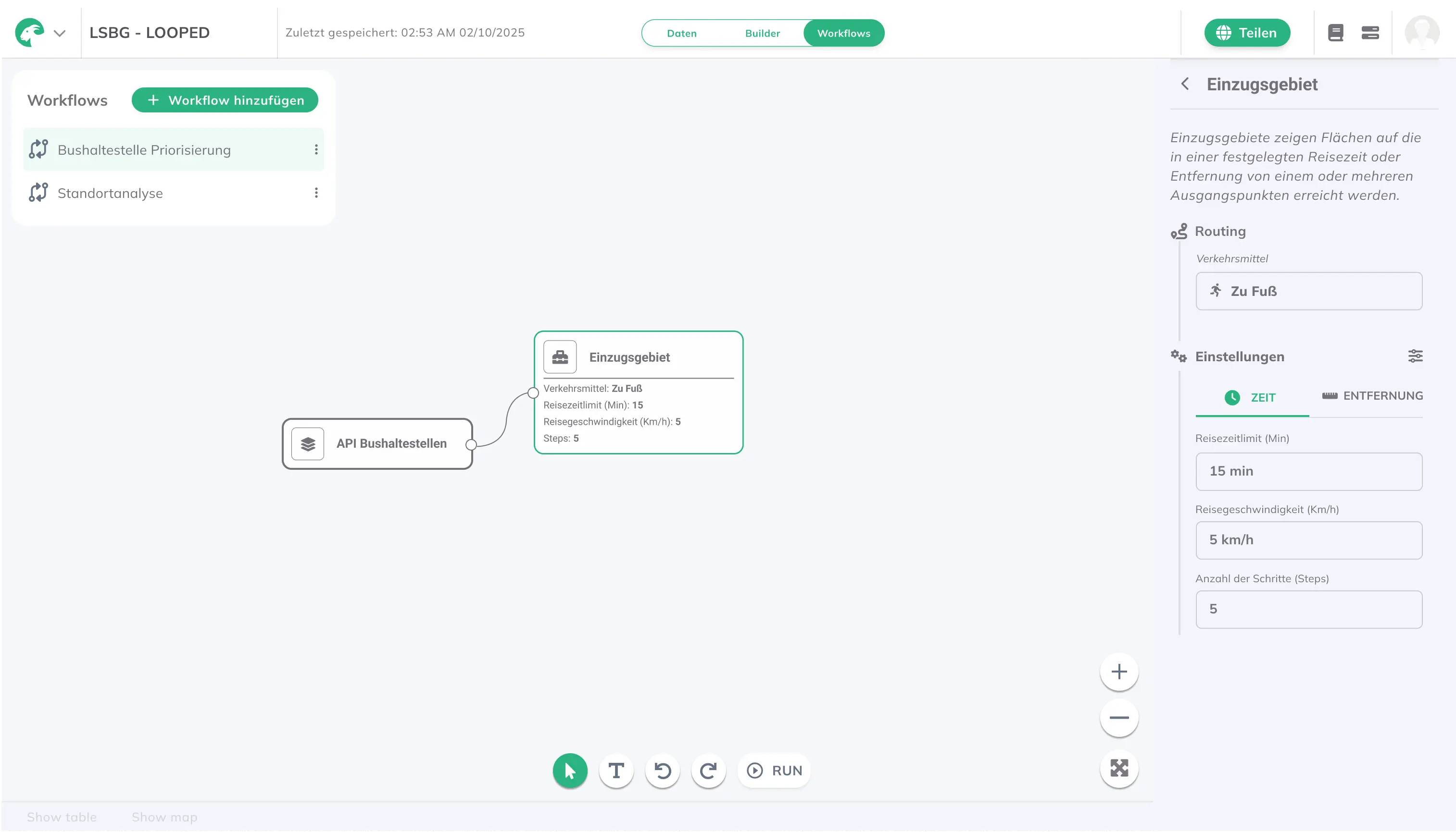
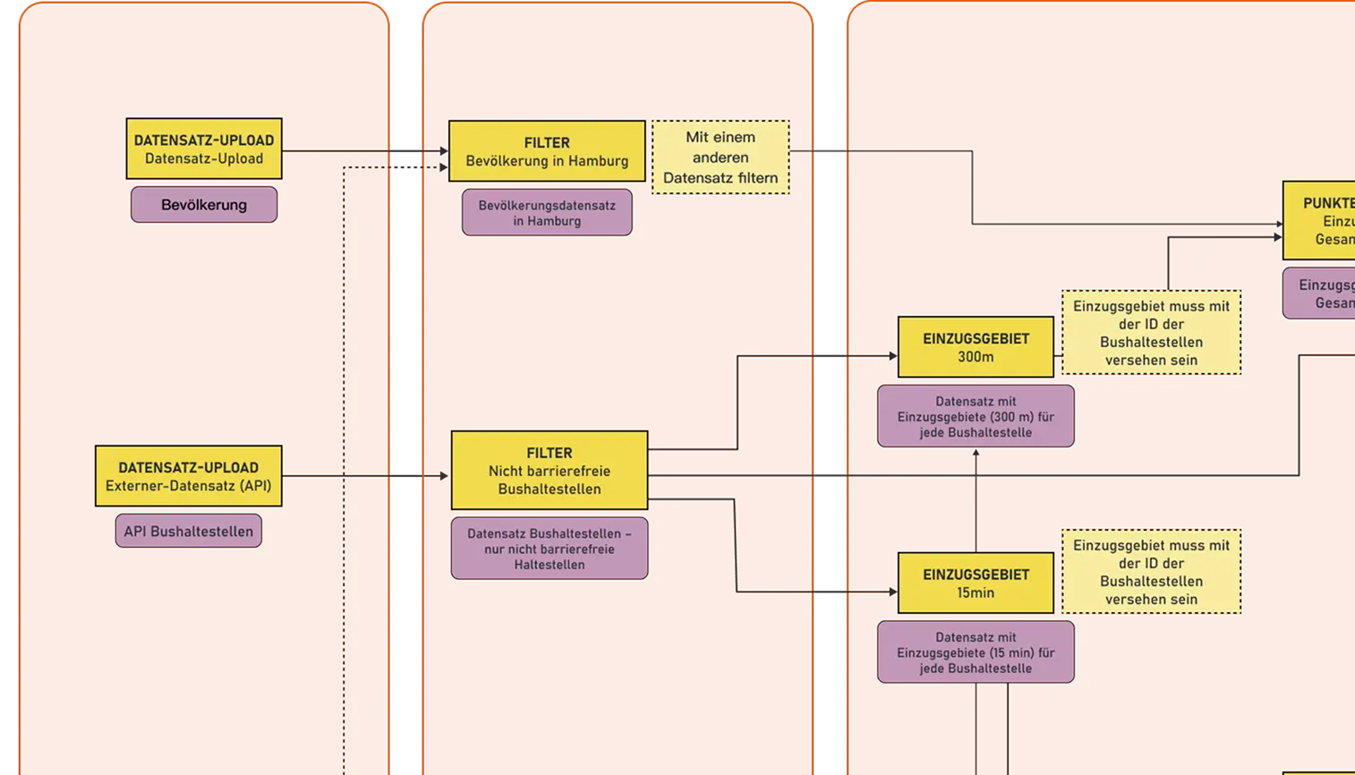
This is where Plan4Better comes in: a web-based solution for clustering prioritized sites, integrating all relevant data (e.g. timetables, sociodemographics and accessibility) and enabling a robust multi-criteria analysis—from initial preliminary planning to on-the-ground implementation within the LOOPED network. The solution is built on the WebGIS GOAT platform, which allows complex indicators to be calculated and visualized in a multi-stakeholder environment. The following GOAT components are being developed for the multi-criteria analysis:

.jpg)
.jpg)
Join planners and cities already using GOAT to make better decisions, faster.
