sMArtroots - App for Locating Handicap Parking Spaces

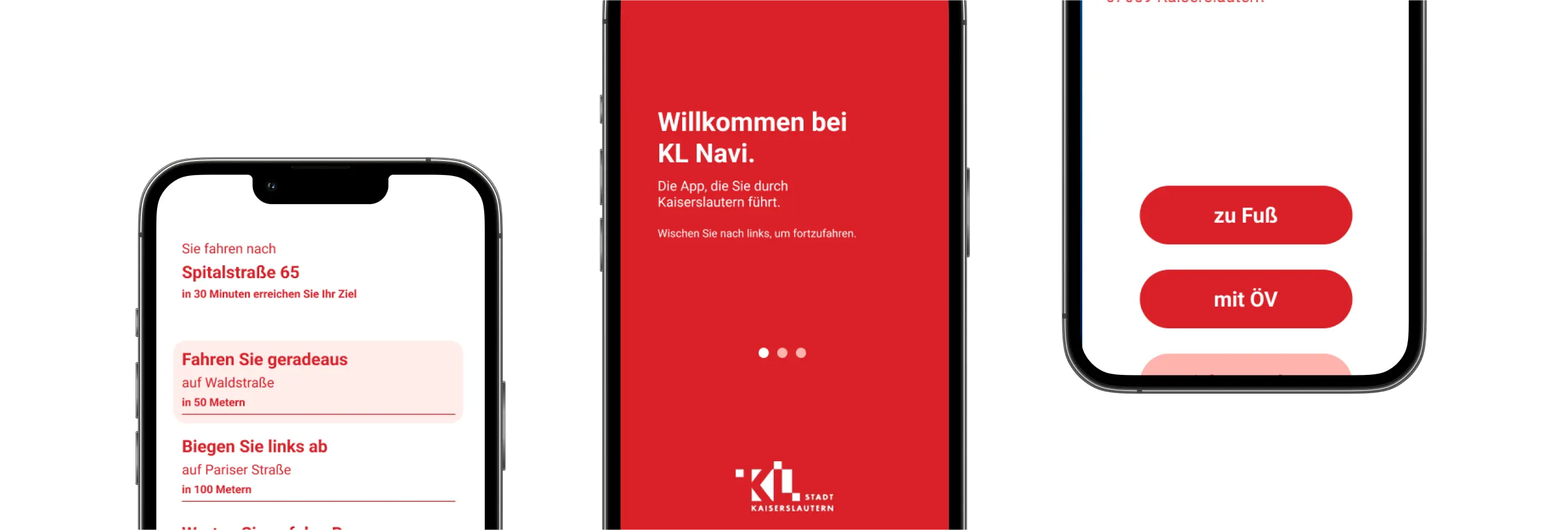
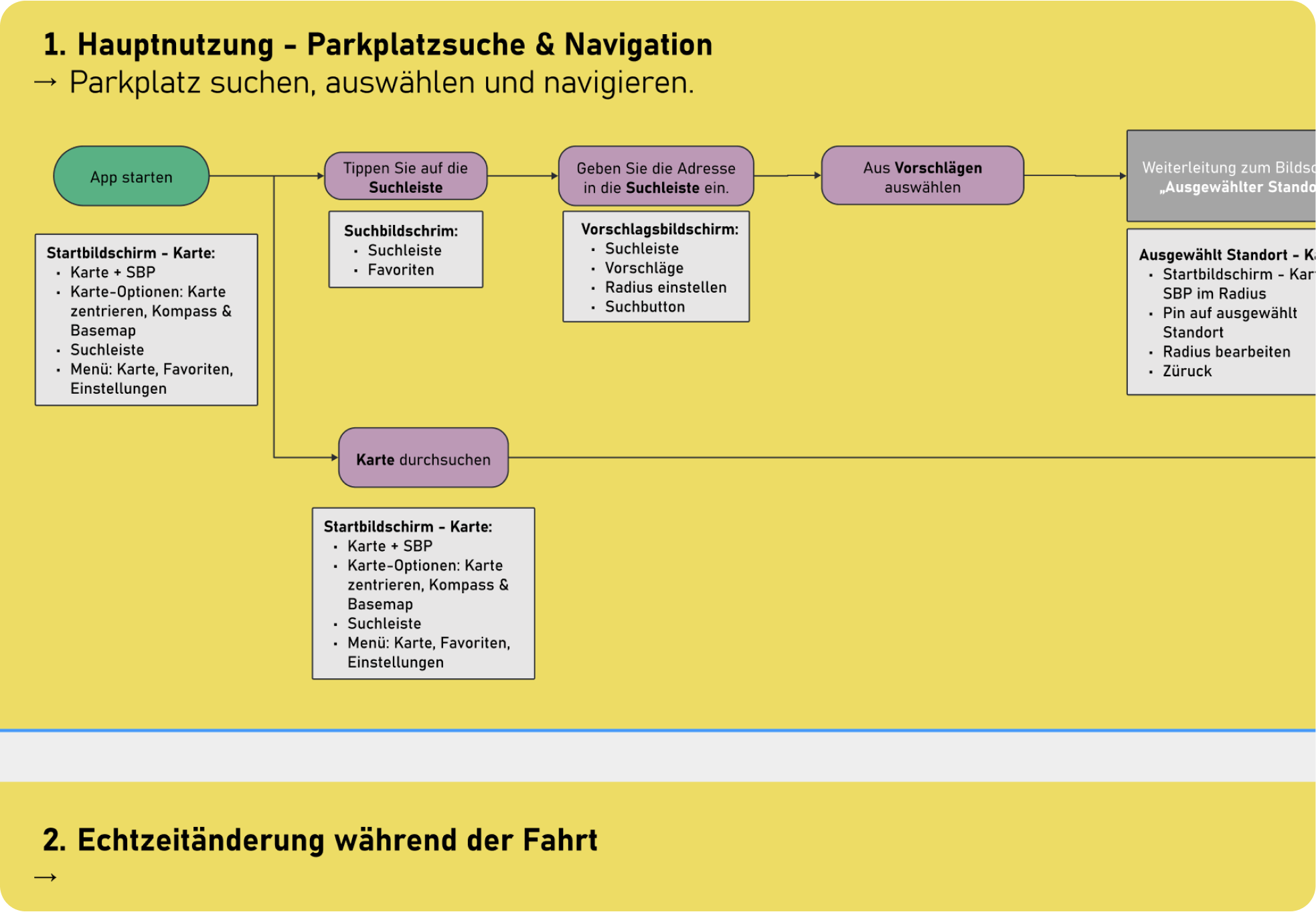
Enhancing mobility for people with disabilities goes beyond physical spaces—it calls for innovative digital tools. Together with the city of Mannheim, we are creating an accessible app that provides real-time information on available disabled parking spots and guides users directly to them, fostering greater independence in urban mobility.
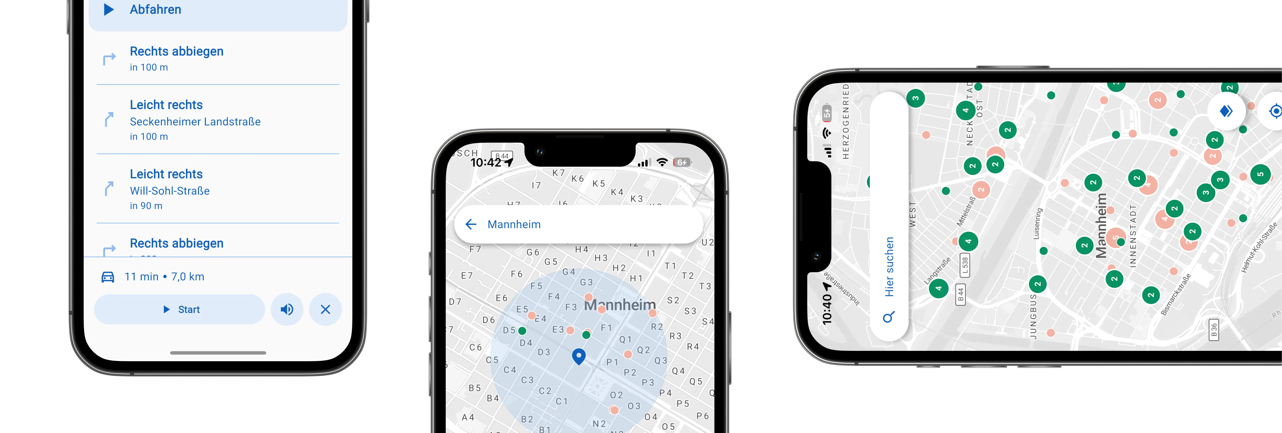
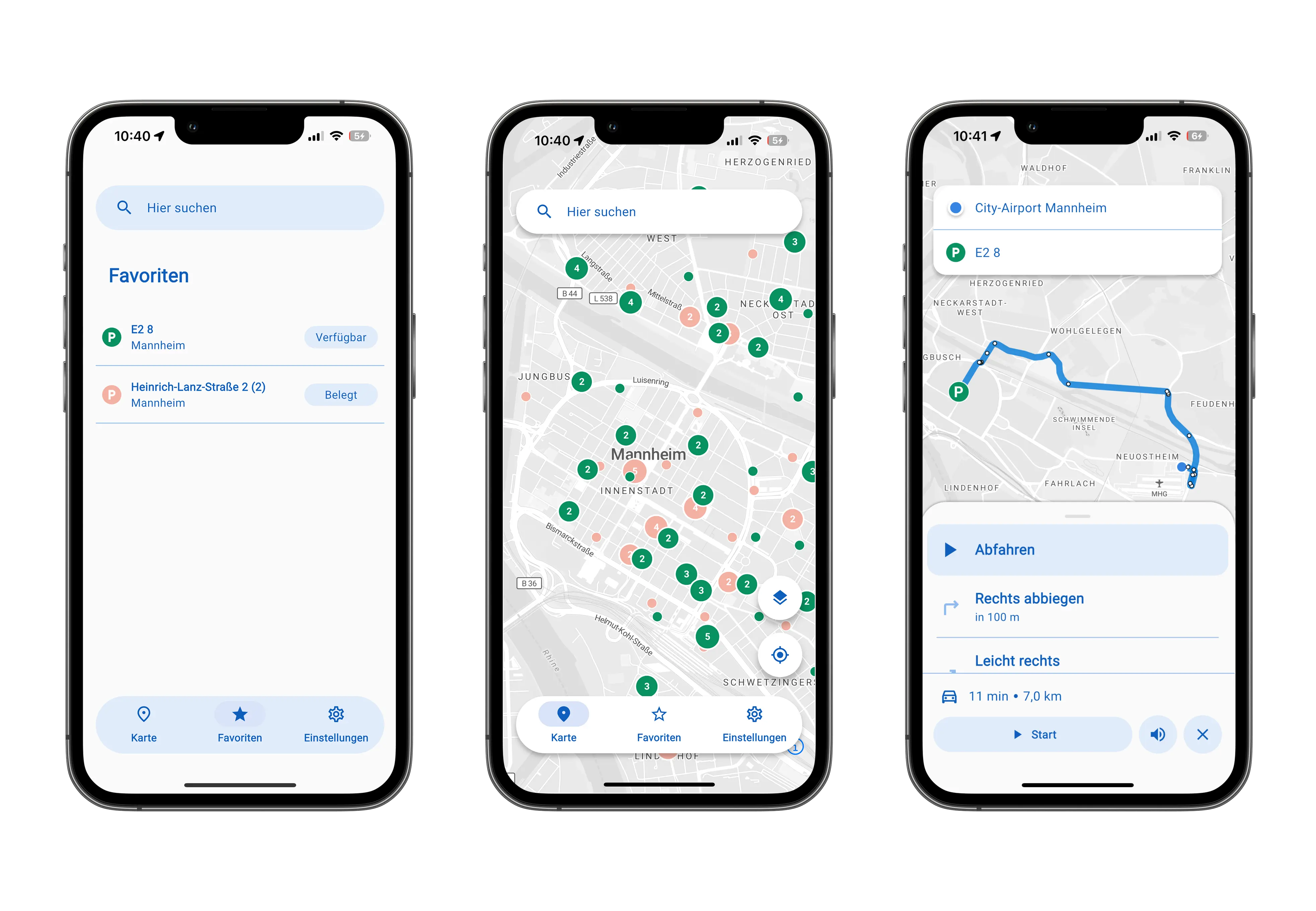
sMArtroots - App for Locating Handicap Parking Spaces

General information:

Client:
City of Mannheim
Period of time:
2025

Planning Cases:

  • Develop a navigation app for people with disabilities to locate and access parking spaces.
  • Use sensor-based real-time data for accurate parking availability.
  • Ensure barrier-free design following accessibility standards (EN 301 549, WCAG 2.2 AA).
  • Collaborate closely with user groups for co-creative development and testing.
  • Overview

    In the pilot project we are developing a navigation app that helps people with disabilities find and access designated disabled parking spaces for the City of Mannheim. Equipped with sensors on 248 parking spots, the app provides real-time availability and guides users reliably to free spaces. It combines open-source routing technologies with official traffic data and is designed to be fully accessible, meeting EN 301 549 and WCAG 2.2 AA standards. The app is planned for scalable rollout across the Baden-Württemberg region via the MobiData BW platform.

    Key Methods & Approach

  • Apply an agile development process with iterative testing phases.
  • Close collaboration with user groups.
  • Development aligned with accessibility standards EN 301 549 and WCAG 2.2 AA.
  • Use a modern, cross-platform tech stack based on Flutter, and integrate routing via OpenTripPlanner.
  • Use of open data as well as municipal data sources  on the availability of parking spots.
  • Designed for easy expansion to new functions, features, and cities via MobiData BW.
  • Features & Accessibility

  • Automatically displays user location and surrounding available parking spaces, in a visual and accessible format.
  • Supports voice input, address search, and favorite locations.
  • Dynamic rerouting if parking availability changes en route.
  • Compatible with screen readers and offers speech control.
  • Focus on data protection, security, transparency, and long-term public availability.
  • Map
    People on bicycles
    People on bicycles

    Let's create sustainable communities!

    Whether you need state-of-the-art GIS technology, extensive datasets or expert advice – we are ready to help you shape a sustainable and liveable future for  our community.

    Make an Appointment