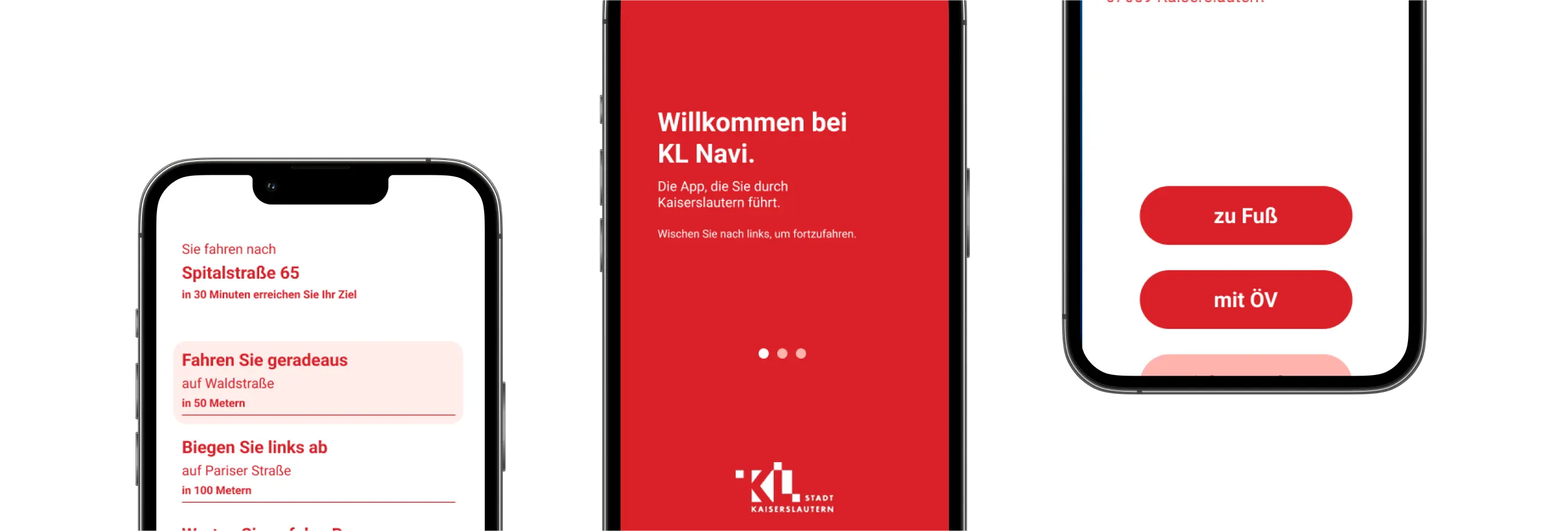
Open-source mobility solutions: Cutting-edge UI/UX enabling accessible navigation, multimodal trip planning, and truly inclusive journeys—for all.
Our services include
We develop cross-platform solutions using a single codebase, enabling seamless deployment across multiple operating systems.
We design inclusive digital solutions that prioritize accessibility, ensuring usability for all, including people with disabilities.
We engage users and stakeholders continuously during development to co-create needs-driven, practical, and inclusive solutions.
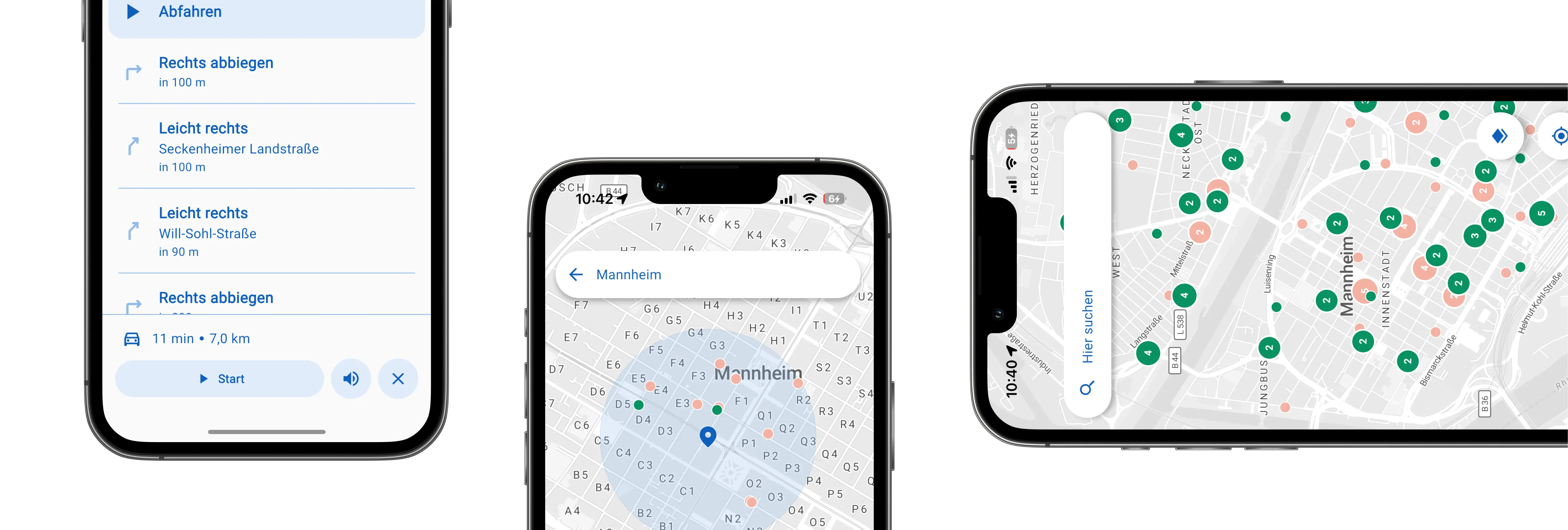
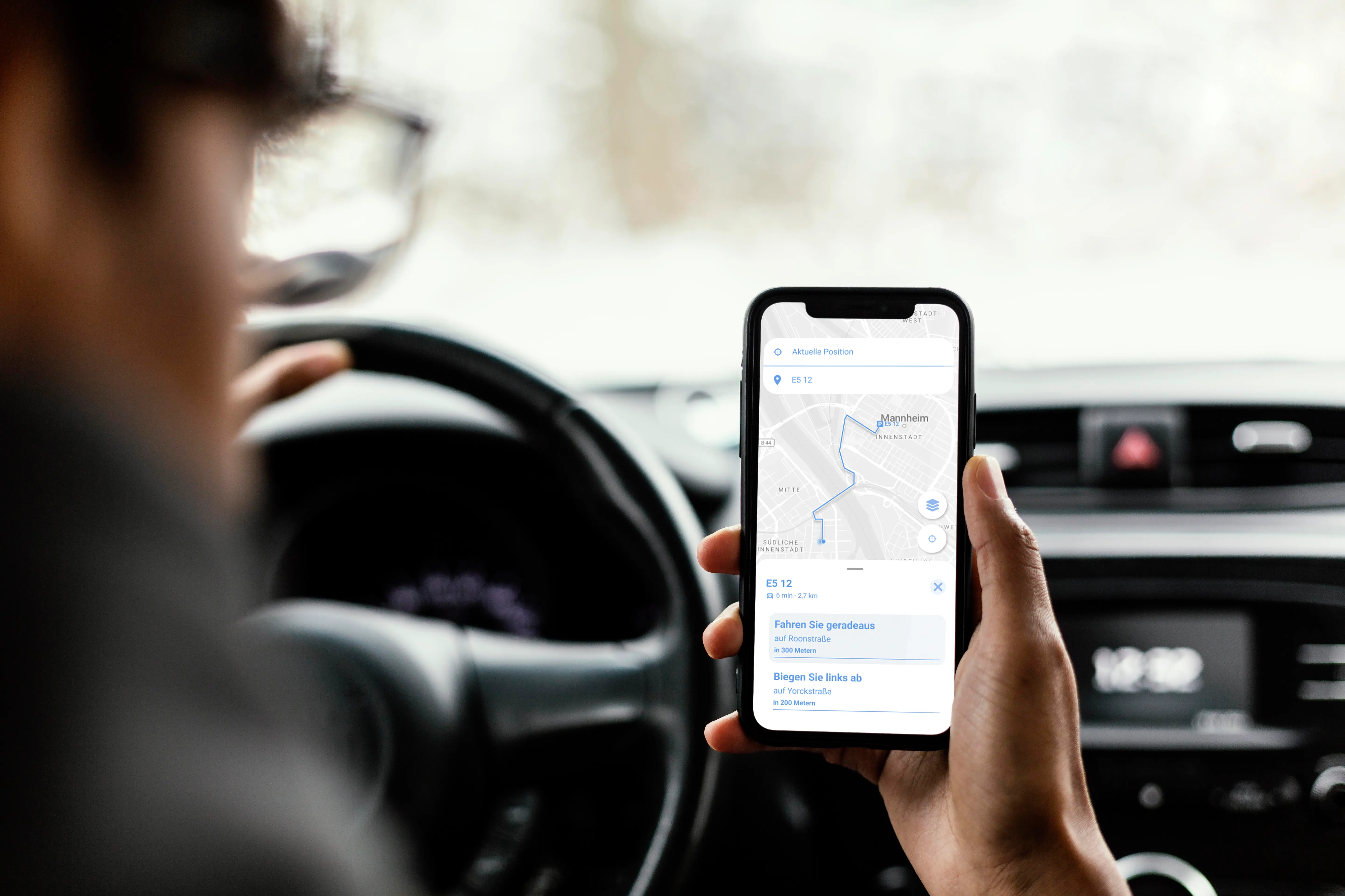
We apply and develop routing algorithms that integrate multiple transport modes and personalize routes based on user preferences and accessibility needs.
We connect platforms to live data and APIs for up-to-date information, enabling responsive and dynamic services.
Scalable by design, our modular systems adapt effortlessly to new features and future needs.
Learn more about related projects.
- We develop open source and apply an agile, user-centered development process continuously integrating feedback from our users.
- Our work is guided by inclusive design principles and adheres to accessibility standards such as WCAG and EN 301 549.
- We apply a modern tech stack, using cross-platform technologies like Flutter and open routing engines such as OpenTripPlanner.
- Our apps integrate open data and can connect to customer-specific data sources, including real-time information.
- All solutions are modular and designed to scale easily — supporting new features, user groups, and different geographic contexts.
%20(1).webp)

.jpg)
.jpg)
Join planners and cities already using GOAT to make better decisions, faster.