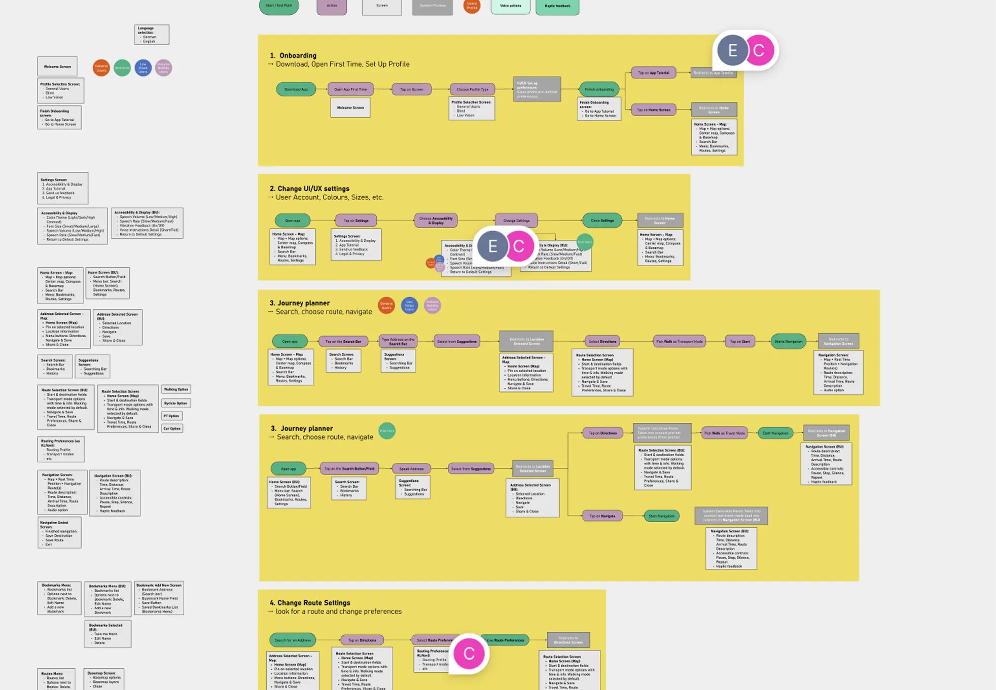
Planning cities today means much more than just arranging streets and buildings; apps decisively shape how we experience urban life. Together with the city of Kaiserslautern, we are creating an app that aims to help blind and visually impaired people navigate the city more easily.
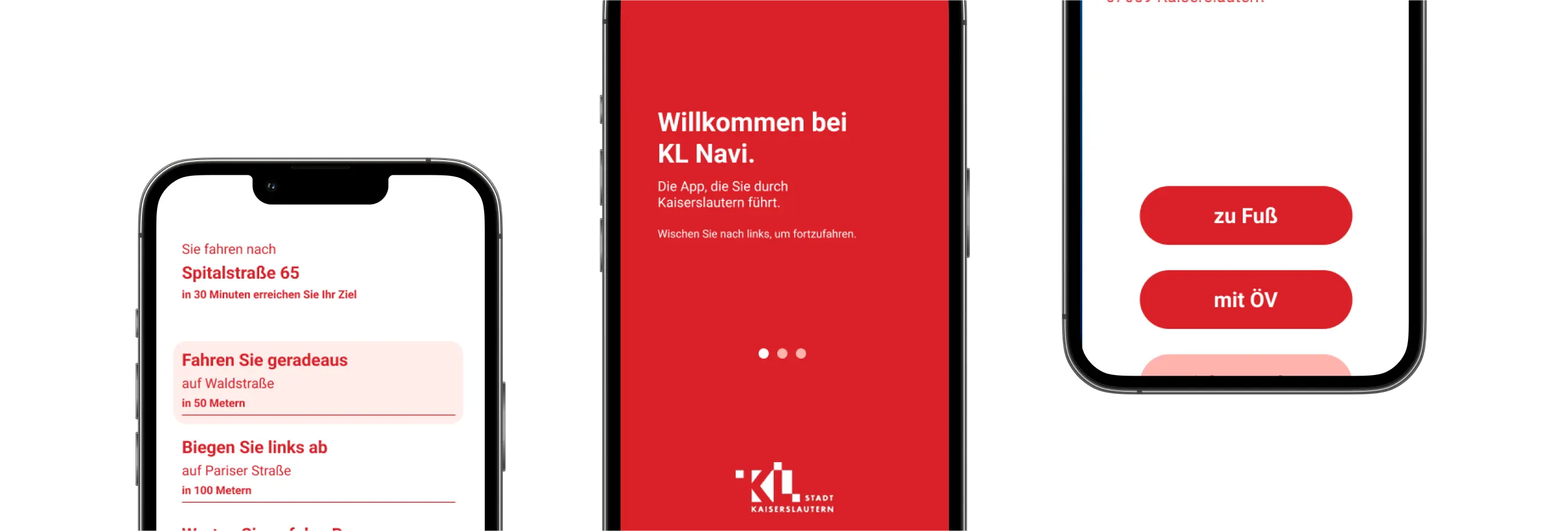
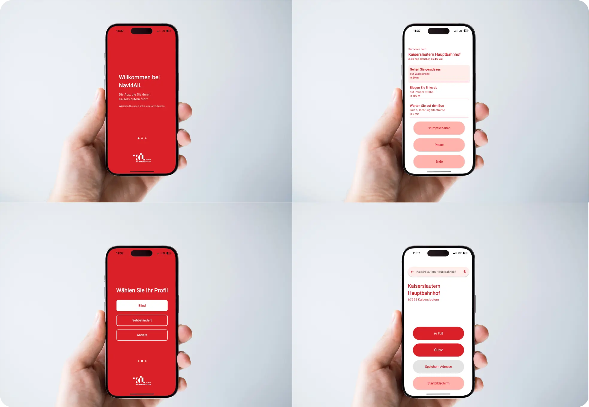
The “Navi4all” project is a pilot initiative to develop a mobile navigation app tailored for blind and visually impaired users developed along with the City of Kaiserslautern. The app focuses on inclusive design, offering personalized routing and accessibility features such as screen reader compatibility, audio guidance, and integration of local data like construction sites and sidewalk quality. Developed in close collaboration with affected users, the app is part of a larger effort to promote barrier-free mobility in urban areas.
The project aims to enhance independent mobility for blind and visually impaired individuals through tailored routing options. The app combines inclusive design, local urban data, and technical integration to create an intuitive, accessible navigation tool. To meet the diverse needs of users — and as part of its integration within the KL.Navi platform — the system offers different user interfaces for different user profiles, including blind and visually impaired users as well as sighted users, each optimized for clarity, usability, and accessibility.

.jpg)
.jpg)
Join planners and cities already using GOAT to make better decisions, faster.