July 14, 2026
GOAT
We announce GOAT 2.3.0 “Tarn”, a major new release of GOAT, our open, web-based WebGIS platform for spatial analysis and data-driven planning across multiple disciplines.
This version introduces a fundamental evolution of GOAT’s backend architecture, focused on performance, interoperability, and long-term scalability. At the same time, it brings an important new feature for printing maps and reports, and new spatial analysis tools, expanding what you can do directly within GOAT.
GOAT 2.3.0 lays the foundation for faster analytics, more robust workflows, and better integration with open geospatial standards, ensuring GOAT can scale with increasingly complex planning and research projects.
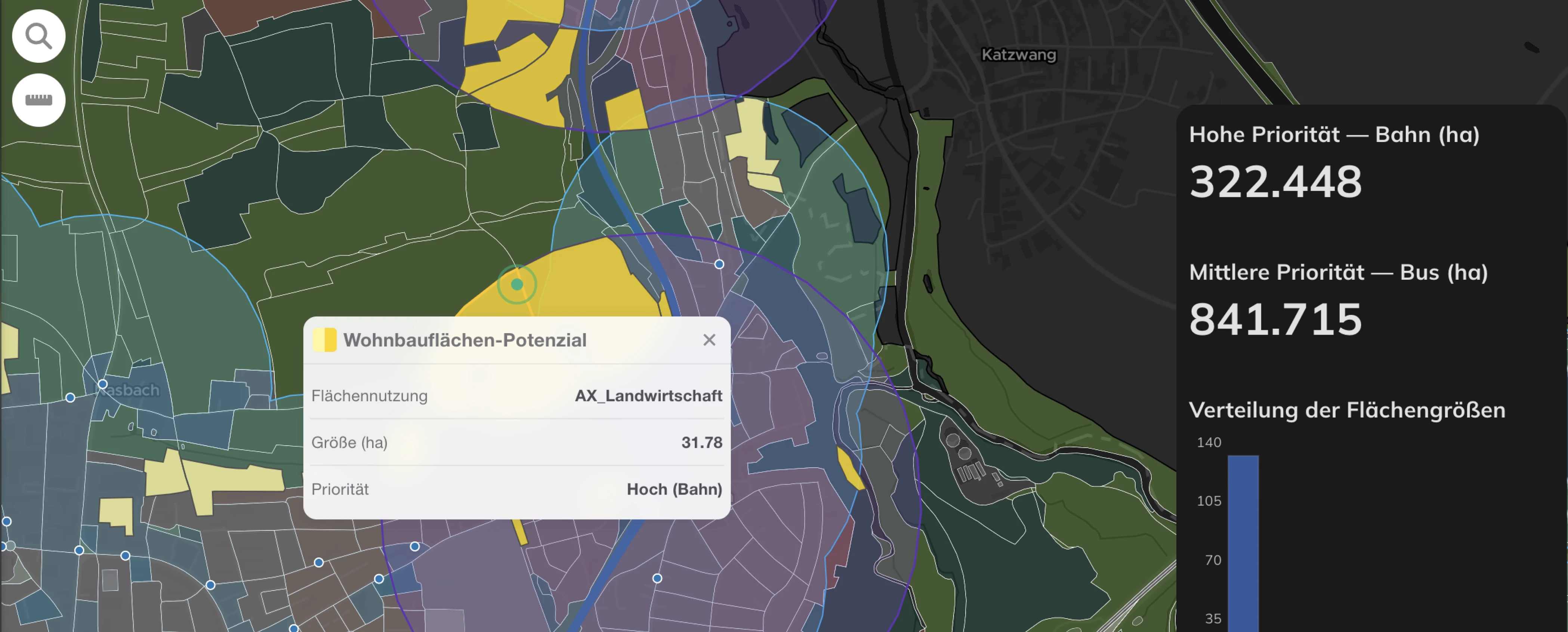
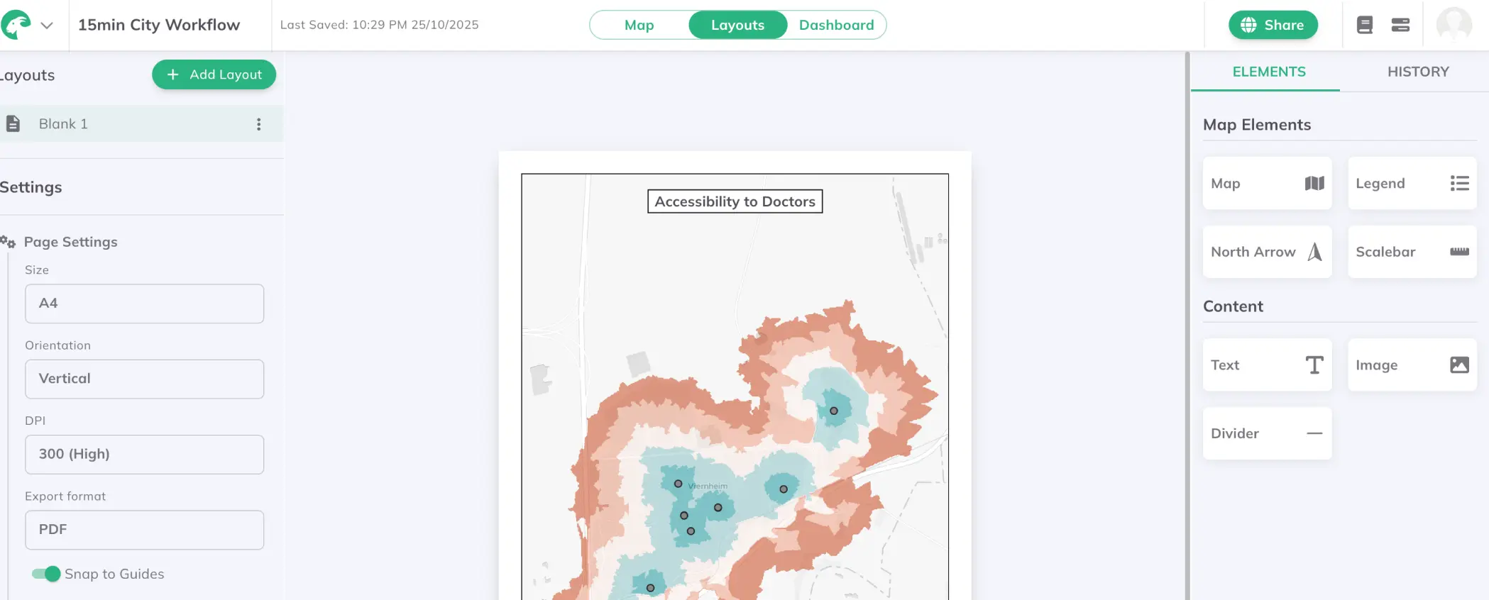
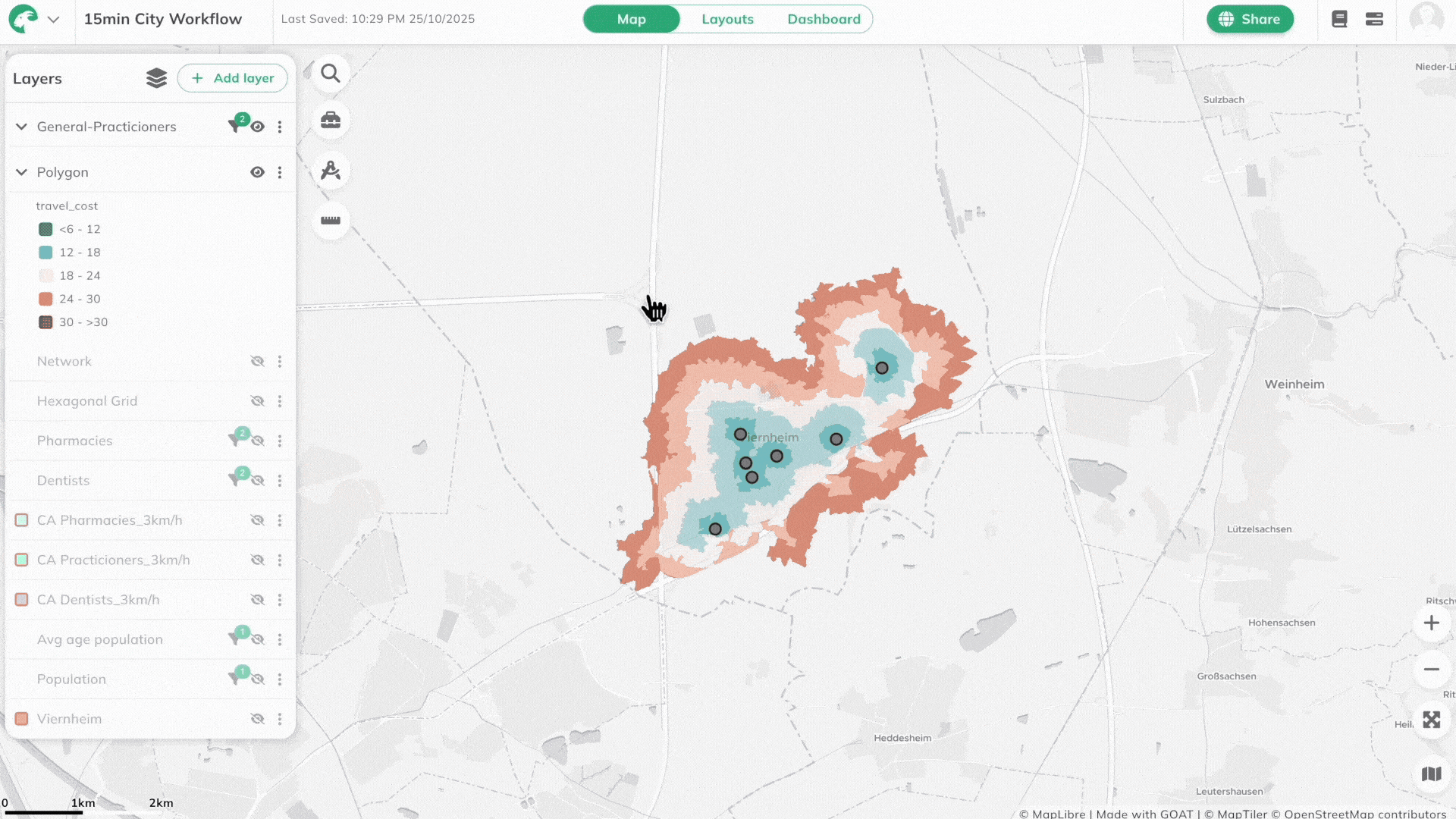
With GOAT 2.3.0, you can now print maps. GOAT already offers interactive dashboards and maps for exploration, analysis, and sharing insights dynamically. However, we know that static maps are still essential in many planning workflows — especially for reports, official documents, presentations, and stakeholder communication.
Our new Layouts mode allow you to design structured, presentation-ready map compositions that can be exported as PNG or PDF, making them ideal for:
This feature helps bridge the gap between interactive spatial analysis and static communication, allowing planners, researchers, and consultants to move seamlessly from insights to print-ready outputs without leaving GOAT.
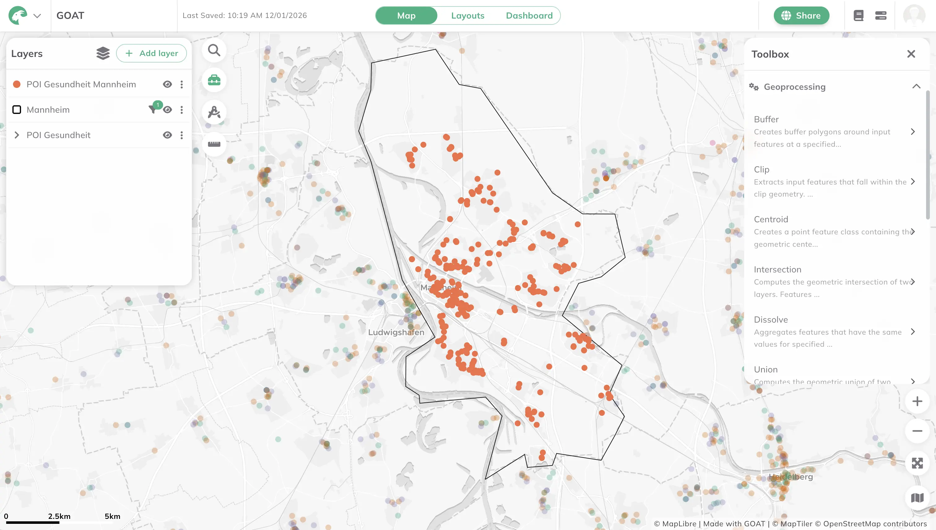
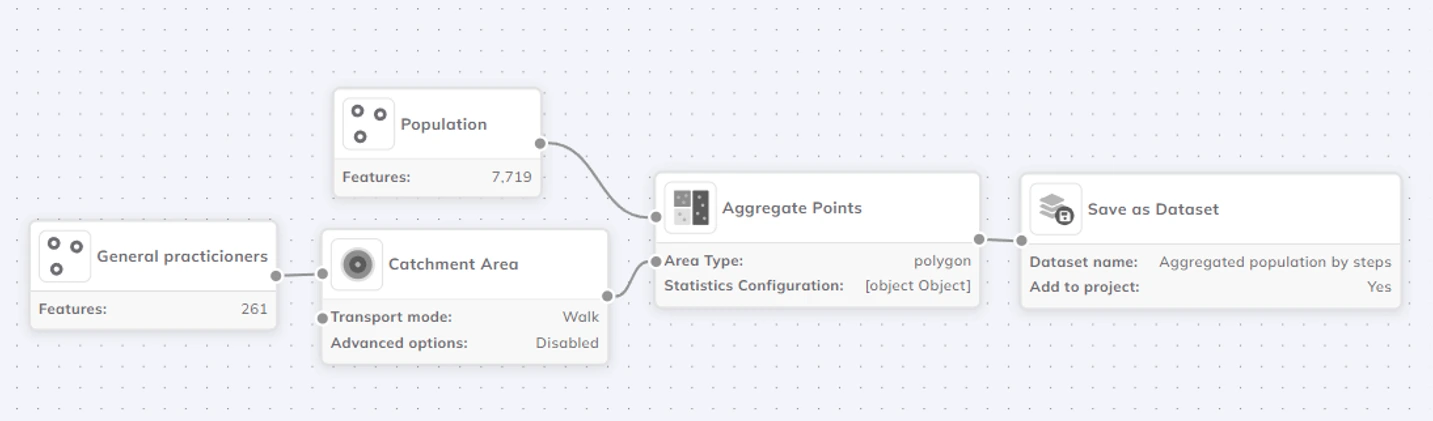
GOAT 2.3.0 also expands the toolbox with new geoprocessing and geocoding capabilities, making it easier to prepare, combine, and analyze spatial data directly within GOAT.
Several commonly used GIS operations are now available as built-in tools, including:
These tools allow you to perform essential data preparation and spatial analysis steps without exporting data to external GIS software, helping keep workflows simpler, faster, and more reproducible.
GOAT 2.3.0 also introduces a geocoding tool.
This allows you to convert addresses or place names into geographic locations, making it easier to bring tabular data (such as addresses or locations lists) into GOAT and use it directly in spatial analyses and maps.
Many of the biggest improvements in GOAT 2.3.0 happen behind the scenes. While you don’t directly see them in the interface, they make GOAT faster, more reliable, and easier to grow over time.
Here’s what changed — in simple terms.
GOAT now uses Windmill to run and manage its internal data workflows.
In practice, this means that tasks like processing data, running analyses, and updating results are handled in a clearer, more structured way. Workflows are easier to monitor, less likely to break, and simpler to extend with new features.
For users, this results in:
GOAT’s internal API has been redesigned to follow OGC API standards, which are widely used in the geospatial world.
This makes it easier for GOAT to:
In short, GOAT becomes more open, interoperable, and future-proof, which is especially important for public-sector projects and collaborative planning workflows.
GOAT now uses DuckDB for analytics, combined with DuckLake for storing data efficiently.
This new setup is designed for fast analytical queries, even when working with large or complex spatial datasets. It also separates how data is stored from how it is analyzed, making the system more flexible and scalable.
What this means for you:
All geospatial data in GOAT is now stored using GeoParquet, a modern open data format.
GeoParquet is optimized for:
By using GeoParquet, GOAT aligns with current best practices in geospatial data management, making data handling more efficient today and more compatible with future tools and workflows.
Together, these architectural improvements deliver:
While many of these changes operate behind the scenes, they significantly improve GOAT’s reliability and performance for everyday use.
GOAT 2.3.0 “Tarn” is a foundational release. It focuses less on isolated features and more on building a future-ready urban analytics platform that supports: open standards and interoperability, scalable spatial analytics, and reliable workflows for professional planning and research. This release ensures that GOAT can continue to grow alongside the needs of cities, planners, and researchers — without sacrificing usability or performance.
If you are not yet using GOAT, you can simply sign up for a free account to start your journey. And if you need help with the features, just check out our updated documentation featuring guides for all features, included the new ones.
GOAT
.png)
Development

.jpg)
.jpg)
Join planners and cities already using GOAT to make better decisions, faster.