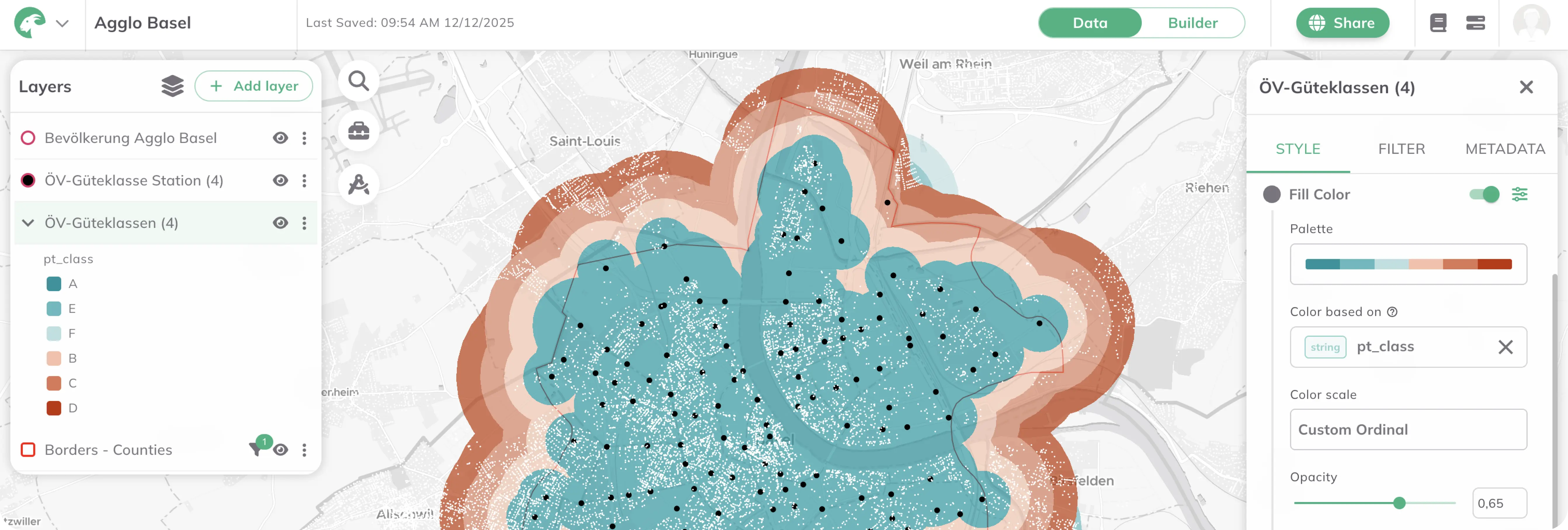
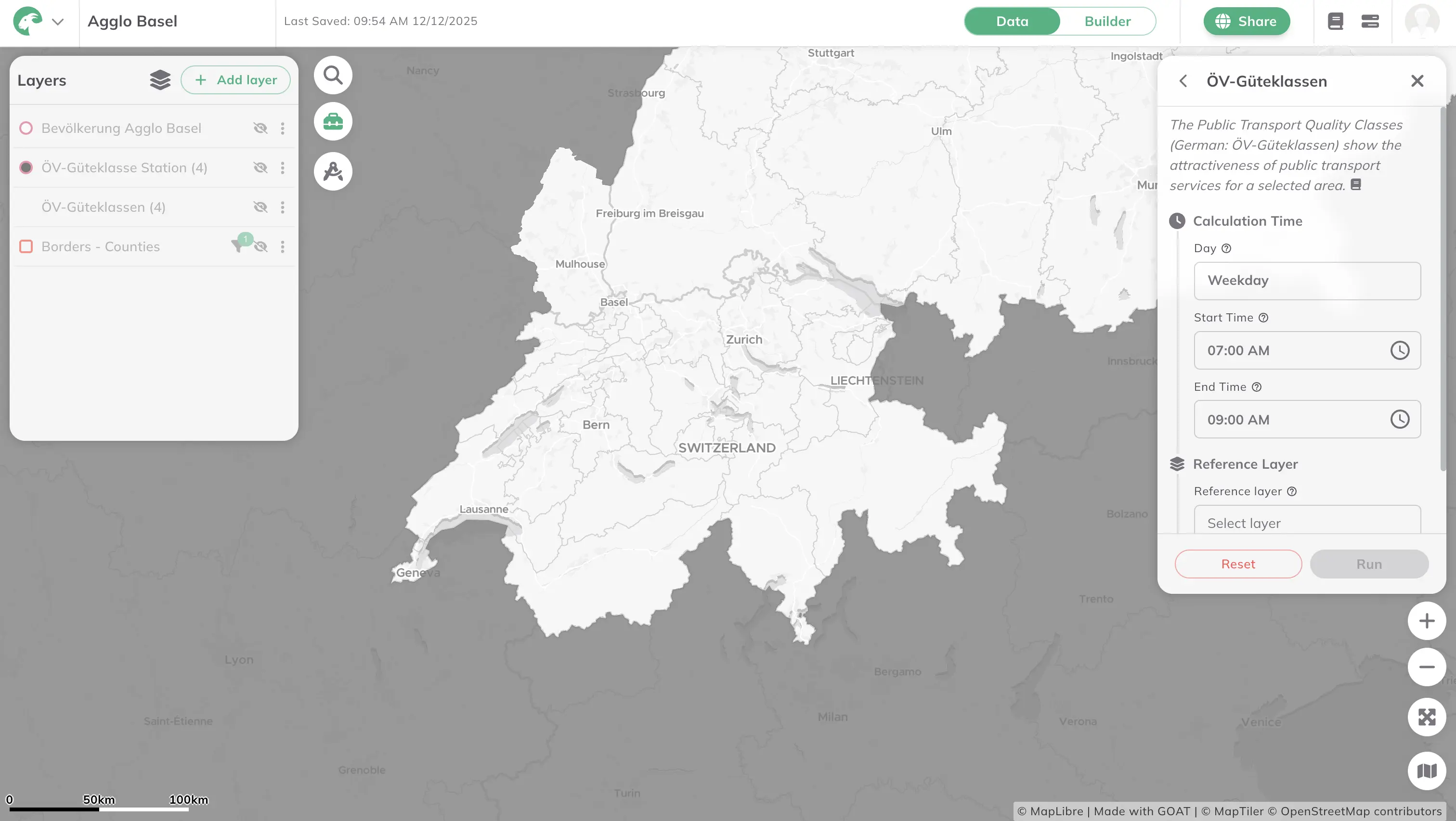
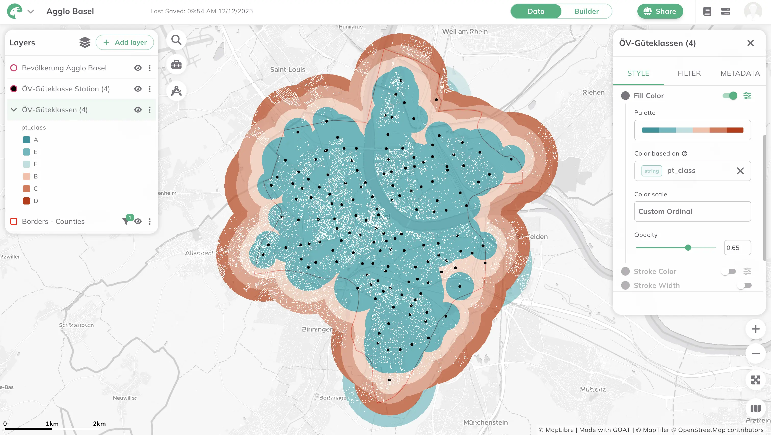
Agglo Basel now uses the WebGIS GOAT for cross-border accessibility analyses. To address local requirements, additional data have been integrated into GOAT.
In the Agglo Basel association, nine local authorities from Germany, France and Switzerland have joined forces to drive the sustainable, integrated development of landscape, settlement and transport across borders.
To carry out cross-border accessibility analyses, Agglo Basel now uses the cloud-based WebGIS GOAT. To meet local requirements, additional data were integrated into GOAT:
To ensure full coverage of the Agglomeration Basel, GTFS schedule data from both Switzerland and France had to be brought in. These feeds were imported into GOAT’s database and processed—paying particular attention to correctly modelling the cross-border connections contained in the datasets. Once prepared, the data were loaded into GOAT so they can be used directly in indicators and analyses.
Country-specific structural datasets—population figures and other points of interest—were cleaned, schema-harmonized and merged. Data were enriched and refined through a series of ETL processes and AI-based methods. The goal of this comprehensive preparation was to establish a single, consistent data foundation for all subsequent analyses across the tri-national agglomeration.


.jpg)
.jpg)
Join planners and cities already using GOAT to make better decisions, faster.