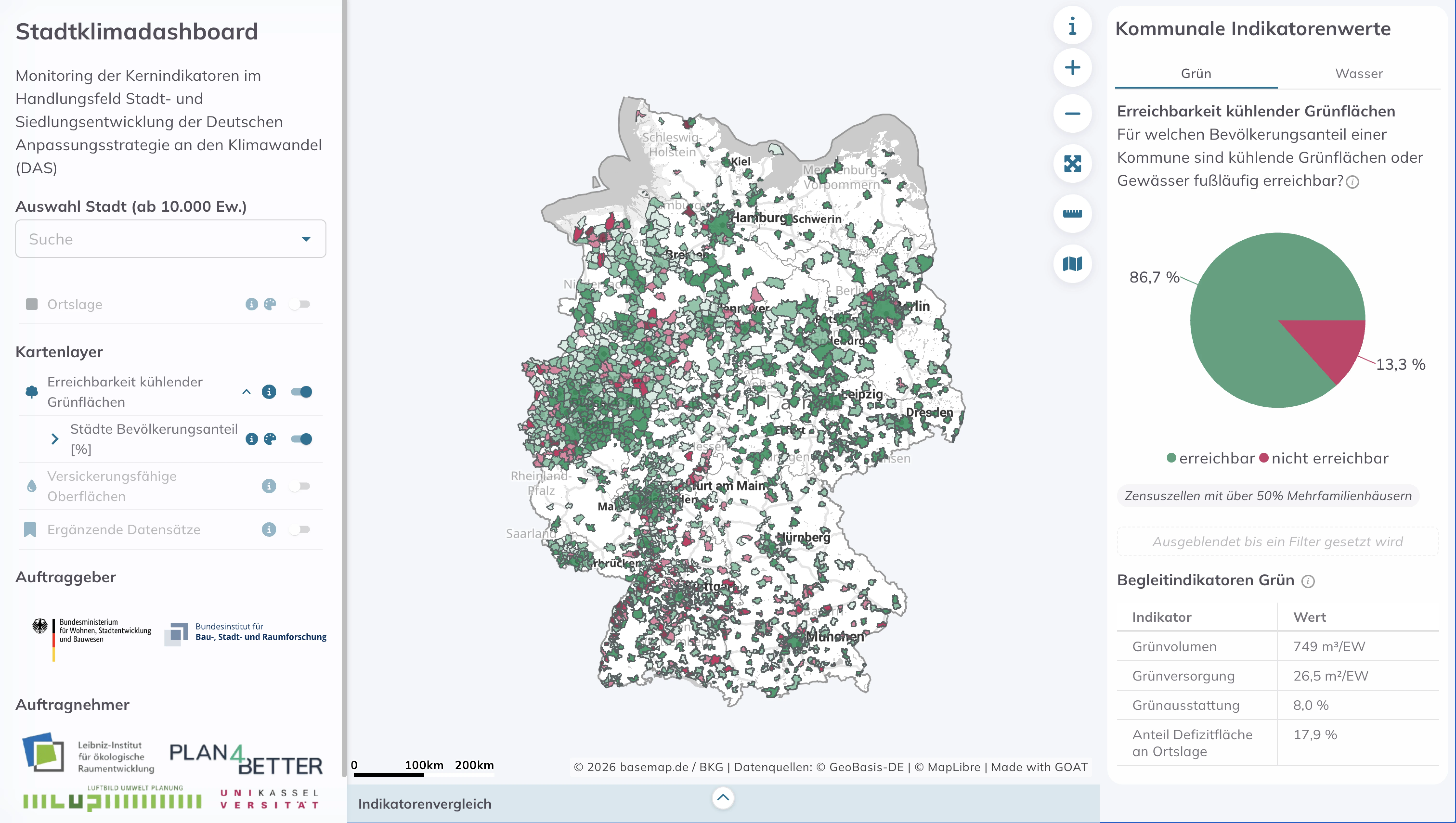
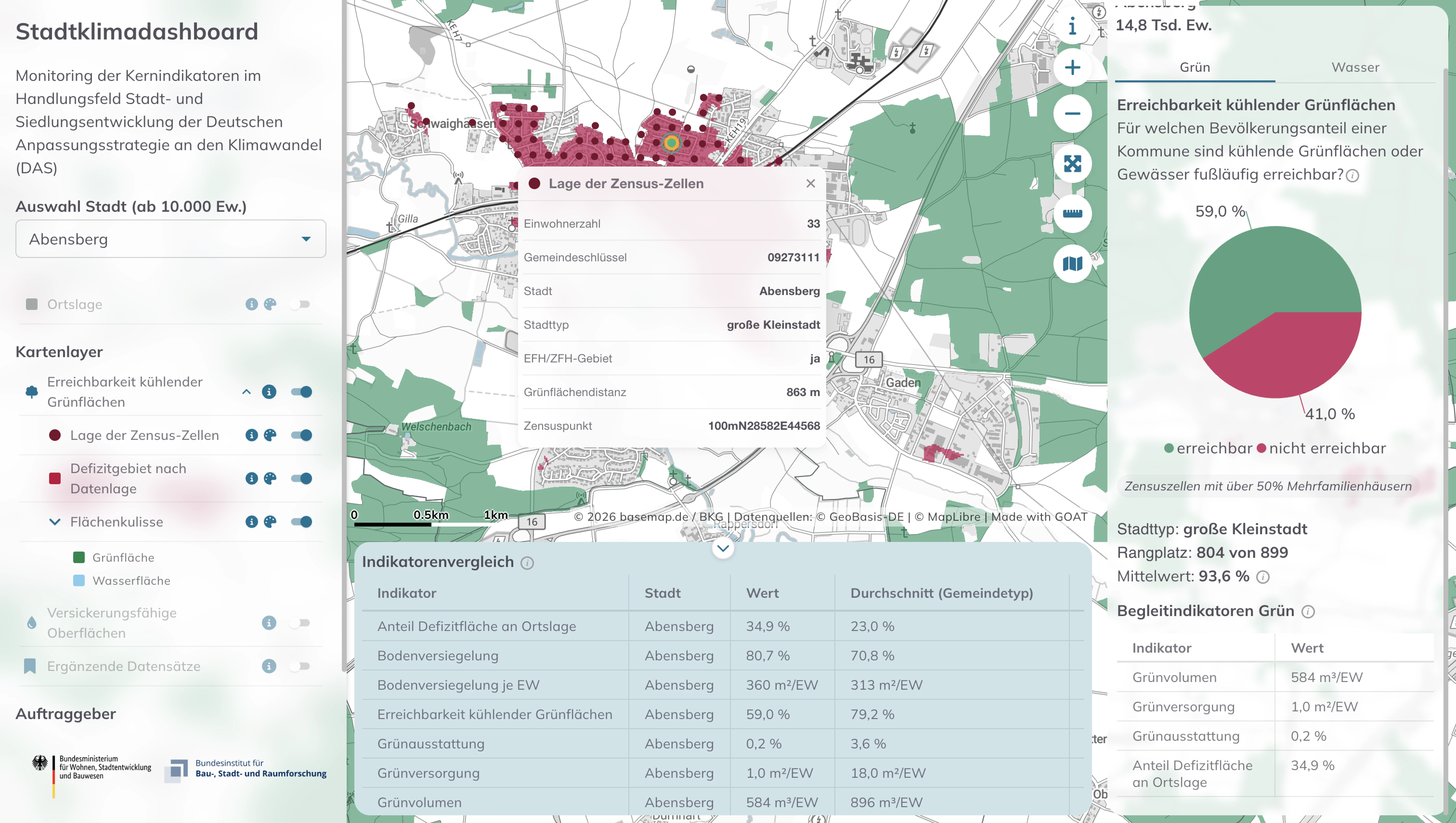
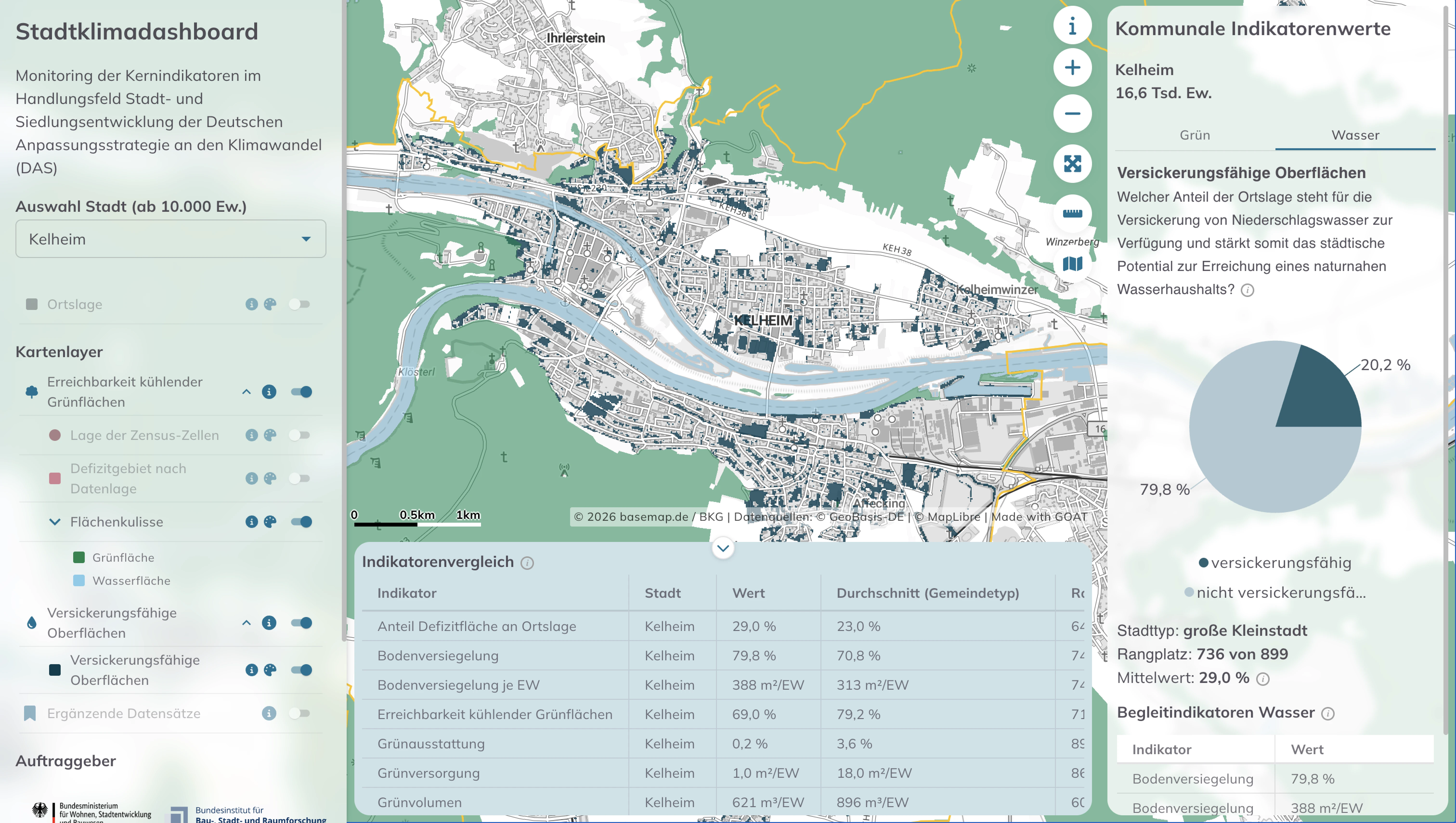
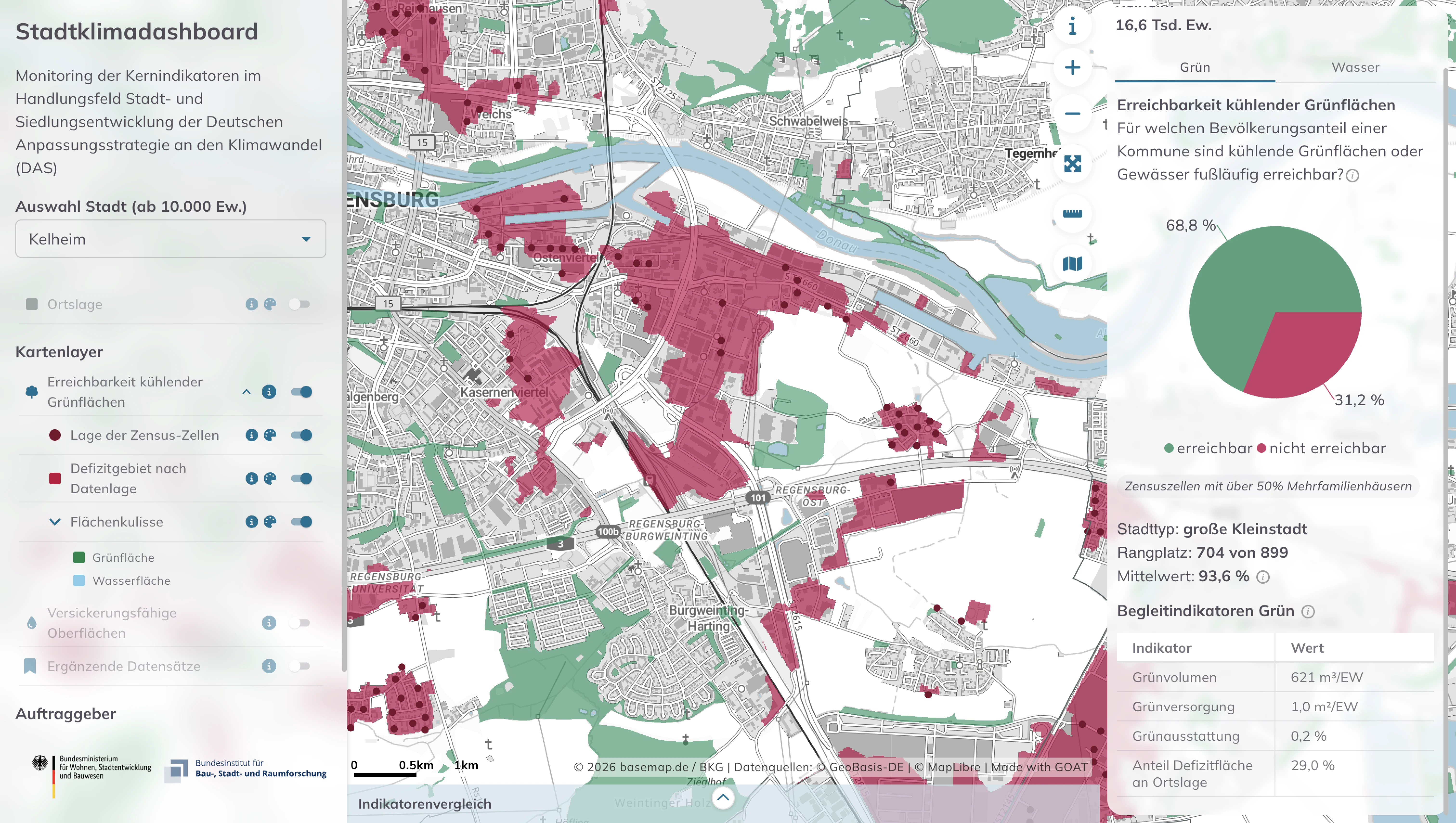
Sustainability & Climate Risk
A heatwave doesn't hit a city evenly. A shaded, green street stays liveable; a sealed, treeless one turns dangerous — especially for small children and older people. The Stadtklimadashboard makes that difference measurable for every German city above 10,000 inhabitants. Built for the federal government as part of the BBSR's ExWoSt programme, it calculates two core indicators nationwide and comparably: how easily residents can reach cooling green spaces, and how much of a city's surface can still soak up water. From these it pinpoints the inner-city hotspots where climate adaptation matters most. From 2027 it will feed the federal climate-adaptation monitoring — and, like the methods and datasets behind it, it's built open: open source, open data, reusable by any municipality. Plan4Better develops the dashboard as part of the project consortium led by the Leibniz IÖR, with LUP and bauchplan.

.jpg)
.jpg)
Join planners and cities already using GOAT to make better decisions, faster.