July 14, 2026
GOAT

The three-year project "GOAT 3.0" has come to a successful close. Funded with a total of 1.03 million euros by the Federal Ministry for Digital and Transport (BMDV) as part of the mFUND innovation initiative, the project brought together five partners: Technical University of Munich (TUM), Plan4Better GmbH, Leibniz Institute of Ecological Urban and Regional Development (IÖR), Prof. Schaller UmweltConsult GmbH, and Münchner Verkehrs- und Tarifverbund GmbH (MVV). Together, they evolved the web-based planning tool GOAT into a comprehensive digital planning platform. Plan4Better GmbH led the implementation and refinement of the tool to make it practical and user-friendly for planning professionals and public authorities.
The project’s goal was to expand GOAT with additional transport modes, new indicators, and extended datasets. Key new features include:
These and other features now enable Plan4Better to address a wide range of new use cases, such as evaluating the 15-minute city, public transport planning, developing mobility concepts, and planning and assessing measures for climate adaptation and green space provision.
The development was grounded in extensive literature reviews, workshops, and interviews with potential users to precisely identify their needs. Findings from the requirements analysis and research were transparently documented in the GOAT Wiki. Additionally, the project team gathered continuous feedback in over 20 workshops with more than 100 participants—mainly from the pilot regions Rhein-Neckar, Munich, Görlitz, and the City of Bonn.
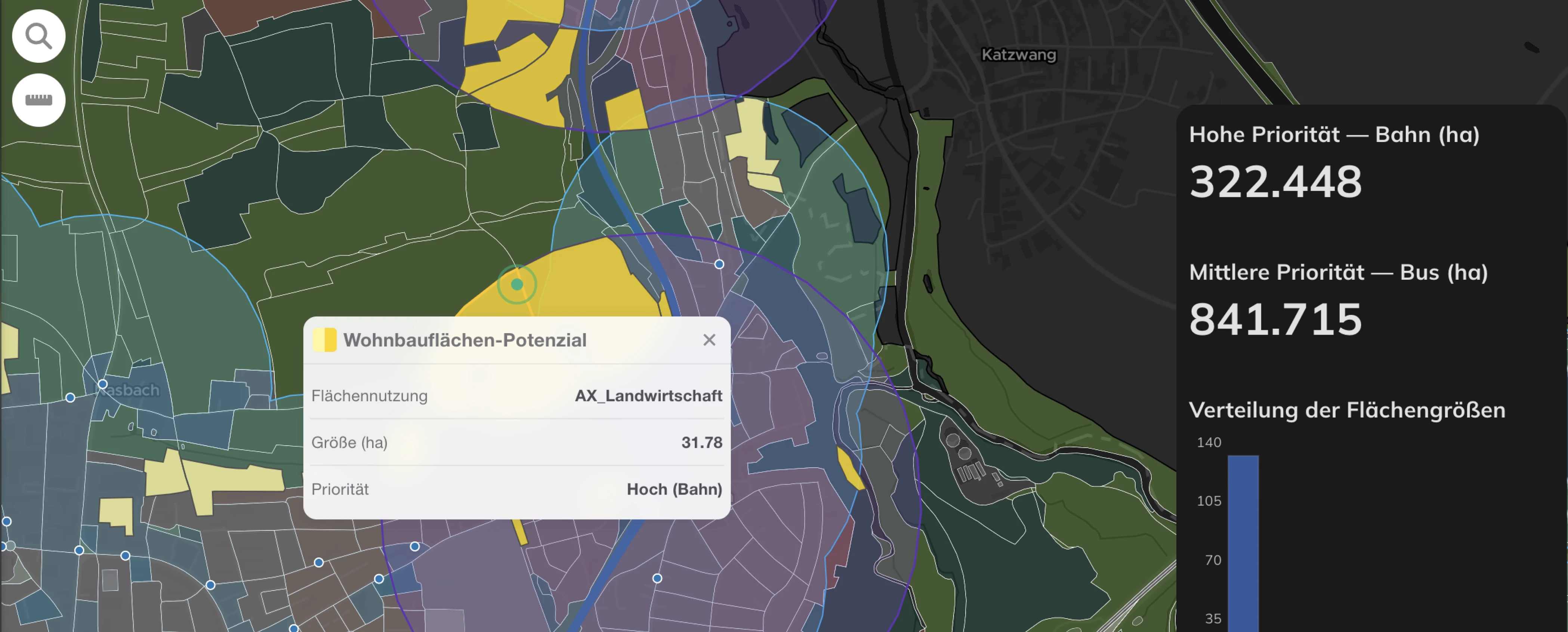
A core goal was to prepare GOAT for nationwide application in Germany. This involved collecting, merging, and enhancing national datasets. In addition to existing data sources, such as GTFS data from DELFIS e.V., the team gathered large amounts of public data and created proprietary datasets—particularly high-resolution population data—greatly expanding the data foundation for comprehensive analyses.
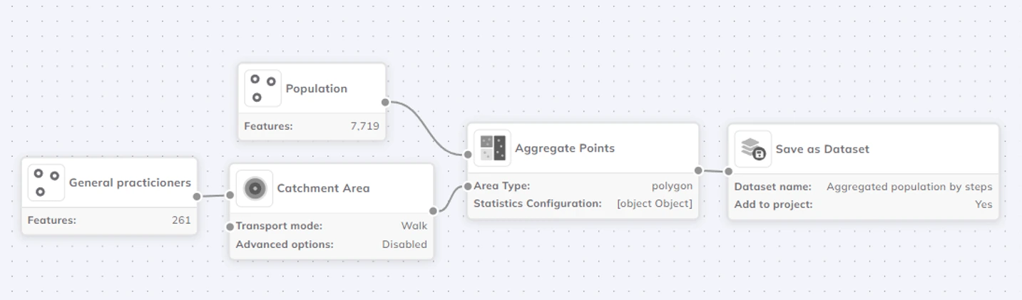
The new capabilities of GOAT are already being used in practice. The project team has conducted nationwide analyses on public transport coverage using ÖPNV quality levels, accessibility to healthcare services, and local access evaluations using the 15-minute city indicator. Partners such as the Rhein-Neckar Metropolitan Region and planning offices like stattbau münchen GmbH are actively using GOAT in their work:
“By implementing GOAT, an advanced analysis tool, we aim to drive transformative change in our transportation infrastructure. Our main initiative within the Smart Region project Rhein-Neckar is to analyze accessibility to Points of Interest (POIs). This will enable us to derive targeted actions to improve access to tourist destinations across the region."
Marius Jörres, Smart Mobility Project Manager, Rhein-Neckar Metropolitan Region
If you'd like to test GOAT yourself, you can register for a free demo version here: https://goat.plan4better.de
Plan4Better will continue to actively promote the adoption of GOAT in the future. Even during the project, Plan4Better was able to attract new clients and apply the tool to new areas of use. At the same time, the company is already working on concrete further development measures for the GOAT WebGIS platform.
About the BMDV mFUND Funding Programme
Since 2016, the BMDV has supported research and development projects through the mFUND programme, focusing on data-based digital innovations for Mobility 4.0. Funding is supplemented by active professional networking between stakeholders in politics, business, administration, and research, along with the provision of open data via the Mobilithek.
Find out more at www.mfund.de.

GOAT
.png)
Development

.jpg)
.jpg)
Join planners and cities already using GOAT to make better decisions, faster.