
GOAT: the open-source WebGIS, now with AI
Ask a planning question and GOAT AI builds the analysis, ready for you to adjust. Or do it yourself: analyze data, compute accessibility indicators, build dashboards and work together, all in your browser.
WebGIS with AI
What is GOAT?
GOAT is a German open-source WebGIS platform for spatial analysis, accessibility modeling, and geospatial data visualization.
It enables planners, researchers, mobility experts, and public sector organizations to analyze spatial data, create dashboards, automate workflows, and collaborate on maps directly in the browser. With GOAT AI, you can also start from a planning question: it finds the data, builds the workflow and makes the map, and you check every step.
new in GOAT
Start from a Planning Question
Type your question in plain language. GOAT AI finds the data, runs the indicators, builds the workflow and makes the map. Every step is a normal GOAT step you can open, check and change.
Ask in Plain Language
No GIS terms needed. Describe what you want to know, the way you'd ask a colleague.
See How It Was Built
GOAT AI builds a normal GOAT workflow. Open any step, adjust the parameters and run it again.
You Make the Decision
GOAT AI summarizes the results with key statistics and the locations that stand out. You interpret them and decide what to share.
all data in one place
Data Integration & Management
Import your own data, connect OGC services, use our built-in catalog, fetch data directly from OSM or Overture, or simply ask GOAT AI to find the data for you.
Built-in Data Catalog
More than 30,000 curated datasets from official open-data providers and trusted sources, ready to use. Ask GOAT AI what each one contains.
Bring Your Own Data
Upload GeoJSON, Shapefile, CSV and other common formats, or connect live to OGC services such as WFS and WMS.
Organise and Share
Keep datasets in folders, share them with your team and control who can view or edit them.
analysis
Spatial Analytics & GIS Indicators
Transform raw geospatial data into measurable insights in seconds. Run accessibility analysis, GIS operations and planning indicators in your browser, or ask GOAT AI to run them for you.
Compute Accessibility Analysis
Perform advanced accessibility analysis with catchments, 15-minute metrics, routing, heatmaps, and public transport indicators (e.g., Swiss ÖV-Güteklassen).
Run Core GIS Operations
Run powerful geospatial analysis tools including spatial joins, data filtering, aggregation, buffering, clipping, and multi-criteria evaluation directly in your browser.
Customize Map Layers
Control basemaps, layer colors, labels, and icons, including attribute-based styling and cartographic customization to produce clear and informative maps.
build once
Automated Spatial Workflows
Automate recurring spatial analysis and cut the manual work. Build a workflow once, or let GOAT AI build it, then reuse it across projects for consistent, reproducible results.
Let GOAT AI Build the Workflow
Describe the analysis in plain language and GOAT AI assembles the workflow. Then check each step and edit what you need.
Build Once and Reuse Across Projects
Build a workflow with drag and drop, or let GOAT AI build it. Then update inputs and parameters and rerun it to save time and keep results consistent.
Document and Share your Processes
Keep workflows transparent and well documented so they can be shared across teams, ensuring consistent methods and faster decision-making.
results
Dashboards, Printed Maps & Visual Analytics
Turn complex spatial analysis into clear, decision-ready insights, interactive or static. Link maps with charts and indicators to create spatial data visualizations tailored for planners, analysts, and stakeholders.
Create Dashboards with No Code
Build interactive GIS dashboards. Connect maps, indicators, and charts in real time to monitor performance and explore urban data.
Generate Print-Ready Maps
Create high-quality maps for reports and presentations. Using the atlas tool, generate map series at once with consistent cartographic design.
Public Sharing & Visual Reporting
Turn analysis into visual reports. Create charts, summaries, and map-linked stats to share insights with decision-makers, stakeholders, and the public.
teamwork
Real-Time Team Collaboration
Collaborate on spatial projects in real time within a multi-user WebGIS environment, without duplicated data or disconnected tools.
Share Work across Teams
Share maps, datasets, workflows, and dashboards with colleagues so everyone works with the same information in a centralized platform.
Work Simultaneously on Projects
Work simultaneously with your team on shared maps, layouts, workflows, and dashboards keeping analyses aligned and maintaining data consistency.
Manage Roles and Permissions
Assign roles and control access across your organization to ensure teams collaborate efficiently while keeping data secure.
More Tools for Everyday Planning
Tools that save time in daily planning work. Each one links to more about how it works.
PT Network Explorer
A GTFS feed is a set of tables.The Explorer turns it into a network.
More about the Explorer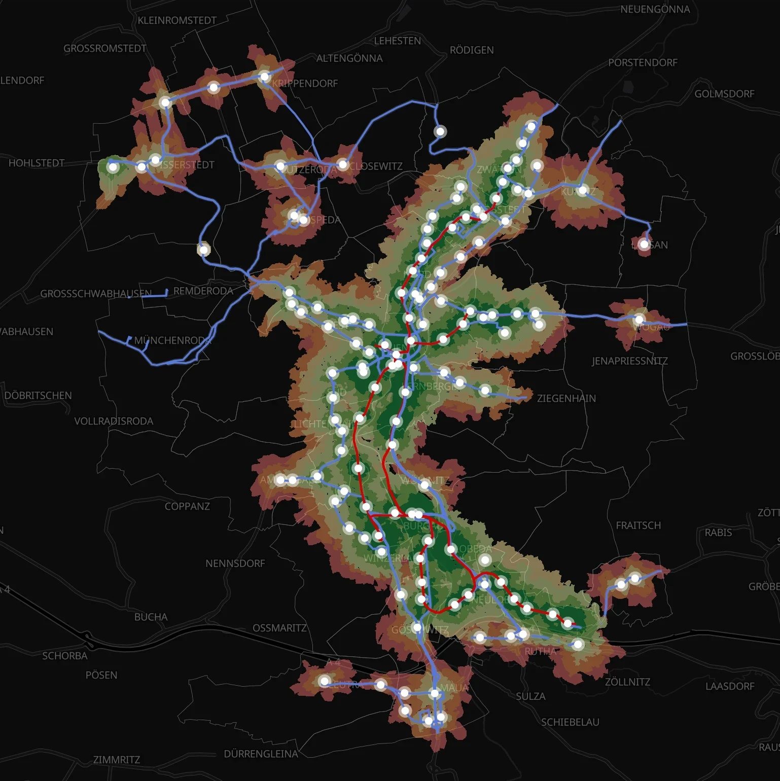
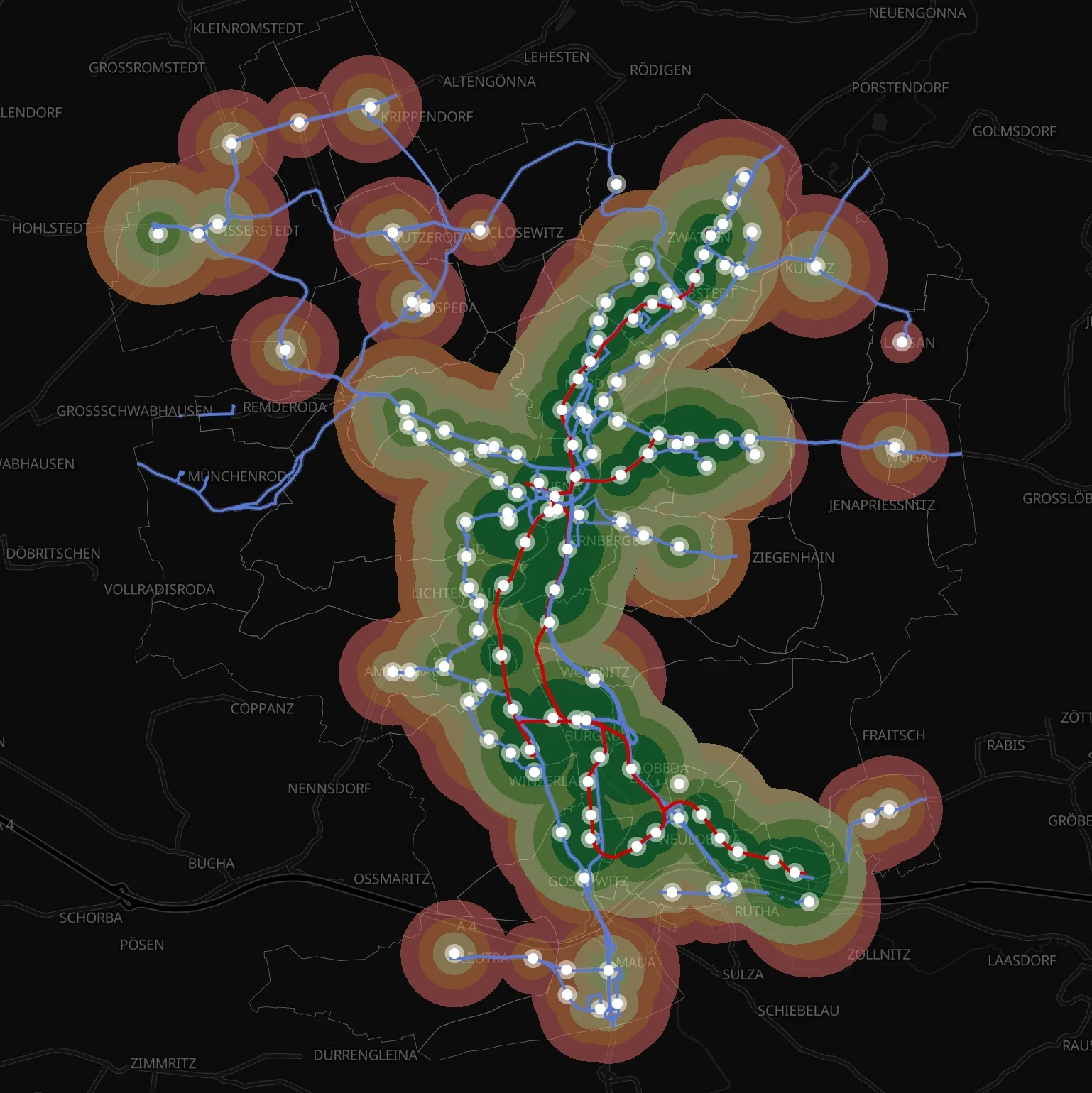
ÖV-Güteklassen
How well is a place served by public transport?GOAT grades it, along the street network too.
Calculate quality classesData Catalog
More than 30,000 datasets.Searched, found, in your project.
More about the Catalog
why GOAT
A Trusted WebGIS Platform for Digital Sovereignty
Developed in Germany, GOAT is a robust and innovative GIS platform designed for modern spatial analysis and collaborative decision-making. Built on open standards and open-source technologies, GOAT supports digital sovereignty, secure data infrastructure, and transparent geospatial workflows.
Web-Based, Modern & High-Performance
GOAT runs entirely in the browser and combines powerful spatial analysis features with a modern, intuitive user interface. Teams can analyze, visualize, and share spatial data quickly, without complex desktop GIS workflows.
Developed & Hosted in Germany
GOAT is developed by an innovative, Germany-based team and hosted on certified servers in Germany. This ensures secure data handling, long-term reliability, and full compliance with European data protection standards.
Open-Source, Flexible & Compatible
Built on open standards and open-source technologies, GOAT integrates easily with existing geospatial infrastructures. Connect OGC services, internal datasets, or external data platforms and continue working with the systems you already use.
Real-World Applications
- Healthcare
- Cities & Government
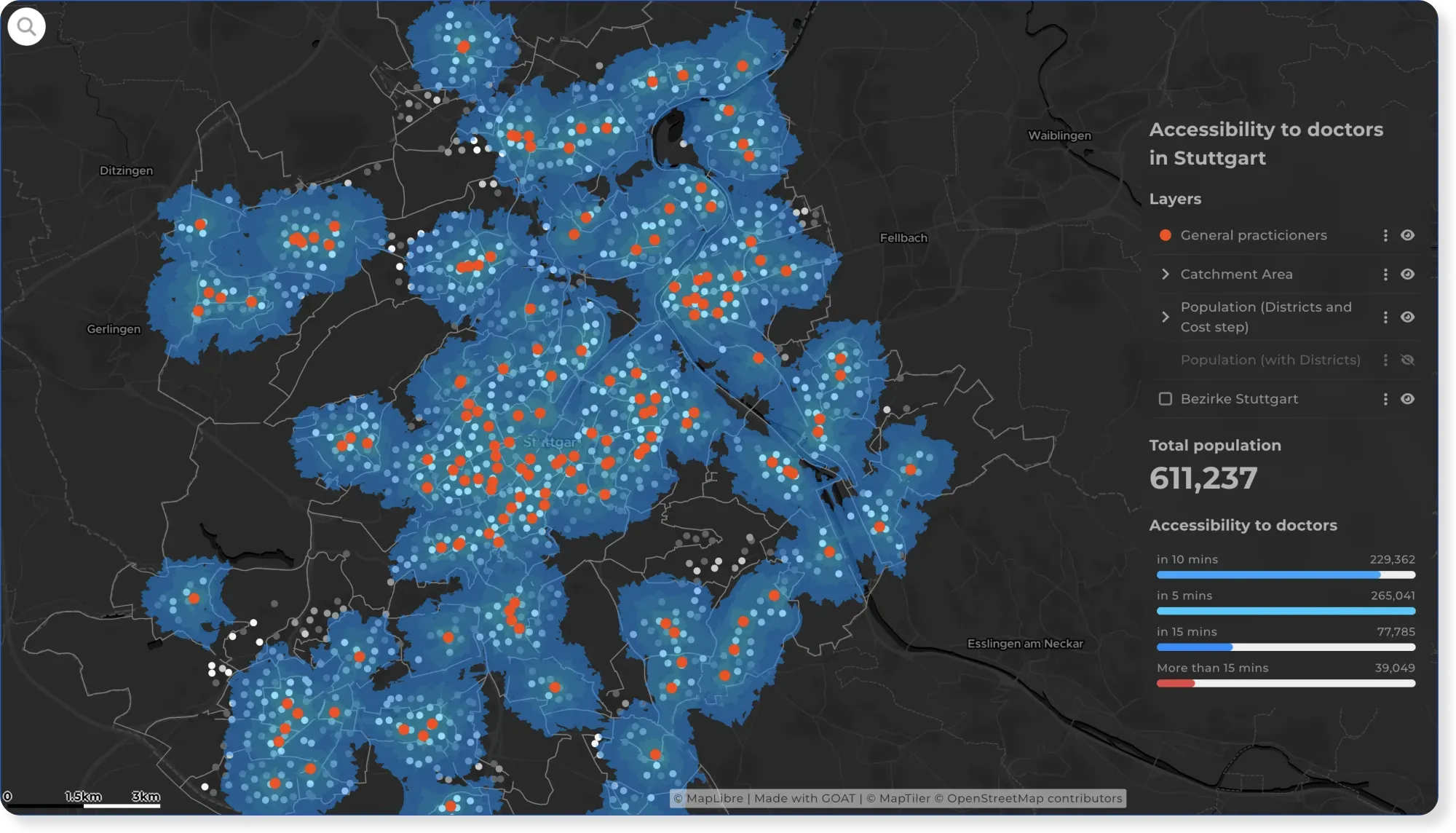
How Easily Can Stuttgart Residents Reach a Doctor?
Reaching a doctor shouldn't depend on where you live. This map shows travel time to GPs across Stuttgart, reveals the areas left underserved, and suggests where new practices should go.
See the map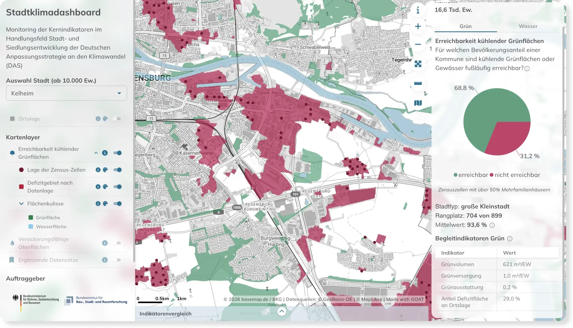
- Sustainability & Climate Risk
Stadtklimadashboard: Monitoring Climate Adaptation Across Germany's Cities
How ready are Germany's cities for extreme heat? The Stadtklimadashboard maps access to cooling green space and permeable surfaces for every German city over 10,000 inhabitants.
See the map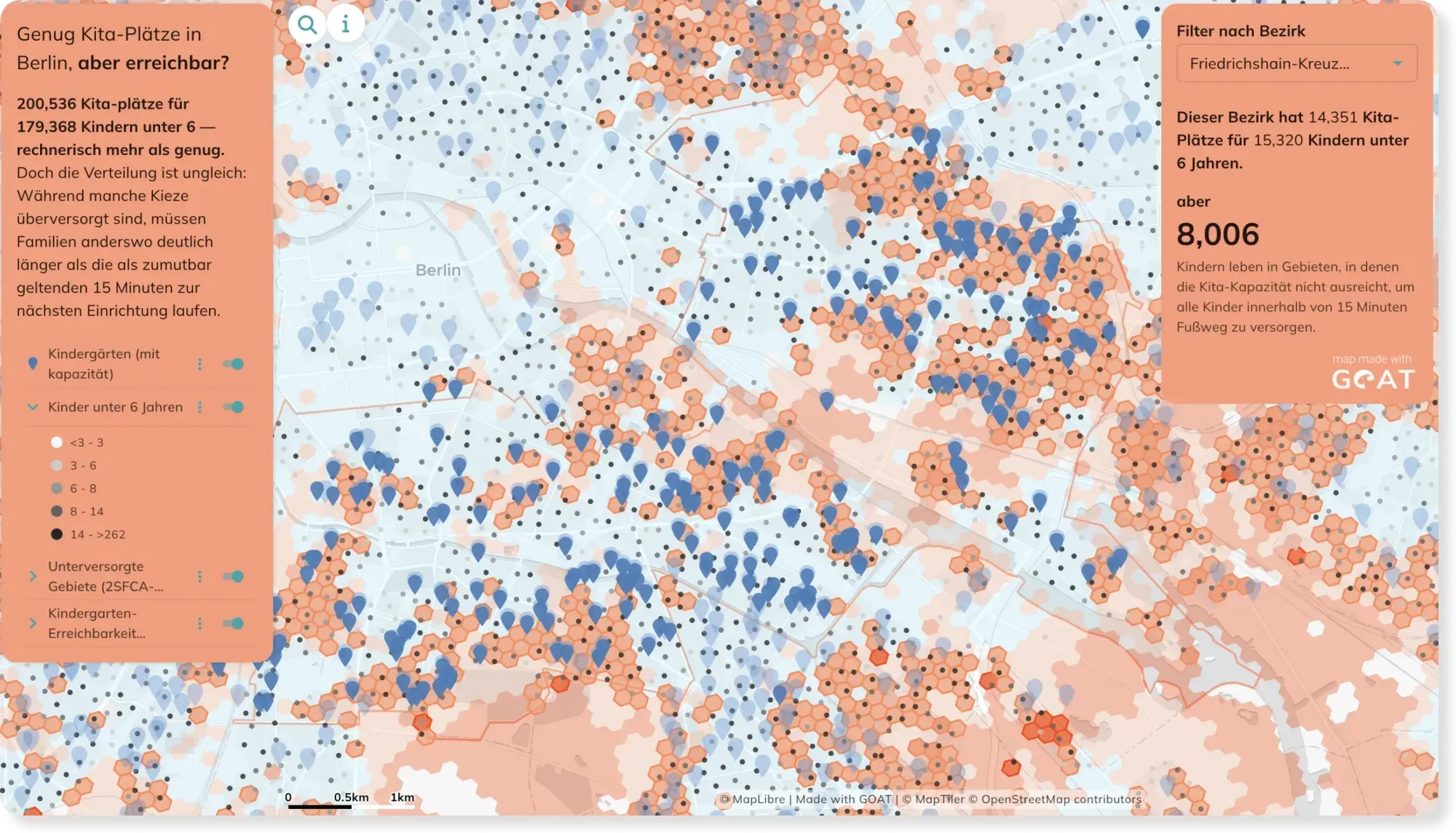
- Mobility Planning
- Cities & Government
Kindergarden accessibility in Berlin: Distance and Capacity combined
A kindergarden five minutes away doesn't help if every place is already taken. This map goes beyond simple distance and factors in capacity too — showing where families are truly cared for.
See the map
learn GOAT
Documentation, Tutorials & Training
Our comprehensive documentation, tutorials, and training resources help you learn GOAT quickly and start building powerful spatial analyses and WebGIS applications.
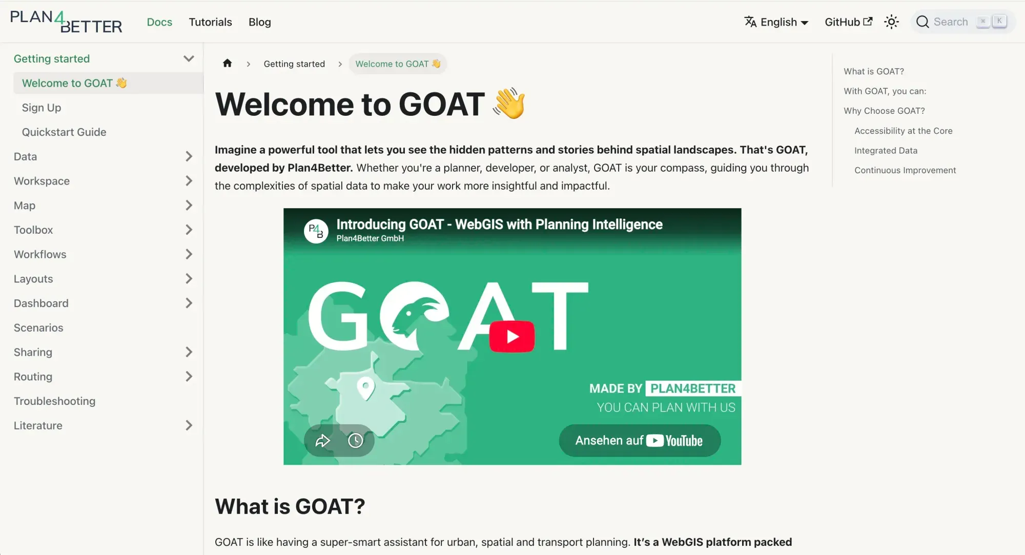
Docs
Detailed explanations, step-by-step guidelines and technical insights into GOAT.
Read the docs (opens in a new tab)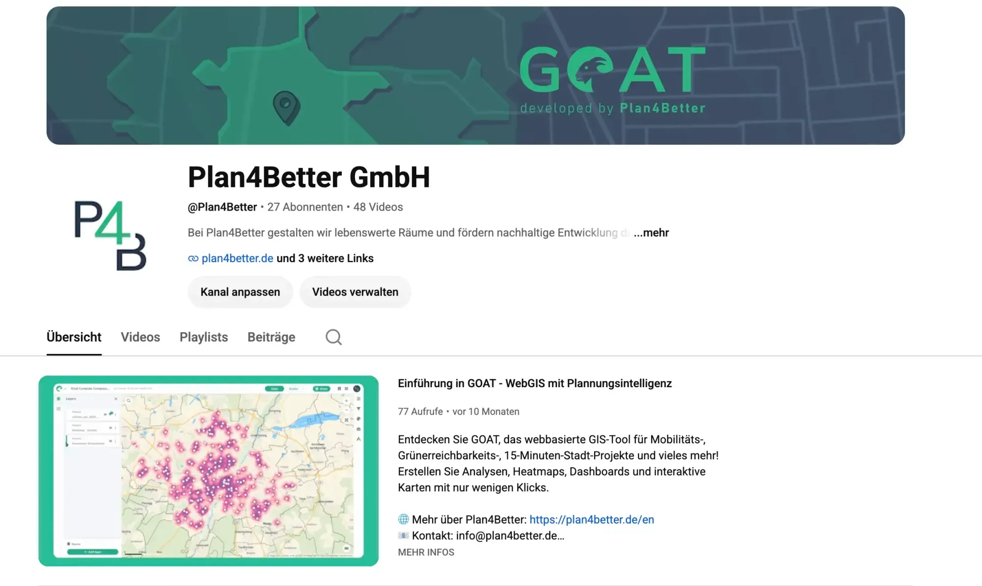
Videos
Video tutorials on the key tools you can use within GOAT.
Watch the tutorials (opens in a new tab)
Frequently asked questions
What is GOAT?
GOAT is a WebGIS platform that enables spatial analysis, accessibility modeling, GIS dashboards, and collaborative mapping directly in the browser.
What can GOAT AI do?
GOAT AI can find datasets in the catalog, build workflows, run accessibility and GIS analyses, create maps, search your data and calculate statistics. It can also summarize results, for example by naming the areas that stand out. It cannot build dashboards yet, so for now you build those yourself in GOAT, using the results GOAT AI created.
Where are the GOAT AI models hosted?
GOAT AI uses open models hosted in Europe, so your questions are processed in Europe under EU data protection rules. GOAT itself remains hosted on certified servers in Germany.
What is a WebGIS platform?
A WebGIS platform allows users to analyze, visualize, and share geospatial data directly in the browser without installing desktop GIS software.
What can you do with GOAT?
With GOAT you can:
- Analyze spatial accessibility and infrastructure coverage
- Combine demographic, mobility, and geographic datasets
- Build GIS dashboards and visual reports
- Create automated spatial workflows
- Collaborate on maps and datasets in real time
What types of analysis can be performed in GOAT?
GOAT supports spatial analysis tools including accessibility modeling, catchment analysis, spatial joins, routing analysis, and indicator-based evaluation.
Can teams collaborate in GOAT?
Yes. GOAT supports real-time collaboration, shared datasets, co-editing of maps and dashboards, and role-based access control.
What data formats does GOAT support?
GOAT supports common geospatial formats such as GeoJSON, Shapefile, CSV, and OGC services including WMS and WFS.
Ready to make sense of your data?
Ask GOAT your first planning question, or build the analysis yourself. No GIS expertise needed.