
Rebuilding VerkehrsInfo BW on the GOAT WebGIS platform
NVBW and Plan4Better rebuilt VerkehrsInfo BW on the GOAT WebGIS platform: one web application bringing the state's traffic and mobility data together, free and open to everyone.
General information
- Client
- NVBW (Nahverkehrsgesellschaft Baden-Württemberg mbH), on behalf of the Ministry of Transport of Baden-Württemberg
- Period
- 2026, ongoing
Planning cases
- A modern, intuitive web application that shows the current traffic situation along with road-related information such as roadworks and traffic reports
- Integration and consistent display of real-time and geospatial data from different sources, in particular through MobiData BW
- A modular, scalable open-source architecture that can be extended with new data sources and functions
Overview
On behalf of the Ministry of Transport of Baden-Württemberg, NVBW (Nahverkehrsgesellschaft Baden-Württemberg mbH) and Plan4Better rebuilt VerkehrsInfo BW from the ground up. The result is a modern, fully web-based application, built on the GOAT WebGIS platform, that brings current traffic and mobility data together and makes it available to the public clearly, reliably and free of charge.
Overview
With the mobility data platform MobiData BW, the state of Baden-Württemberg brings together mobility data from different sources and across different modes of transport, standardises it, and makes it available for digital applications. VerkehrsInfo BW uses that data to give road users central, reliable information for their daily travel.
The project modernised the state’s official traffic information portal, both technically and visually. The new VerkehrsInfo BW is fully web-based and works on smartphones, tablets and desktop computers. Nothing needs to be installed, so users always have the current version and the latest available data.
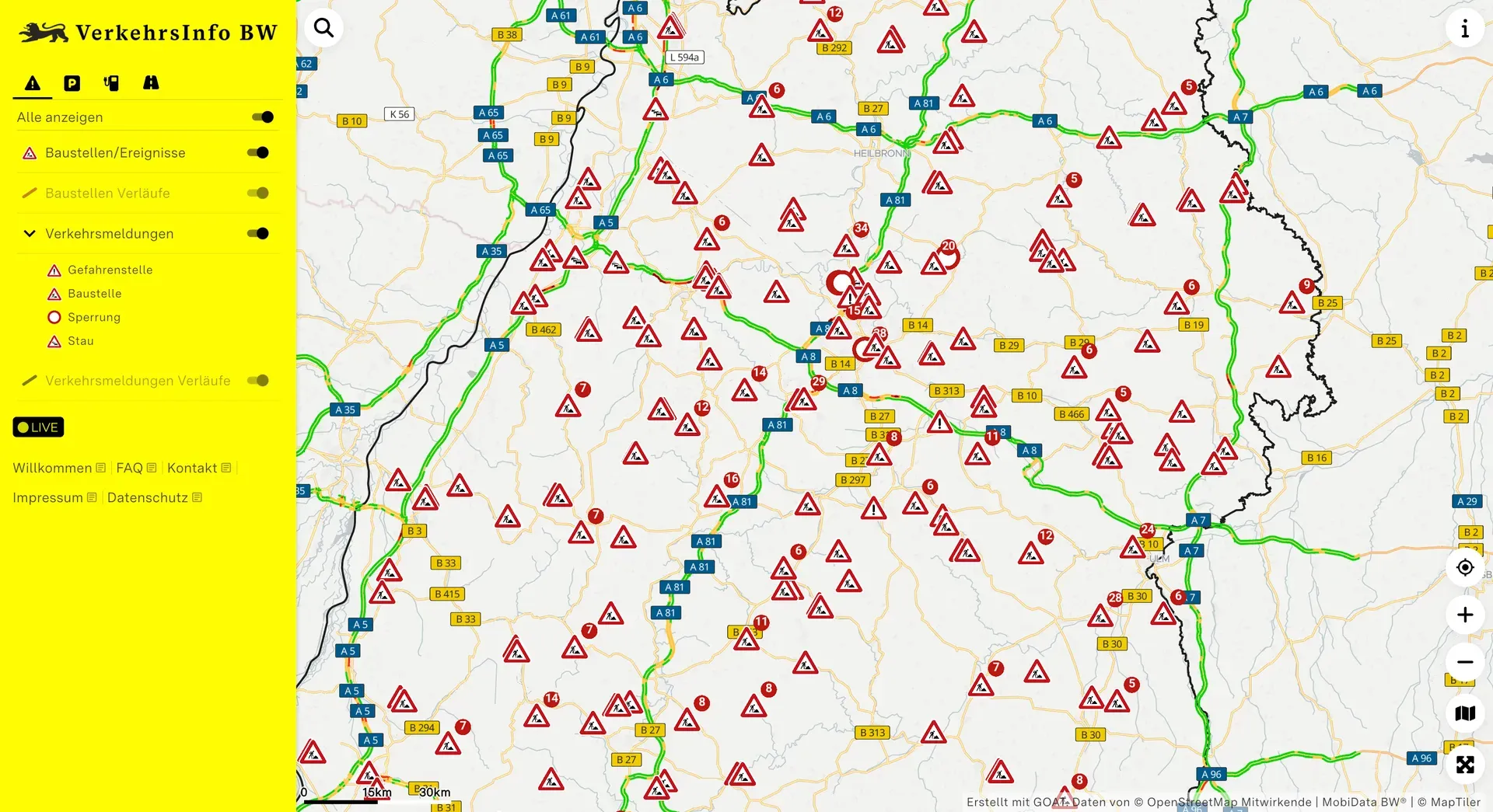
An interactive map shows the current traffic situation, roadworks and traffic reports, as well as parking options and charging infrastructure. The different data sources are combined centrally, prepared, and shown in a single user interface.
The technical basis is the GOAT WebGIS platform. Its modular architecture makes it possible to add new data sources and functions step by step, and to adapt the platform to future requirements.
Core goals
- A central information platform: real-time and geospatial traffic data for Baden-Württemberg, brought together and displayed consistently in one place
- Better information for users: current, transparent and easily understood information through a modern, intuitive interface
- Use on any device: optimised for smartphones, tablets and desktop computers, with no app to install
- Infrastructure built to last: a scalable, technologically independent open-source architecture that can be extended and developed further
Technical implementation
- Modern WebGIS framework: built on an open-source stack with React.js, MapLibre GL, Python and FastAPI
- Broad data integration: real-time data from various sources, including MobiData BW, using standards and formats such as DATEX II
- Standardised interfaces: static geospatial data and external services integrated through standardised APIs and OGC-compliant interfaces
- Modular system architecture: components are separated so they can be scaled, maintained and extended independently
- Responsive web application: one web application, optimised across devices
The current traffic situation across the state A roadworks entry, with its lane closures and how long it runs Parking options, from garages to park and ride Each site carries its own details, here a park and ride car park Charging infrastructure, live: connectors, price, and what is free right now
Ready to make sense of your data?
Join planners, organizations and cities using GOAT to make better decisions, faster. No GIS expertise needed.