
Analysieren, Kartieren, Teilen: ein WebGIS
Bringen Sie Ihre räumlichen Daten zusammen, führen Sie Erreichbarkeits- und GIS-Analysen durch und erstellen Sie automatisierte Workflows. Verwandeln Sie alles in interaktive Karten und Druck-Layouts oder Berichte.

Vertrauen von Kommunen, Verkehrsverbünden und Planungsbüros












Open-Source und cloud-basiert
Das WebGIS GOAT
Eine Plattform für den gesamten räumlichen Workflow: Bringen Sie Ihre Daten zusammen, führen Sie Erreichbarkeits- und GIS-Analysen durch, erstellen Sie Dashboards und druckfertige Karten, automatisieren Sie Wiederkehrendes und arbeiten Sie in Echtzeit zusammen.
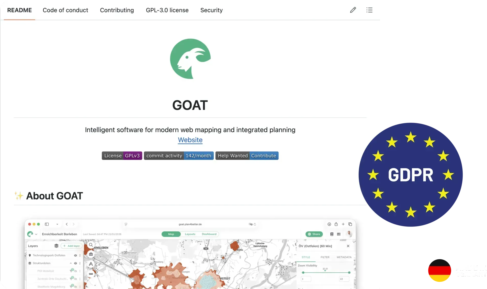
Daten zusammenführen
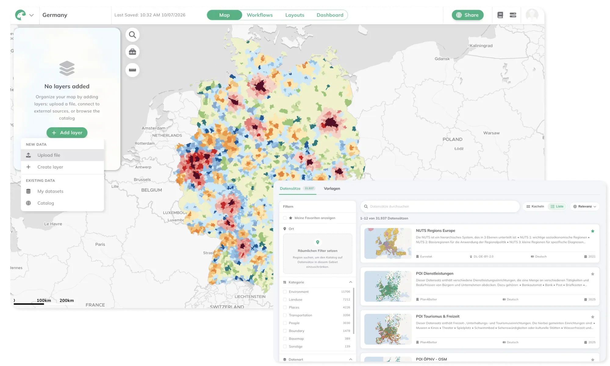
Eigene Dateien hochladen, externe Dienste einbinden oder aus unserem Katalog mit über 30.000 kuratierten Datensätzen schöpfen. Alles liegt in einem Workspace, bereit für die Analyse.
Erreichbarkeits- und GIS-Analysen
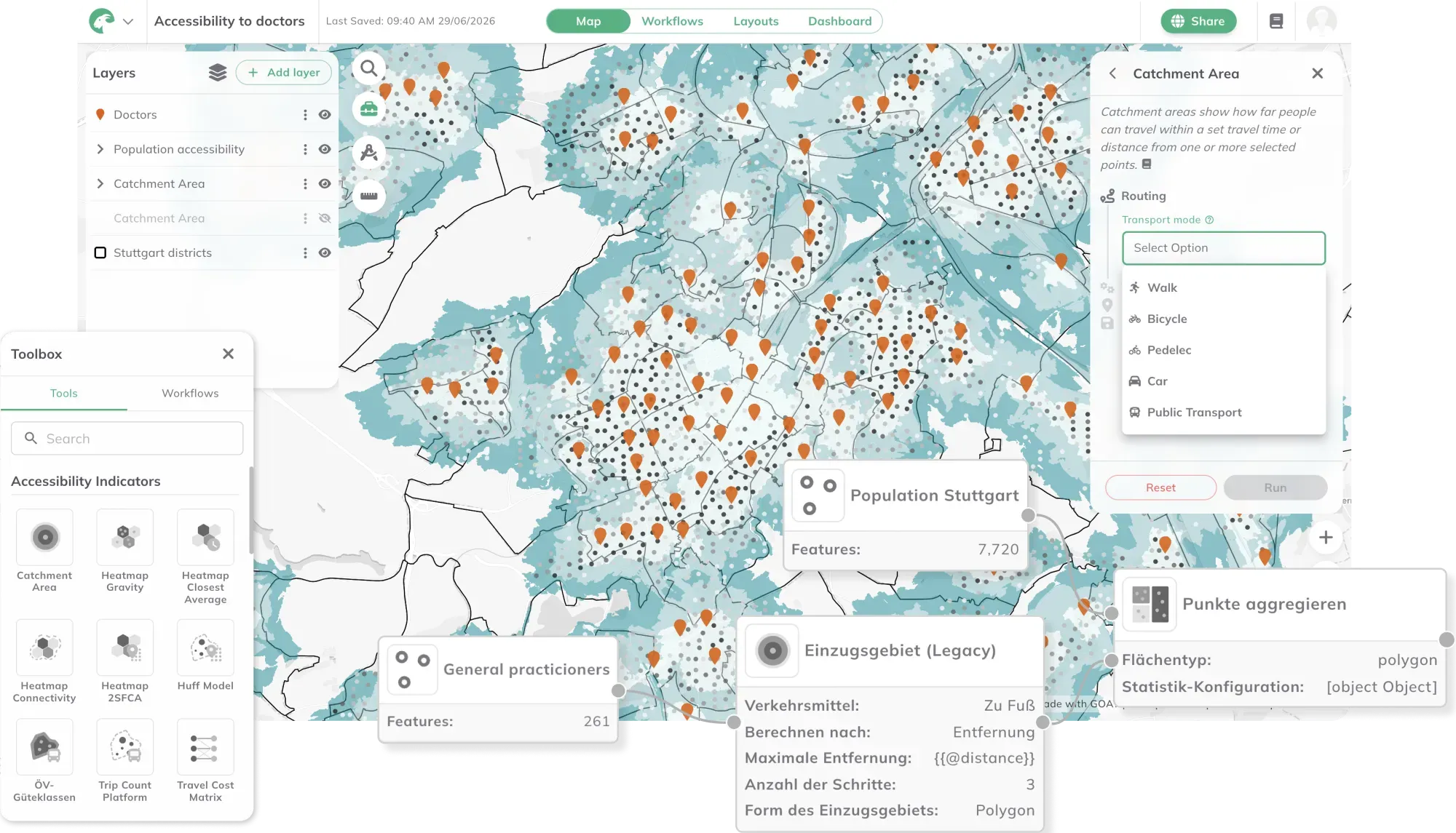
Beantworten Sie räumliche Fragen, für die früher ein GIS-Spezialist nötig war – Erreichbarkeit, Bedarf, Abdeckung, Standortwahl – direkt im Browser.
Automatisieren Sie Ihre Workflows
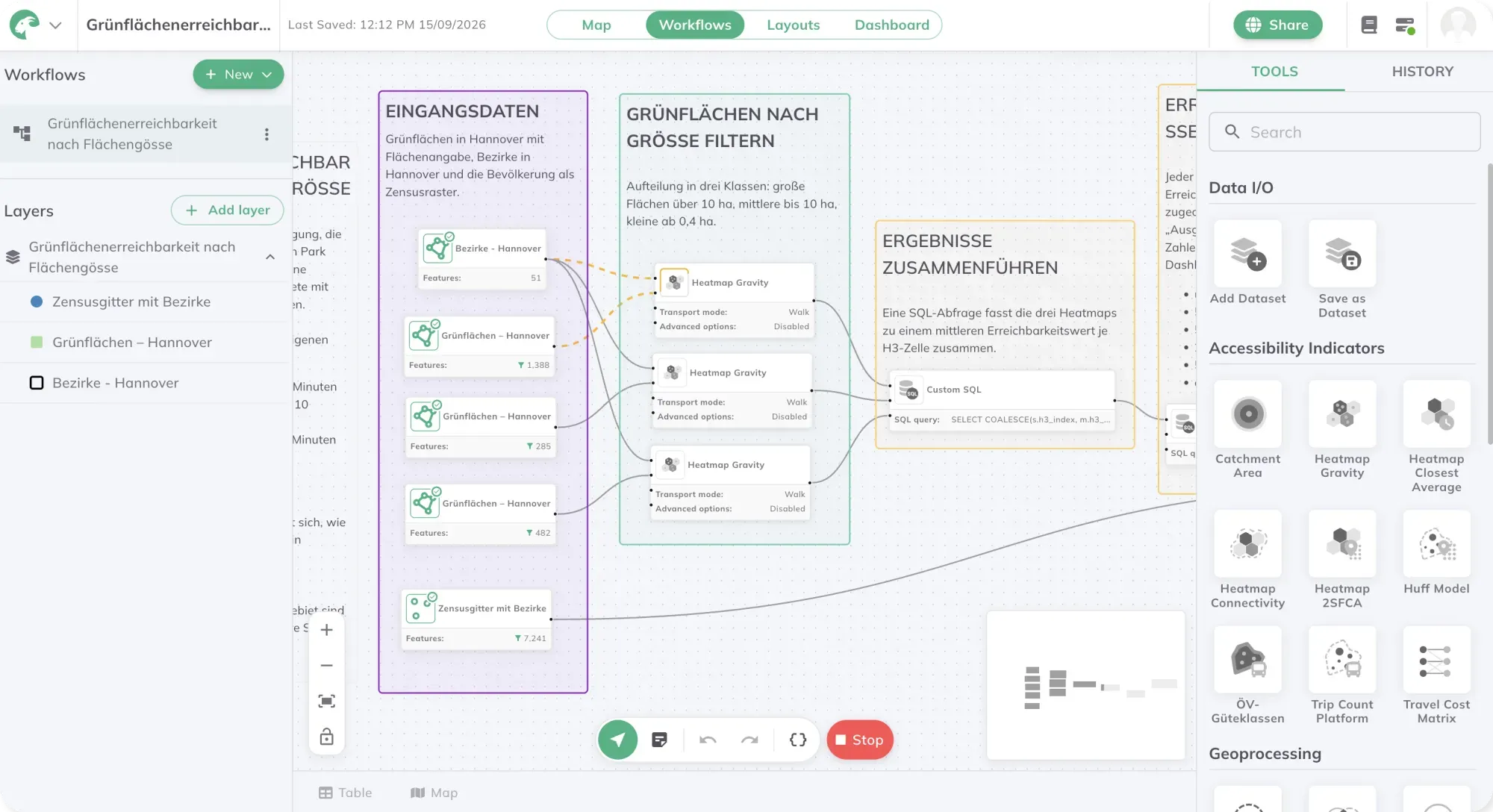
Aus einer Woche manueller Analyse wird ein Workflow, den Sie mit einem Klick erneut ausführen.
Live zusammenarbeiten und teilen
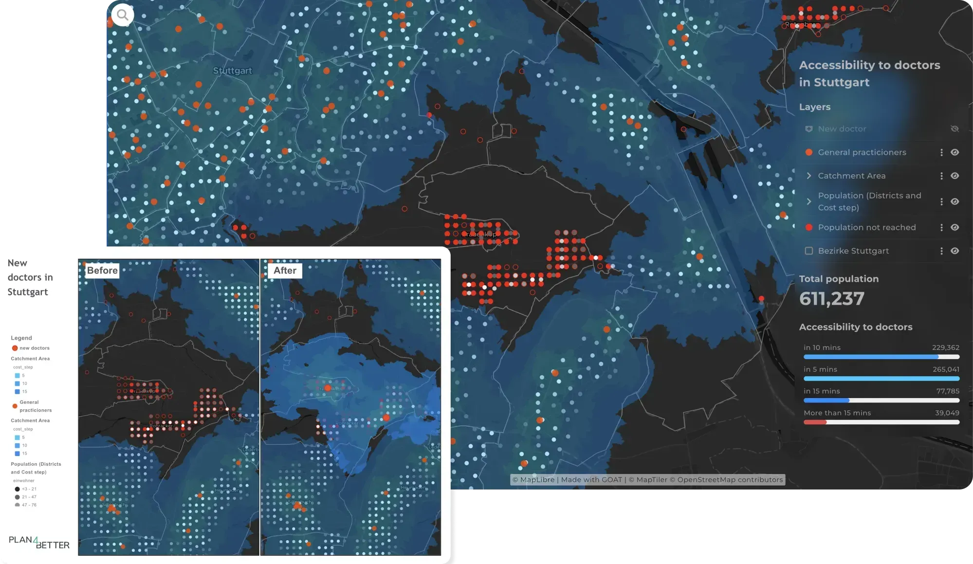
Übergeben Sie Stakeholdern oder Entscheidungsträgern ein Live-Dashboard statt eines PDFs, das schon bei Ankunft veraltet ist.
Open-Source und DSGVO-konform
Wissen Sie genau, was drinsteckt – Open-Source-Grundlage, keine Black Box, kein Lock-in, und Ihre Daten bleiben nach EU-Regeln geschützt.
GOAT im Einsatz
Was planen Sie?
Erreichbarkeitsanalysen, Bewertungen zur 15-Minuten-Stadt und Studien zur Versorgungsabdeckung – im Browser, ohne GIS-Abteilung.
Mehr zu dieser Branche
Hamburg priorisiert den barrierefreien Umbau seiner Bushaltestellen mit GOAT
Der Landesbetrieb Straßen, Brücken und Gewässer (LSBG) kombiniert Erreichbarkeit, Fahrplandaten und soziodemografische Daten in einer automatisierten Multikriterienanalyse, um zu entscheiden, welche Haltestellen zuerst umgerüstet werden. So fließt das begrenzte Budget dorthin, wo es am meisten bewirkt.
Pilotprojekt Looped
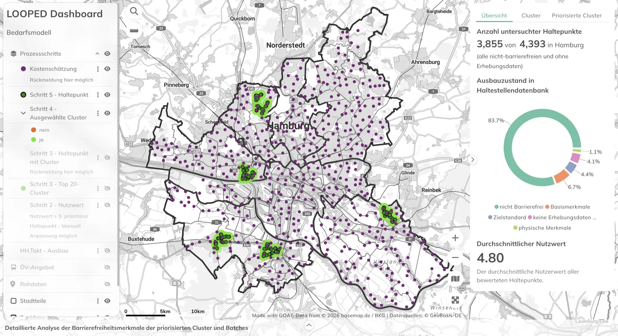
Modellieren Sie Einzugsgebiete, testen Sie Netzänderungen und zeigen Sie Entscheidungsträgern die Wirkung, bevor gebaut wird.
Mehr zu dieser Branche
München plant, wo Sharing-Angebote im Harthof entstehen sollen
Für den Stadtteil Harthof wollte die Landeshauptstadt München wissen, welche Standorte sich für Car- und Bikesharing eignen. Mit GOAT wurden Gehbarkeit und Erreichbarkeit analysiert, zusammen mit dem digitalen Zwilling der Stadt und sozialdemografischen Daten, um die zu Fuß erreichbaren Orte zu finden – und anschließend Szenarien für die Platzierung von Hubs modelliert.
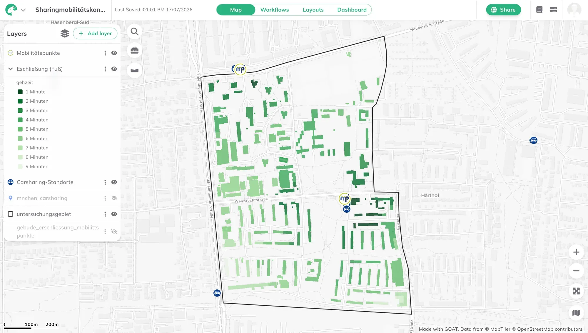
Bewerten Sie einen Standort danach, wer ihn tatsächlich erreicht: Verkehr, Angebote, Einzugsgebiet, Frequenz.
Mehr zu dieser Branche
stattbau analysiert, wie gut Wohnstandorte wirklich angebunden sind
Das Münchner Büro nutzt GOAT seit 2022 und untersucht, was Menschen zu Fuß, mit dem ÖV, dem Rad und Carsharing erreichen – und testet Szenarien für zusätzliche Angebote. Die Ergebnisse fließen in Mobilitätskonzepte für neue Quartiere und Arbeitsorte ein, einschließlich der Frage, wie viel Parkraum tatsächlich nötig ist.
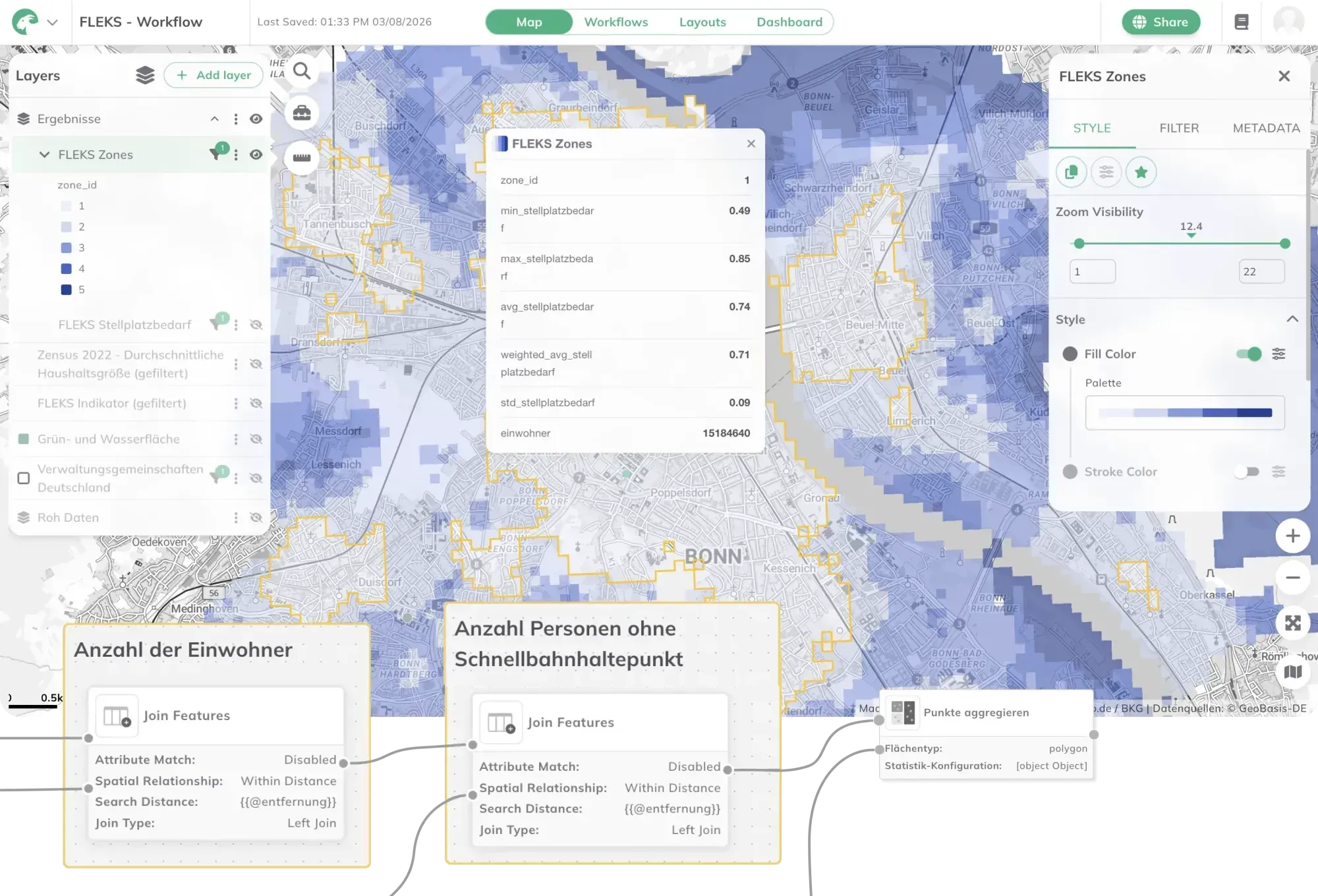
Finden und verteidigen Sie Standorte mit echten Erreichbarkeits- und Bedarfsdaten statt mit Bauchgefühl.
Mehr zu dieser Branche
Bonn holt die Einzelhandelsplanung in die eigene Datenplattform
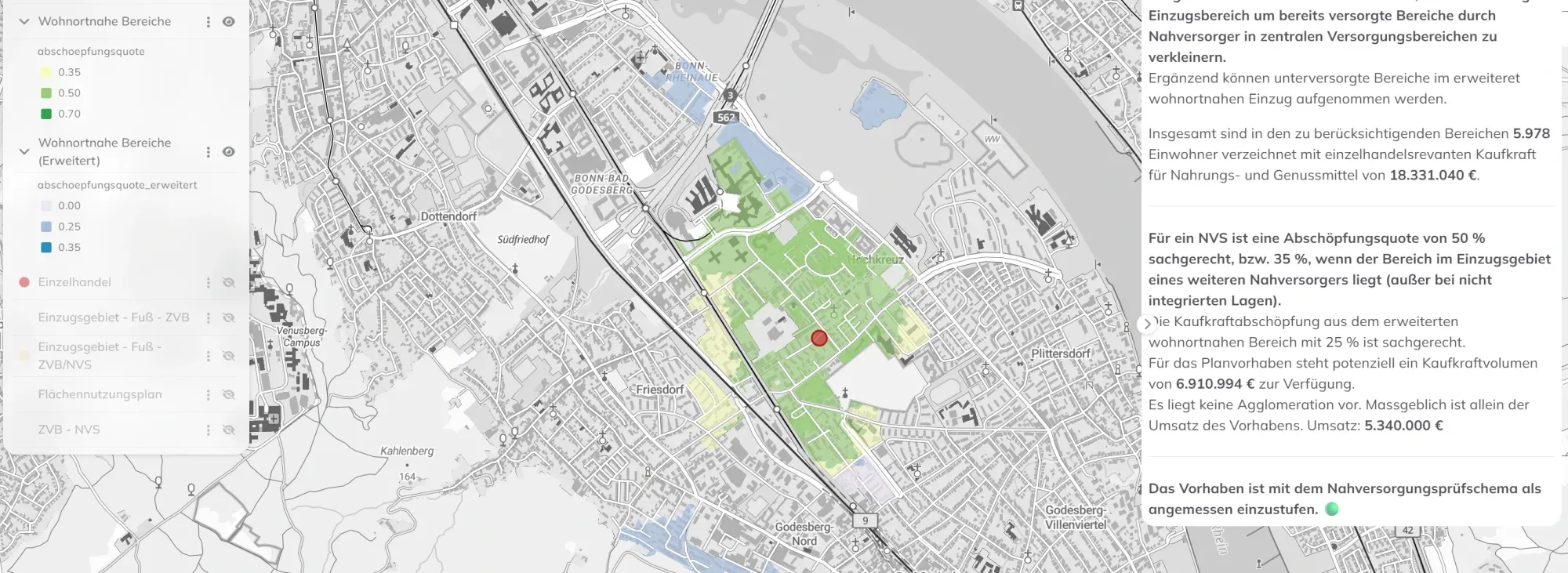
Die Stadt Bonn baut in GOAT einen GIS-basierten Workflow für die Einzelhandelsplanung auf, mit automatisierten Erreichbarkeits- und Nahversorgungsanalysen auf der Urbanen Datenplattform der Stadt. Die Frage, wie gut ein Quartier versorgt ist, wird aus Daten beantwortet, die die Stadt schon hat.
Kartieren Sie Betroffenheit, erkennen Sie unterversorgte Gebiete und belegen Sie Ihre Klima- und Mobilitätsziele.
Mehr zu dieser Branche

Ein bundesweites Dashboard dafür, wie Städte sich an Hitze anpassen
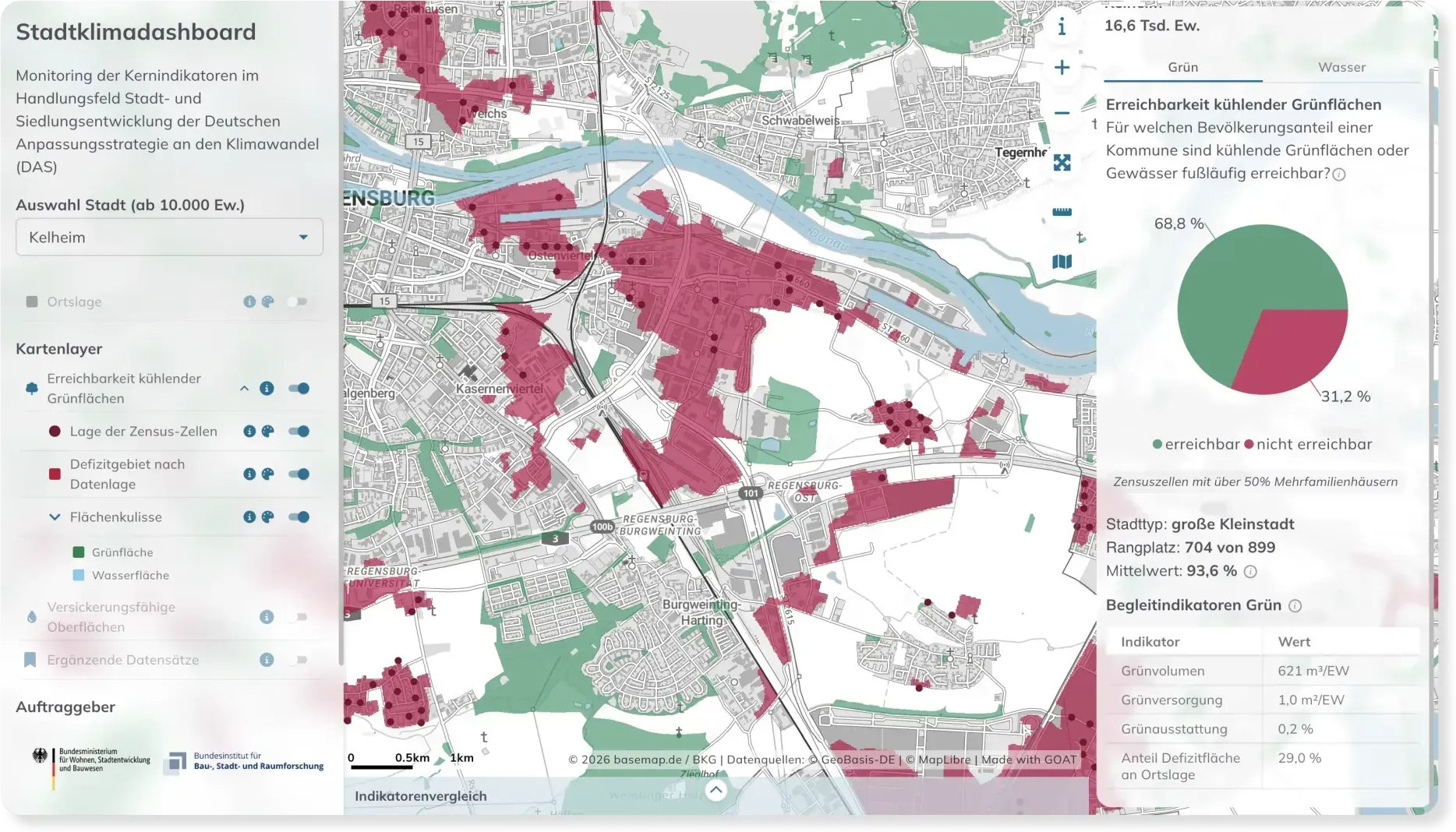
Das BBSR entwickelt auf GOAT das deutsche Stadtklima-Monitoring, gemeinsam mit IÖR, LUP und bauchplan. Es erfasst bundesweit vergleichbare Indikatoren – von der Frage, wie viele Menschen eine Grünfläche erreichen, die tatsächlich kühlt, bis dazu, wie viel Boden noch versickerungsfähig ist. Ab 2027 fließen sie in das Bundesmonitoring ein, um zu beurteilen, ob die Anpassung wirkt.
GOAT ist außerdem im Einsatz inGesundheitswesenEnergie
Kundenstimmen
Kundenstimmen & Erfolgsgeschichten
Lesen Sie die Erfahrungsberichte unserer zufriedenen Kunden, darunter öffentliche Behörden, Planungsbüros, Berater, Wissenschaftler und andere Experten aus verschiedenen Bereichen. Entdecken Sie ihre Erfolgsgeschichten und unseren Einfluss in Deutschland und Europa.
„Ich bin begeistert von dieser Softwarelösung, die komplexe Analysen ermöglicht und an unsere gesamtstädtischen Systeme angedockt ist. Was vorher aufwendig und isoliert lief, wird künftig standardisiert, ämterübergreifend und ohne Medienbrüche ablaufen. Die Urbane Datenplattform wird damit zum eigentlichen Herzstück unserer Stadtentwicklung: effizient, transparent und zukunftsweisend.“
 Janina EderStadtplanerinStadt Bonn
„Mit Plan4Better haben wir die VerkehrsInfo BW grundlegend modernisiert. Die neue Plattform bündelt vielfältige Mobilitätsdaten und stellt sie übersichtlich und verlässlich bereit. Die offene, skalierbare Architektur schafft zugleich eine starke Basis für die kontinuierliche Weiterentwicklung.“
 Marlene PichaInnovationsmanagerinNVBW - Nahverkehrsgesellschaft Baden-Württemberg mbH
„Ein hervorragendes Tool zur datengestützten, modernen Stadt- und Mobilitätsplanung für ambitionierte 15-Minuten-Städte.“
 Dr. Michael BauderStadt Freiburg
„GOAT ermöglicht es uns, die Erreichbarkeit von baulichen Vorhaben zielgerichtet und effizient zu analysieren. Die Ergebnisse der Analysen bilden eine klare Grundlage für die Entwicklung passgenauer Mobilitätskonzepte im Wohnungs- und Gewerbebau. Wichtig ist dabei für uns die Einbindung der Konzepte in den Kontext bestehender, zumeist öffentlicher Mobilitätsinfrastruktur.“
 Julia KorstenProjektleiterinStattbau München GmbH
„GOAT bringt durch intuitive und schnelle Analysen mit optisch ansprechenden und leicht verständlichen Ergebnissen einen großen Mehrwert zur Beantwortung komplexer Planungsprobleme im Mobilitätssektor.“
 Shravan ShindeBereich Konzeption & ConsultingMünchner Verkehrs- & Tarifverbund GmbH
„Mit Plan4Better konnten wir unsere spezifischen Fragestellungen zu einer bundesweiten Mobilitätsgarantie klären. Auch die Internationalisierung des ÖV-Atlas haben wir sehr erfolgreich gemeinsam umgesetzt.“
 Philipp KosokProjektleiter Öffentlicher VerkehrAgora Verkehrswende
„Mit der Implementierung von GOAT im Rahmen des Smart Region Projektes Rhein Neckar streben wir eine transformative Veränderung in unserer Verkehrsinfrastruktur an. Das Tool ermöglicht eine stärkere Vernetzung und Zusammenarbeit zwischen verschiedenen Interessenvertretern in unserer Region und trägt so zu einem integrierten und nachhaltigen Verkehrssystem bei.“
 Marius JörresProjektleiter für Smart MobilityMetropolregion Rhein-Neckar GmbH
„Eine richtungsweisende Unterstützung für die Umsetzung der 15-Minuten-Stadt!“
 Jonas BellingrodtAmt für Stadtplanung und Umwelt, Stadt Freising
„In Fürstenfeldbruck wird GOAT in der Stadt- und Verkehrsplanung eingesetzt und ist eine große Hilfe für Barrierefreiheitsanalysen zu Fuß- und Radwegen.“
 Dr. Montserrat MiramontesMobilitätsmanagerinStadt Fürstenfeldbruck
„Wir verstehen GOAT als ein innovatives und kostengünstiges Analyseinstrument um gute Argumente für eine zukunftsgerichtete, moderne Mobilität zu finden. Dank der guten Betreuung durch das Team von Plan4Better haben wir einen schnellen und umfassenden Überblick der verkehrlichen Erreichbarkeit aller wichtigen Point of Interest unserer Amberger Innenstadt erhalten. Sei es zu Fuß, mit dem Rad oder mit dem Auto.“
 Ulrich SchallerLeiter Stabsstelle Mobilität und VerkehrStadt Amberg
„GOAT has decisive advantages for environmentally sound urban, local and spatial planning because it includes the user perspective from the outset and does not represent the expert view first. This is new!“
 Dr. Johannes GnädingerProf. Schaller UmweltConsult GmbH
„GOAT ist ein sehr gutes Tool zur Berechnung und Darstellung von Erreichbarkeiten in der Verkehrs- und Stadtplanung.“
 Attila LüttmerdingAbteilungsleiter Grundlagen und DatenMobilitätsreferat, Landeshauptstadt München
Jetzt mit GOAT starten
3 Wege, mit uns zu arbeiten
Wir entwickeln GOAT und nutzen es selbst für unsere eigenen Planungsprojekte. Sie können das Tool also selbst in die Hand nehmen oder die Arbeit uns überlassen.
Nutzen Sie GOAT selbst
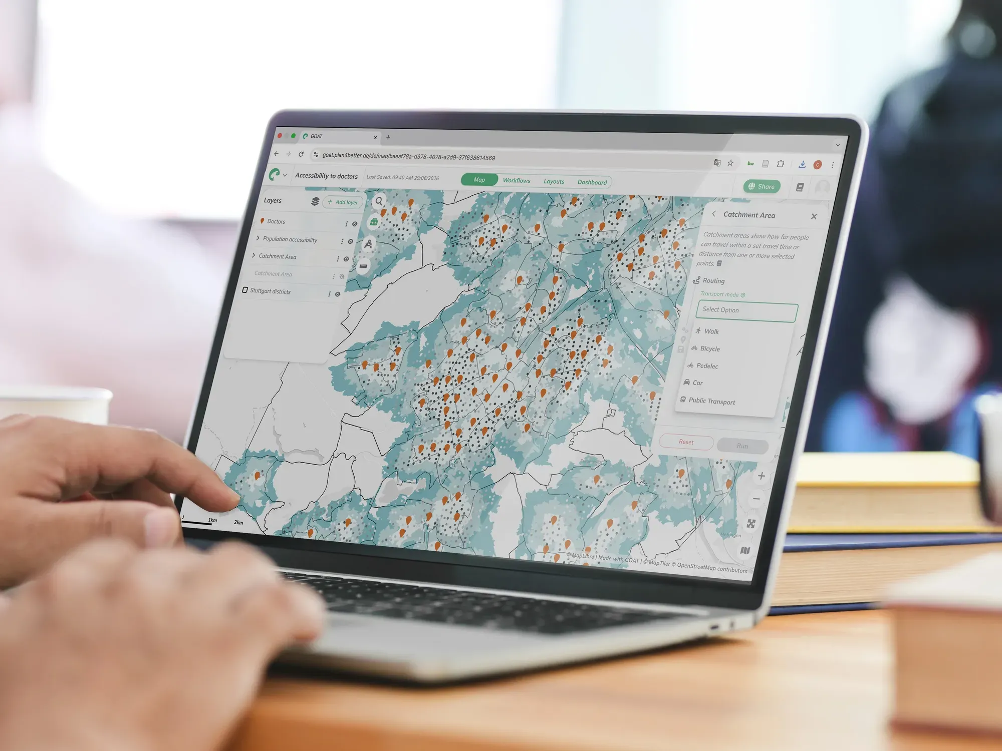
Abonnieren Sie GOAT, führen Sie eigene Geodatenanalysen durch, automatisieren Sie sie und teilen Sie Karten & Dashboards.
Testen Sie GOAT kostenlos
Wir analysieren für Sie
Sagen Sie uns Ihre Frage, wir führen die Analyse in GOAT durch und liefern Ihnen einen fertigen Bericht.
Kontaktieren Sie uns
Wir entwickeln für Sie
Brauchen Sie etwas Individuelles? Wir entwickeln maßgeschneiderte Tools und Dashboards auf Basis von GOAT.
Kontaktieren Sie uns
Unsere Ressourcen
Zwischen Projekten und GOAT-Releases schreiben wir auf, was uns auffällt.
Beiträge im Blog
Anwendungsbeispiele, Beiträge zur Methodik, Kartengestaltung – und woran wir beim Bauen hängengeblieben sind.
- Fünf Monate bis zur neuen VerkehrsInfo BW, und die Jahre Arbeit, die dahinterstecken
VerkehrsInfo BW, die neue Webplattform des Ministeriums für Verkehr Baden-Württemberg, entstand in fünf Monaten mit GOAT auf offenen Daten von MobiData BW.
- 30.000 Datensätze, ein Klick: So entsteht der KI-gestützte Katalog in GOAT
Jedes Planungsprojekt beginnt mit der Suche nach Daten. So haben wir einen Katalog mit über 30.000 Datensätzen gebaut, die mit einem Klick in Ihrem GOAT-Projekt landen, und warum eine KI-Suche das nicht ersetzen kann.
- Auf den Platz kommt es an: Stellplatzschlüssel datenbasiert festlegen
Wie deutsche Städte sich von einem Stellplatz pro Wohnung verabschieden und wie FLEKS mit Daten zum Pkw-Besitz Stellplatzzonen für das Wohnen festlegt.
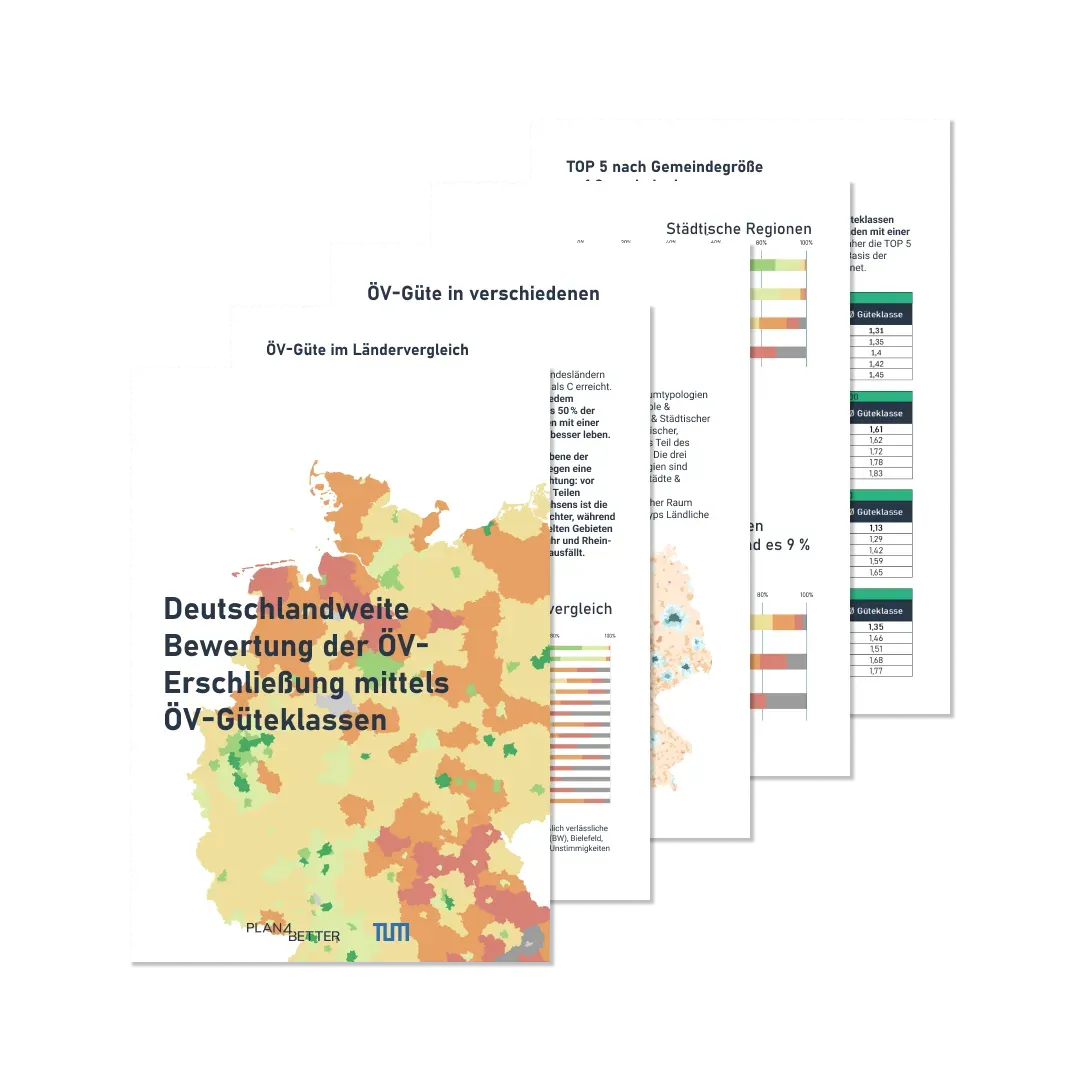
Whitepaper
Längere Texte: wie die ÖV-Erschließungsqualität gemessen wird und wie sich eine 15-Minuten-Stadt tatsächlich berechnen lässt.
Whitepaper lesenNewsletter, monatlich
Was es Neues in GOAT gibt, aktuelle Analysen und was wir dabei lernen.
AbonnierenBereit, Ihre Daten auf die Karte zu bringen?
Testen Sie GOAT kostenlos, oder sprechen Sie mit uns über Ihr Projekt.